
A Pawley's Island Christmas (Day 1) - Exploring Georgetown, SC + Pawley’s Island
Sunset at the beach is often an amazing display of slowly shifting colors.
UPDATED: 2/4/2023
Note: Some links throughout our site are affiliate links, which means we may receive a small commission at no cost to you.
If you are not familiar with Pawley’s Island , you may not be alone. We had never heard of it ourselves until we booked a 4-day family Christmas get-away. Our goal was to go somewhere at least a little warmer than our home state of Virginia and to be on the beach for a relaxing trip. Of course, as these things go, we then started seeing and hearing much more about Pawley’s Island, so then again, maybe you have heard of it.
Pawley’s Island is a small island but an island nevertheless. It is connected to the mainland across two, fairly short causeways. The island is about 3 miles long and about 1/4 of a mile wide, though its width varies. One side of the island is sandy and ocean-front; the other side sits in grassy, marshy swamp that has significant shifts in tidal heights throughout the day. The house we rented (search for your own Pawley's Island rental here ) was in the central part of the island and all the homes along there tend to sit on the sandy beach on one side, have the two-lane road on the other, and then have a second, private dock at the end of a long pier sitting out over the marsh. As far as scenery goes, the ability to shift between ocean-front and marsh-front provides nice variety.
Pawley’s Island is a small island but an island nevertheless. It is connected to the mainland across two, fairly short causeways. The island is about 3 miles long and about 1/4 of a mile wide, though its width varies. One side of the island is sandy and ocean-front; the other side sits in grassy, marshy swamp that has significant shifts in tidal heights throughout the day. The house we rented (search for your own Pawley's Island rental here ) was in the central part of the island and all the homes along there tend to sit on the sandy beach on one side, have the two-lane road on the other, and then have a second, private dock at the end of a long pier sitting out over the marsh. As far as scenery goes, the ability to shift between ocean-front and marsh-front provides nice variety.
Our home away from home. This rental was well kept and very comfortable.
Geographically, Pawley’s Island sits between Myrtle Beach and Charleston. It is about 20 miles south of Myrtle Beach and 70 miles north of Charleston. First settled in the 1700s by rice planters who spent the hot southern summers on the shore away from their inland river plantations to avoid the stagnant air, the town evolved over time into a summer home destination. There are several homes and buildings on the island that date back to those earlier days. One element that sets this area apart from many other beach destinations is that it is devoid of the overly tourist-focused elements. All shopping and restaurants and the like are across the causeway.
High tide at Pawley’s Island
Low tide reveals oyster bars and a host of burrows.
We arrived in the evening after a very long day of driving in the rain with substantial chunks of the trip through downpours. The trip itself was about 6 hours for us but between stopping for lunch and other stops, we probably spent about 7 1/2 hours in transit. On our way, we swung by a nearby grocery store (there are several options conveniently near Pawley’s Island) to grab some basics and food for an easy dinner.
In the morning, I went for a walk with my mom along the main road of the island where we passed a few older houses and inns that had been earlier builds on the island - The Pelican Inn (built in the 1840s) and Sea View Inn (dating to 1937). There are nine buildings highlighted on the local website that date to the 1800s, all of which are in a relatively small part of the island between the two causeways. You can check out these historic homes and inns here.
In the morning, I went for a walk with my mom along the main road of the island where we passed a few older houses and inns that had been earlier builds on the island - The Pelican Inn (built in the 1840s) and Sea View Inn (dating to 1937). There are nine buildings highlighted on the local website that date to the 1800s, all of which are in a relatively small part of the island between the two causeways. You can check out these historic homes and inns here.
While my mom and I were out in the brisk morning air of the seaside, Dustin wandered outside to check out low tide on the marsh and beach.
The rental was home to 2 outdoor cats. One spent a lot of time looking in this direction….. cats should be kept indoors.
Tidal pools are interesting to look at… even when empty.
Photos of piers and beach vacations always seem to go hand in hand.
Erosion is a constant issue for beach communities.
Erosion has caused floating stairways to be a common sight.
Waves at the beach.
This little bird (Sandpiper?) was taking a break to sunbathe on the rocks.
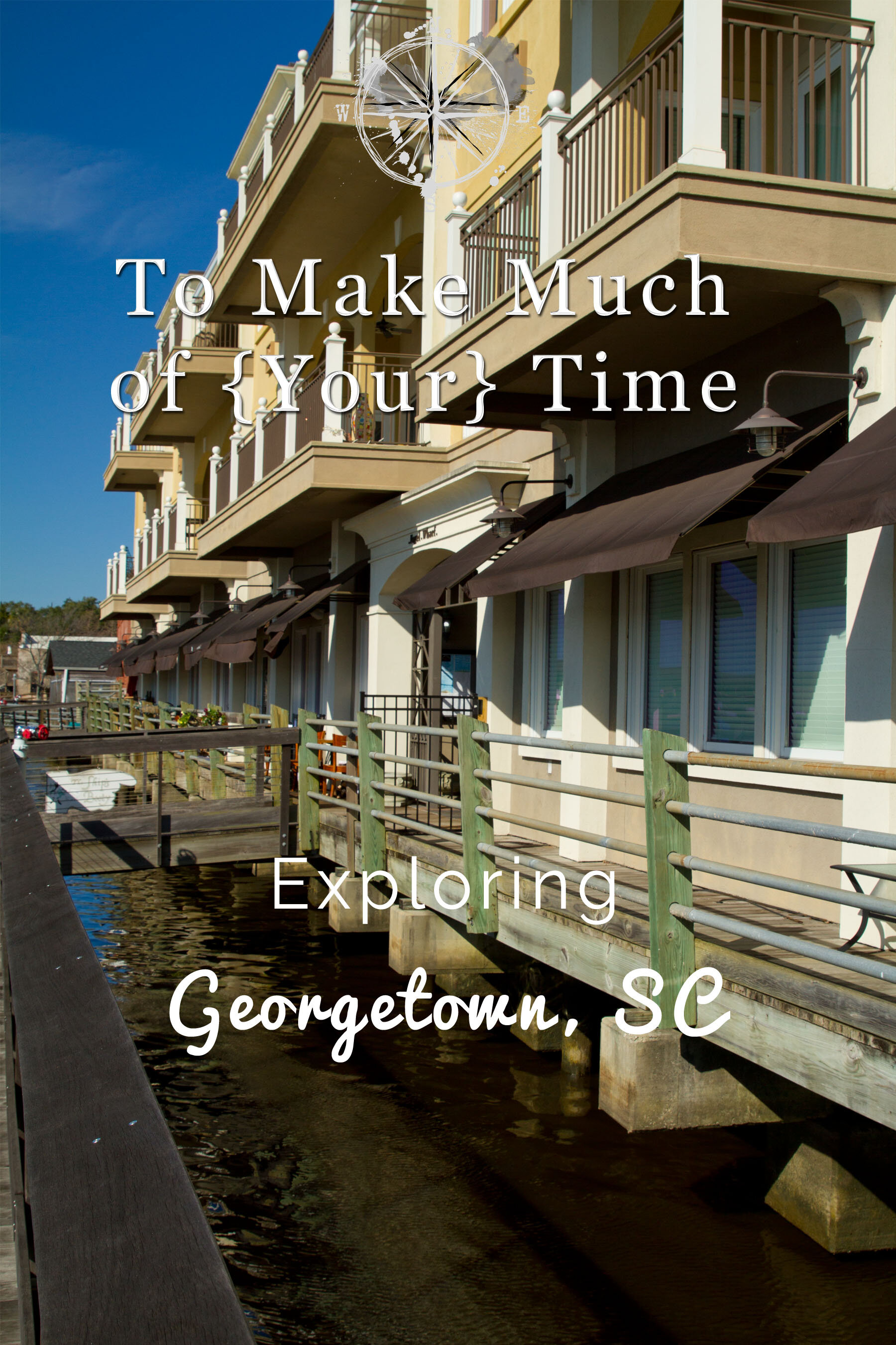
For lunch we headed a brief way down the road - about 20 minutes - to Georgetown, SC . Georgetown sits a little more inland and is at the convergence of the Great Pee Dee and Waccamaw rivers as they become Winyah Bay before spilling into the ocean.
Georgetown is a cute little harbor town with old tree lined streets and historic houses. The downtown area along the wharf had a nice small town feel and was very walkable. There are a lot of cars, and it is clear this is the central visiting spot for out-of-towners with many restaurants, ice cream stores, museums, and stores lining the street. Along the river there is a wooden boardwalk that allows people to walk along the river and marshland as well as check out any boats moored to the pier.
A small section of a larger water fountain. The red leaves looked cool floating in the water.
Restaurants and other shops can be found in buildings that face the water.
The only eyesore is the distant paper mill, whose parent company is International Paper, which ruins an otherwise pretty skyline and also fouls the air. While rather stinky when the ocean breeze blows toward the town, the mill is a major employer in the area so residents refer to the scent as “the smell of money”. Pollution from the plant is down significantly compared to what it was a century ago and was further reduced in the 1990s when the plant moved away from using dioxin.
Ahoy mate! A nice selection of boats were moored here if you like to look at boats.
International Paper might not do the tourism industry any favors, but the locals love it for a solid source of jobs.
Moving inside to get away from the December ocean air, we at lunch at River Room. This was a nice restaurant with a warm cozy feel. Dark wood, a cozy fire, and great food made this an excellent choice for a winter lunch. We both had a fried flounder sandwich, which was excellent.
After walking a bit more through the town, we headed back to Pawley’s Island for a relaxing evening, where Dustin captured some late afternoon pictures of the tide receding. The marsh in front of the house was reduced to a mudflat with oysters exposed to the air. Once it was dark, we were rewarded with the first of several nights of a large so-called super moon rising over the ocean right out our window.
Super orange moon rising over the ocean. I love the reflection!
Its getting late. Time to fly home.
Still unsure how anyone thought there was a man in the moon.
Watching the color of the moon and its reflections on the water change as it rose higher was very interesting.
While we did these various stops on different days, this provides a lay of the land of this trip.
Click the image below to save this post to Pinterest!
Check out our other posts about South Carolina:


Day 2 - Santee Coastal Reserve + Sewee Shell and Clam Mounds
Time for some hiking as we check out a wildlife refuge and a state park.