
New Brunswick Road Trip - Fundy National Park 2-Day Itinerary
Hiking the coast in Fundy National Park
Note: Some links throughout our site are affiliate links, which means we may receive a small commission at no cost to you.
This is the 3rd post in a series for this trip and covers days 3-4 of a 13 day road trip. You can view links to the other posts at the bottom of this one.
Two day itinerary for Fundy National Park in Alma, New Brunswick
why visit fundy national park
Fundy National Park sits along the Bay of Fundy, which is famous for some of the highest tides in the world. Depending on the exact spot, the difference between low and high tide fluctuates between 15 and 48 feet, roughly the height of a 4-story building! The shore along the park is varied – from rocky outcrops and cliffs to tidal zones and salt marshes. The park itself is at the convergence of two distinct ecological zones: Bay of Fundy marine coastal environment and Caledonia Highlands plateau.
Fundy National Park has varied plant life along the border of these two zones, and driving and hiking through the park made that abundantly clear to us. The forest was very interesting and is home is 32 species of tree, over 250 types of birds, and 400+ species of lichen, very prevalent on our first hike. The park is home to a multitude of mammals, including moose and fox. Within Fundy National Park is some of the last old-growth Acadian forest in the world, a forest that is one of six types of forests in North America that are endangered. The most common tree species in the area are red spruce, balsam fir, yellow birch, white birch, red maple, and sugar maple. We saw (and smelled, particularly in the case of the red spruce) all of these on our hikes.
This is one of the reasons that national parks and other protected land areas are so important to preserve, protect, and showcase the natural environment that is struggling to survive in so many places.
MAKE THE MOST OF TWO DAYS IN fundy national park
Tip: We found staying in the town of Alma, right outside the park entrance allowed us easy access to all areas within the national park without adding on a lot of driving time. There are a number of accommodations options, including camping. You should note that the area can have pretty intense mosquitoes so do your research before determining you want to tent camp. We enjoyed our three nights staying at this AirBnb and would recommend it to others.
Day 1: With rain in the forecast, we had low expectations but decided to grab our rain coats and explore Fundy National Park anyway! Our first stop was Dickson Falls, a beautiful and short hike down to and along a raging series of waterfalls. The forest around the falls was humid and created a mesmerizing low fog over the water. At Herring Cove Beach, we enjoyed a short walk in the cove and learned about the history of early explorers who built cabins along the sand. When then hiked about 3 miles on our own created loop trail that was a combination of a portion of the lengthy Coastal Trail and the Matthews Head Trail. We stomped through mud and extensive tree roots but were rewarded with views of the Bay of Fundy. On a whim, we headed to Point Wolfe Beach and found ourselves there at low tide. We were able to walk the length of the cove - normally under the water - and be mesmerized by the most colorful, gorgeous rocks. This random stop ended up being a place we hiked and explored for an hour and a half. I would highly recommend all visitors to the park visit this spot at low tide! After stopping for a covered bridge photo op, we headed back to Alma and walked to Tipsy Tails Restaurant, where we sat outside for a shore view dinner, next to boats that were left entirely high and dry from low tide.
The coast of Fundy National Park
Day 2: On our second day, we again mostly lucked out with the weather in spite of the foreboding forecast. We spent the morning on a challenging hike that combined both Moosehorn Trail and Laverty Falls Trail for a total distance of 4.6 miles over 3 hours. The trail comes into contact with various waterfalls and creeks, all of which were particularly swollen from recent rains, and this trail was incredibly muddy, slippery, challenging, filled with mosquitoes, and totally worth it. In the afternoon, we opted for a calmer activity and headed over to the much more popular Hopewell Rocks. We timed our visit for low tide and were able to walk among the flowerpot stacks that would soon be four-stories underwater again. We walked an additional 3 miles along the sand and drank in the beautiful vistas of the rock stacks and the water beyond, made prettier by the skies darkened from passing storms. For dinner we decided to be creatures of habit and returned for a second time to Tipsy Tails Restaurant.
Day 1 in Fundy National Park: Dickson Falls, Herring Cove Beach, Coastal Trail & Matthews Head Trail, and Pointe Wolfe Beach
As I usually do before a trip, for better or for worse, I’d been checking the long range weather forecast, which did not promise pristine weather while we were in Alma for three nights. In fact, we were seeing a forecast with day upon day with near or over one inch of rain. So, our expectation of getting to explore the park was low heading in to these first few days of our trip. Luckily, the storm track altered a bit with large rainfall expected on our second day but with only passing rain and less accumulation on Thursday, our first day.
With gray clouds and rain shifting between gentle drizzles and steady but quick showers, we decided to depart from our Airbnb after breakfast and give hiking a shot. What else are water-proof hiking boots and rain jackets for?
Feeling bullish about our ability to hold poor weather at bay, we headed to Fundy National Park, which is literally so close to Alma that you can walk from the town to the park.
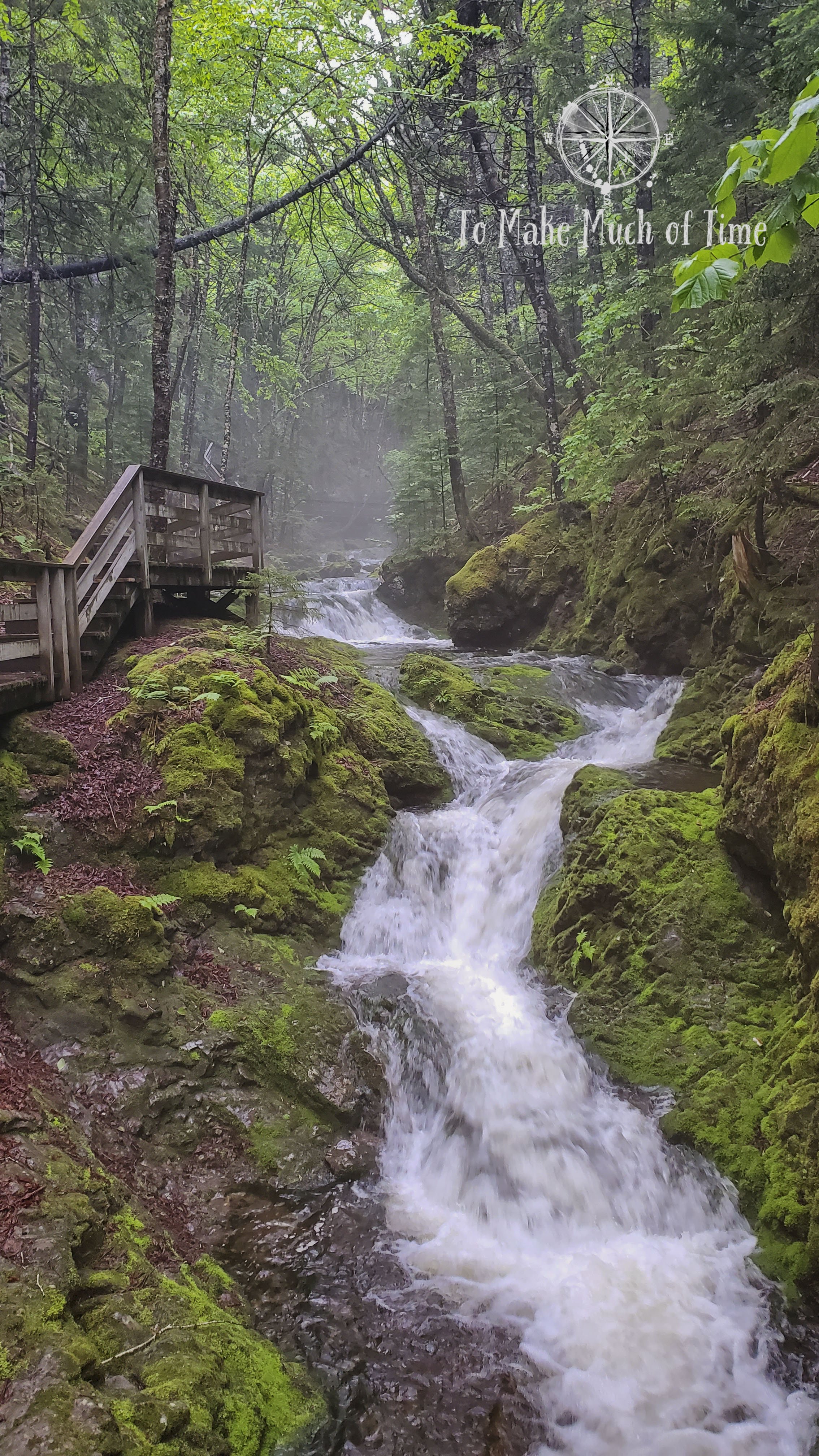
hiking dickson falls
Our first stop was Fundy National Park’s Dickson Falls, which is a loop trail with boardwalk sections along the waterfall and a decent number of wooden steps. The hike has either a long or short loop option, but the long loop trail was closed and didn’t look like it would be open any time soon.
The hike started with a downhill descent, including wooden stairs, and a peaceful walk through a very humid forest before we saw the waterfall, streaming down the rocks. The trail has a boardwalk bridge that first crossed over the streaming waters and then ran alongside the waterfall and followed it up hill. By this point in our hike, the gentle drizzle declared itself serious and broke out into a steady rain. With the humidity in the air, a pretty fog rose up through the waterfall. With the amount of rain that had passed through the area for many days leading up to this, the waterfall was swollen with extra water.
We spent about 40 minutes taking in the Dickson Falls hike and traversed just over half a mile. The trail is rated moderate by the park’s standards, and in our assessment, it would really only be a challenge for someone who struggles with inclines due to issues such as knee sensitivity.
Dickson Falls

The stairs down to Dickson Falls

The path at Dickson Falls get really close to the waterfall!

The trail at Dickson Falls goes right over portions of the waterfall.

The trail to Dickson Falls was very lush and green and looked more like a rainforest than Canada!
exploring and hiking herring cove beach
With the rain continuing, we weren’t ready to commit to a longer hike quite yet so we drove a short distance to Herring Cove Beach to check out the coastal view. Information at the spot discussed the community founded at Herring Cove in the 1850s by settlers. A few decades on, the entrepreneurial locals anticipated a railway coming to the spot and built a breakwater; unfortunately for them, the train stopped at Alma and went no further. For many years, up to as late as the 1940s, vacationers came to Herring Cove and spent time on the water in cabins. All the buildings were removed in 1948 when Fundy National Park was created. Today the spot looks like a beautiful beach and water vista with no clear signs of what once was, so it was interesting to see old photographs of what used to be in the spot.
Herring Cove Beach is also rated as a moderate trail for reasons similar to Dickson Falls. There are a series of wooden stairs down to the beach and the return trip can either be back up those stairs or through continuation of a loop trail, which is a little steep. The entire walk took us about 30 minutes and covered just half a mile of ground. We got our first listen to the local birds and heard a Swainson’s thrush and a Gold-crowned kinglet.

Low tide at Herring Cove Beach in Fundy National Park
Low tide at Herring Cove Beach in Fundy National Park
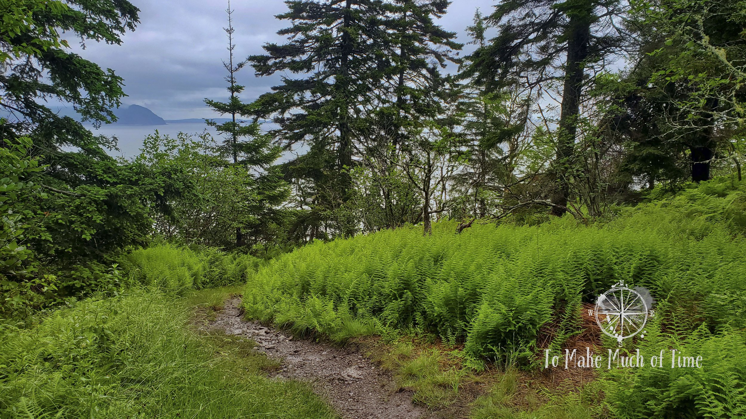
hiking part of the coastal trail and matthews head trail
After checking our weather app and seeing that a storm was about to pass through and would maybe include lighting, we decided to enjoy a picnic lunch in the car in the parking lot while the weather passed before tackling our next hike, accessible from the same parking lot as where we accessed Herring Cove Beach. When no such storm emerged, we determined that the coastal weather might be a tad unpredictable and so took a post-lunch hike on portions of the Coastal Trail and Matthews Head trail. To create our own loop, we then caught the road back to the parking lot. The Coastal Trail itself is very lengthy and takes 4.5 to 5 hours one way.

Exposed tree roots made the Coastal Trail and Matthews Head route at Fundy National Park a bit more challenging!

We found some pretty muddy sections during our hike of the Coastal Trail and Matthews Head at Fundy National Park.
The loop trail of our own creation ended up being just over 3 miles and took us about 1 hour 40 minutes to hike. The trail had both beautiful views of the coast at times – most notably at Matthews Head – but was also a wonderful walk through the diverse forest.
The first part of the trail was a fairly steep uphill and had a lot of rough terrain with extensive (and slippery!) tree roots, not to mention huge swaths of deep mud. That was all on the Coastal Trail, which is rated as difficult. Matthews Head trail is considered moderate. We only met a small number of other solo or groups hiking. One man, hiking alone, was blasting pop music out of his phone. Every so often we come across hikers doing this and are a bit flummoxed by the decision. To each their own I guess! For our part, we enjoyed listening to the birds, including Red-eyed vireo, Northern parula, Black-throated green warbler, Blue-headed vireo, Blackburnian warbler, Dark-eyed junco.

Hiking on the Matthews Head Trail

Hiking on the Matthews Head Trail

Hiking on the Matthews Head Trail
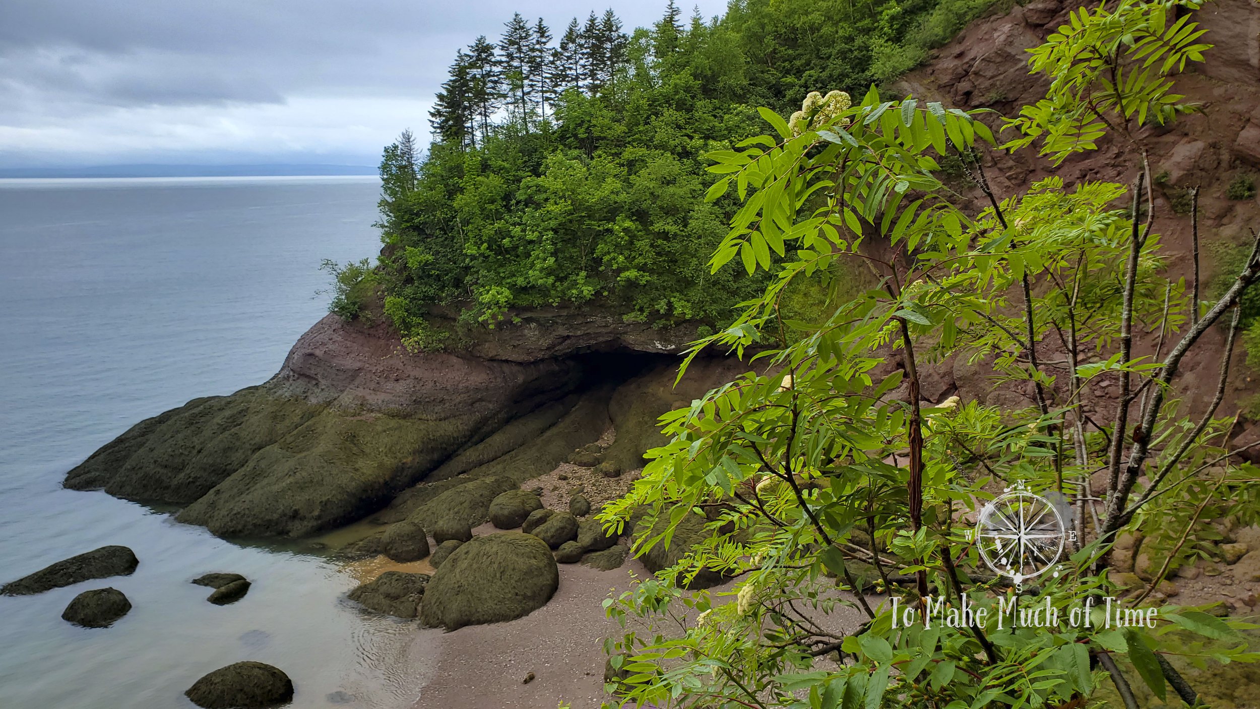
exploring low tide at point wolfe beach
On a bit of a whim and mostly to maximize the day – the following day was calling for rain all day, accumulating over an inch – we decided to drive the short distance along the road to Point Wolfe Beach. The hike down to the beach is short but steep, earning it a rating of moderate trail difficulty. We honestly expected nothing more than a cove and water but were pleasantly surprised with what we found, which ended up being one of my favorite spots of our time in Fundy.
It was low tide and the deep inlet was essentially water-free so we got to walk along what had just been the ocean’s bottom. The entire area was filled with the most varied, beautiful rocks I’ve seen in one place. They were of various states of ocean tumbling with many being very smooth. We walked until near the end of the inlet where the rocks got larger and more slippery before turning around. All in, the entire walk was about 1.5 miles in length, and we spent a full hour exploring and oohing and aahing the colors. In multiple places miniature waterfalls streamed out from the hillside above, sending the water from the land to ocean.
On the return trip into town, we drove back through a beautiful covered bridge, stopped to capture a photo, and continued on with our sights set on dinner.

The beautiful rocks at Point Wolfe Beach in Fundy National Park
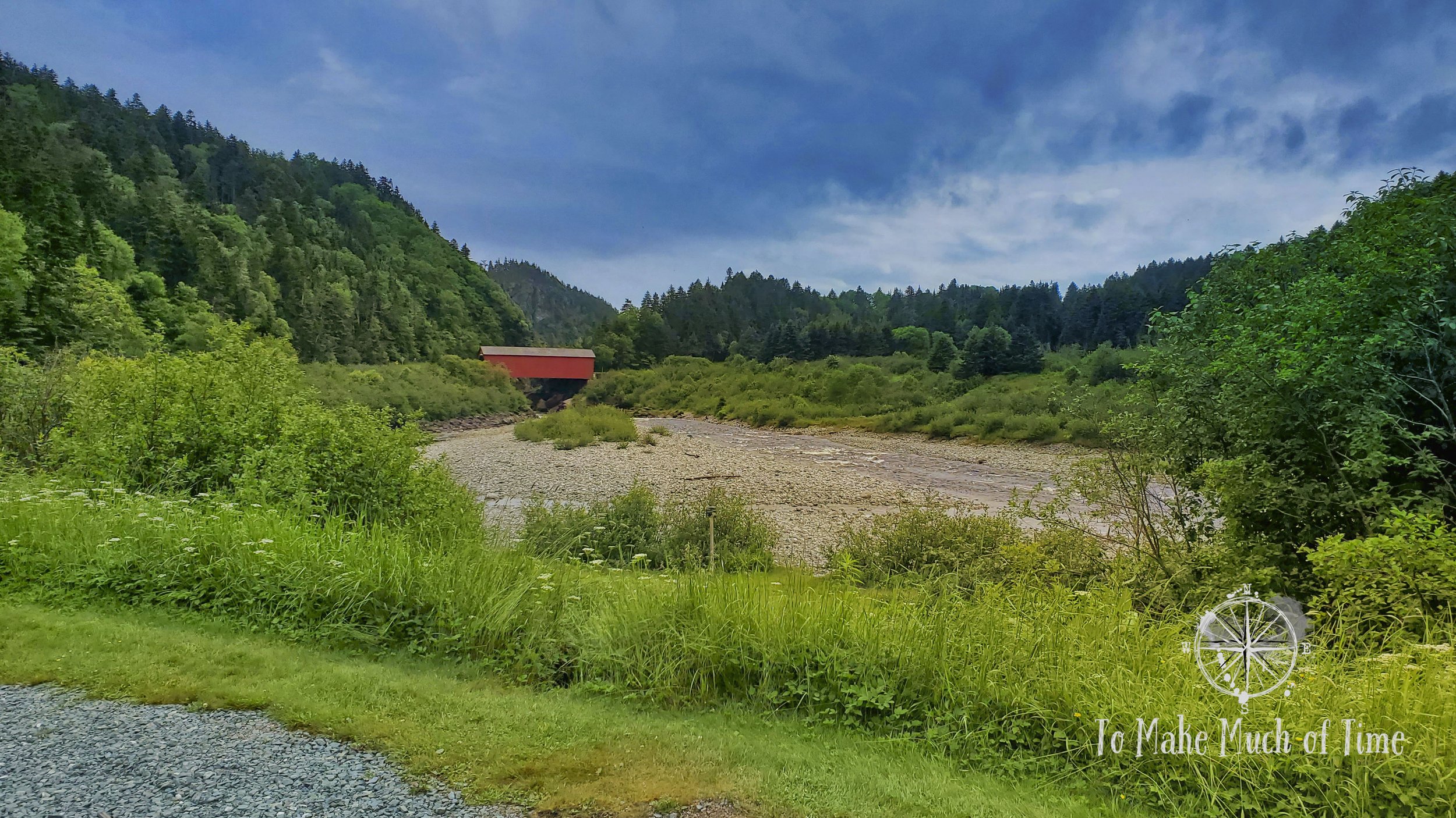
Covered bridge near Point Wolfe Beach in Fundy National Park
dinner in alma at tipsy tails restaurant
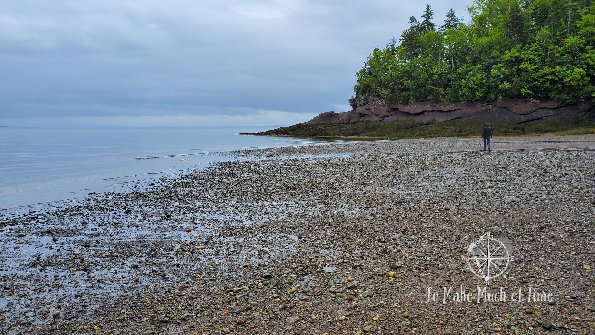
Because our Airbnb was so conveniently located, we parked at home and enjoyed a short walk into town where we looked at the fishing boats sitting entirely out of the water in low tide before heading into Tipsy Tails restaurant and lucking out with a patio table on the water. Dustin had battered haddock (fish and chips by any other name), and I had fish tacos, all of which were delicious with some of the crispiest battered fish we’ve ever had. To accompany our dinners, we tried the scow apple cider and Flying Boats’ Pixie IPA.
Day 2 in Fundy National Park: Moosehorn Trail and Laverty Falls Trail, and Hopewell Rock
In the morning, when we were still closer to high tide, we decided we needed to stop by the Alma dock and take a companion photograph to the boat picture from the evening before during low tide. What a hard place to make a livelihood off of fishing! A tidal calendar is a must! For those who aren’t familiar, the time of the tide changes by nearly an hour each day, meaning it is a lot more challenging to track than something with minute changes like sunset.
hiking moosehorn trail and laverty falls trail
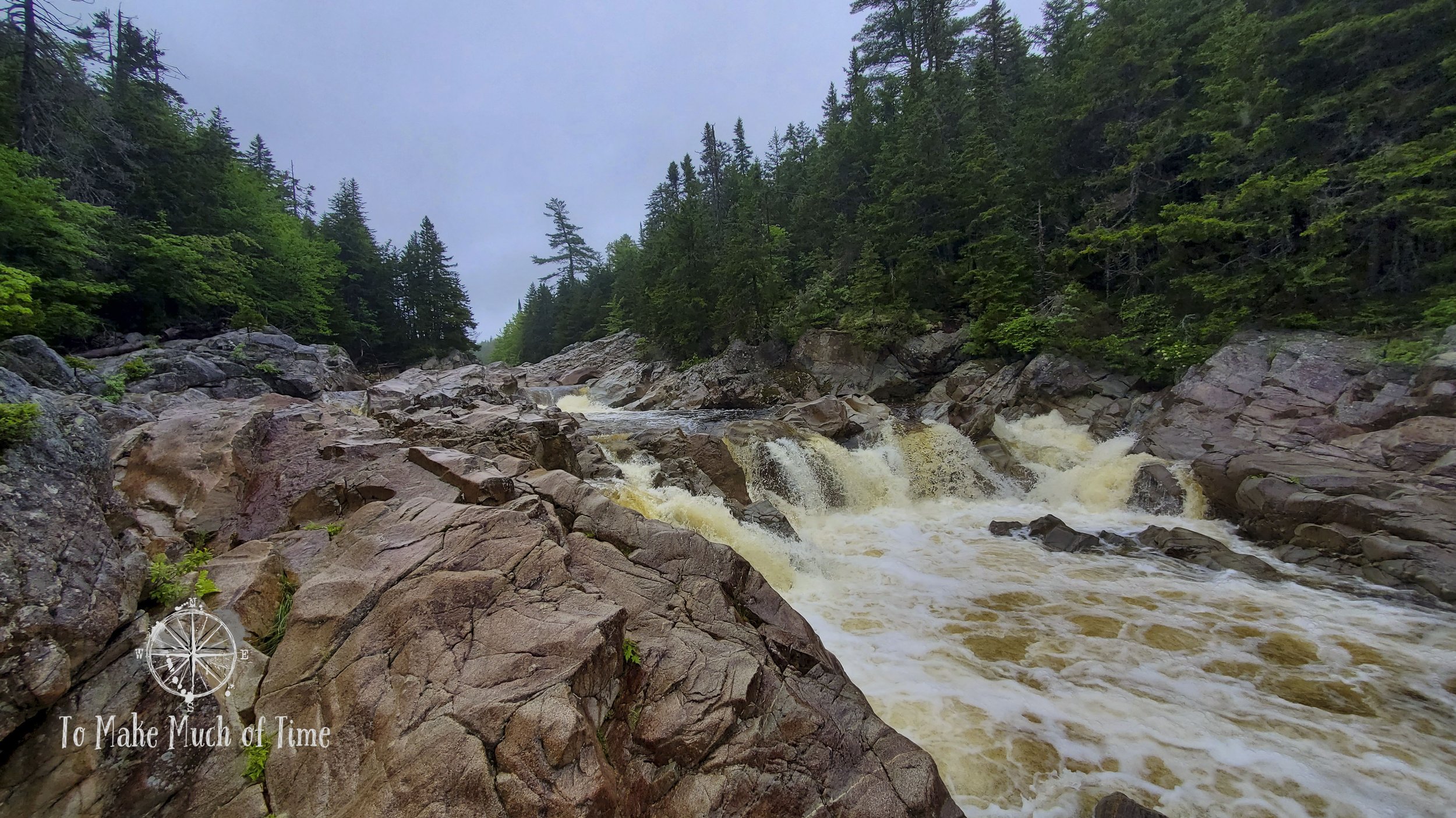
This day was supposed to bring over an inch of rain but the skies seemed to be leaning in our favor, though questionable. We decided to get started early in the day on a longer hike and targeted a loop that included Moosehorn trail, marked difficult, and Laverty Falls, marked moderate. The trailhead is further into the park down an unpaved road, which was a nice drive in its own right. Three trailheads all began at the same parking lot – the two we would be taking plus The Forks. What attracted us to this loop trail was the fact that it had multiple waterfalls along its route and also spent a large segment along a few different rivers.
What we didn’t quite factor in was that a difficult trail along water would be extra muddy, slick, and – by extension – mosquito-filled. Some things are best not known ahead of time. What none of the trail descriptions mentioned is that the path crossed through a rapidly raging waterfall – carrying extra water from the rain – and an entire section was nothing more than scrambling across boulders that were about 10 feet high along a raging river and very slippery from the rain. But I’m writing this, so we survived. And for the millionth time we said: we really should get hiking sticks for this sort of trail.
The first part of the trail – Moosehead – was quite a steep downhill, very pretty and very, very muddy. At this point in the hike, we were still trying to avoid the water and mud and walked gingerly around as best we could. Another couple was hiking sometimes ahead of and sometimes behind us. At one point they got out of sight ahead of us and then circled back because the trail was so flooded they needed to find another route over the water. We can honestly say that our hiking boots have proven themselves on hikes such as this one with completely dry feet in spite of wading through water well over the tops of our feet.
A little ways down the trail we spotted a short spur that led to an overlook of a waterfall and by overlook I mean we were right next to the waterfall, which was – like everything – way faster and larger than normal due to the recent rainfall.
It was down the hill at the bottom of that same waterfall that we came to a spot where the trail disappeared into the water and emerged on the other side. In normal conditions, it would be relatively easy and safe to walk across the water but in its state, it didn’t look safe. The distance across was probably 15-20 feet and deeper than our boots. With the rushing water, it was hard to clearly see the rocks and a loss of footing would not be a good thing.
Dustin walked uphill to scope out other crossing options and found an area where the waterfall split into multiple sections where we could balance on fallen tree trunks and jump across a few sections to dry land. This seemed like a better option and got us safely across.

The upstream portion of the waterfall that we crossed during our Moosehorn-Laverty Falls Hike.

Moosehorn-Laverty Falls Hike in Fundy National Park

Moosehorn-Laverty Falls Hike in Fundy National Park

Moosehorn-Laverty Falls Hike in Fundy National Park
There were a few times on the trail further on where we lost sight of the markers on the tree and had to check around a few corners before we located the trail. Other than that, it was well marked.
When we came to the section of slippery boulders along the river, we had no choice but to scramble using ledges in the rocks to steady our feet. After that section, the only real hazards on the trail were huge muddy sections and a ridiculous number of mosquitoes who acted like they hadn’t eaten in weeks. Even though I was quite warm by this point, I left my raincoat on to protect me from the thirsty mosquitoes, but they made quick work of any visible skin. I got at least 9 bites on my neck, several in my hair, one on my eyebrow (go figure), a few on my face, but none of that was as bad as what they did to my hands. I ended up with a large number of red welts and spent the last uphill section of the trail with my hands on fire from the bites. They would continue to feel that way a solid two days before I finally noticed they no longer hurt. I will forever wonder about the other hikers we passed who were wearing shorts and short sleeves.
The boulders in this picture ARE the trail, and we had to scramble over them while hiking Moosehorn-Laverty Falls in Fundy National Park

Looking back downhill after scrambling up these slick boulders along the river during our Moosehorn-Laverty Falls Hike in Fundy National Park
After that description of this trail it feels like I shouldn’t be recommending it, but I absolutely would. It was a beautiful and challenging hike in all the good ways but also I don’t recommend it right after lots of rainy days and without being prepared for mosquito attacks. When we talked to our server at dinner and she learned we’d done that hike in those conditions, she was impressed. She’s also a hiker and enjoys that trail and said it’s a good indicator of conditions on another 4-day trail nearby that tends to have similar challenges. Our hike took us 3 hours (the guide book said it would take 3 to 4.5 hours so we made good work of it) and covered about 4.6 miles. I can’t imagine 4 days hiking in those sorts of conditions so props to whomever accomplishes that!
visiting hopewell rock
The rain settled in just as we got to the car, in which we picnicked, and then we drove over to Hopewell Rock, northeast of Alma.
Hopewell Rock is famous for its flowerpot stacks that become denuded of their water cover during the extreme tides in Fundy Bay. We had planned our visit to correspond with the afternoon low tide so that we could walk out onto the beach and among the rocky sea stacks. Because Hopewell Rock is a tourist attraction, it was filled with way more people than we saw anywhere else in the vicinity. There was a huge parking lot and ticket lines (with no wait).

A flowerpot stack at Hopewell Rock
The seastacks began to form about 330 million years ago as runoff from the Calendonia Mountains. The runoff deposited gravel and other layers of sand. These got compressed into layers of conglomerate and sandstone and as the earth moved, they tilted out and away from the shore. Since they broke off, they have continued to be eroded by wind, water, and the weather in general.
There are multiple access points to the beach at low tide, including one at the far end called North Beach, which allows ramp access; Staircase Cove, where the beach is accessed down 101 stairs; and Demoiselle Beach, which appears to be a regular beach and which we didn’t visit during our time at the site.
In terms of our route, we took the Walking Trail to Staircase Cove, descended to the beach, walked as far as we could out to and past Diamond Rock, returned the entire length and continued on to North Beach before taking the ramp up and returning. We made a quick stop at the scenic overlook near Diamond Rock.

Hopewell Rock had beautiful colors from its unique tidal differences.

Several flowerpot stacks as our backdrop at Hopewell Rock

Stormy weather made for beautiful pictures during our visit to Hopewell Rock.
The beach was – no surprise – quite crowded. It was also really cool to walk along the enormous stacks, dotted with algae and water lines from high tide. We got some great photos due to nice late afternoon lighting and even had a few specks of sun between storm clouds that passed by. At one point the skies opened up with a solid downpour and we protected ourselves with our raincoats while other visitors climbed under rocks that had been cordoned off for safety reasons. I guess in their minds the threat of rain was a good enough reason to ignore safety signs and hide under rocks. Odds are probably in their favor, but still.
In total, we spent just over 90 minutes at Hopewell Rock and walked just under 3 miles. It was a relaxing way to pace ourselves after the strenuous morning hike!
dinner in alma at tipsy tails restaurant (again)
Call us creatures of habit or call us tired but instead of trying a new restaurant for dinner, we headed back to Tipsy Tails for a second night, wanting to go with tried-and-true. We didn’t luck out with outdoor seating for a second night so ate in the small interior. We both had fish tacos, Dustin had a second night of the Scow Apple Cider and while I thought I ordered the same IPA, I got a different drink that I think was probably the Irish Pale Ale from Celtic Knot. In any case, it was all delicious!
Click the image below to save this post to Pinterest!

Check out other posts in this trip series:


