
6 Days at Breaks Interstate Park (Kentucky & Virginia) - Day 4

Sunset at Stateline Overlook at Breaks Interstate Park
UPDATED: 10/14/2025
Note: Some links throughout our site are affiliate links, which means we may receive a small commission at no cost to you.
This is the fifth post in a series for this trip. You can view links to the other posts at the bottom of this one.
breaks interstate park: hiking tower tunnel overlook, prospector trail, and ridge trail
With temperatures set to soar to the mid-to-upper 80s (yes, in Virginia and Kentucky in mid-April!), we planned a morning hike and an afternoon drive in Breaks Interstate Park. Like the prior day, we looked at the trail map and concocted our own version of a multi-trail loop: Tower Tunnel Overlook (0.2 miles) to Prospector Trail (1.5 miles) to Ridge Trail (0.5 miles), and 0.8 miles back along the road to our car for a total of a 3-mile hike over the course of 2 hours 15 minutes.


Tower Tunnel Overlook was a short walk from the parking lot and provided a view of the train tunnel across the river as it dips into the rock near The Towers. While it was a nice spot, it was less picturesque than some of the other overlooks we had seen by this point. Midway back towards the parking lot, we met up with the Prospector Trail, which was to be our longest portion of the hike. This trail descends pretty steeply from the upper rocks to a spot below several outcroppings that we had hiked above the prior day on the Overlook Trail. The original descent was somewhere in the 320-420 foot range based on my GPS tracker. While it was steep, it didn’t feel particularly precarious, and we made the hike without hiking sticks, though I’d certainly recommend them for other hikers looking for extra stability.

Trail sign to Prospector Trail Breaks Interstate Park
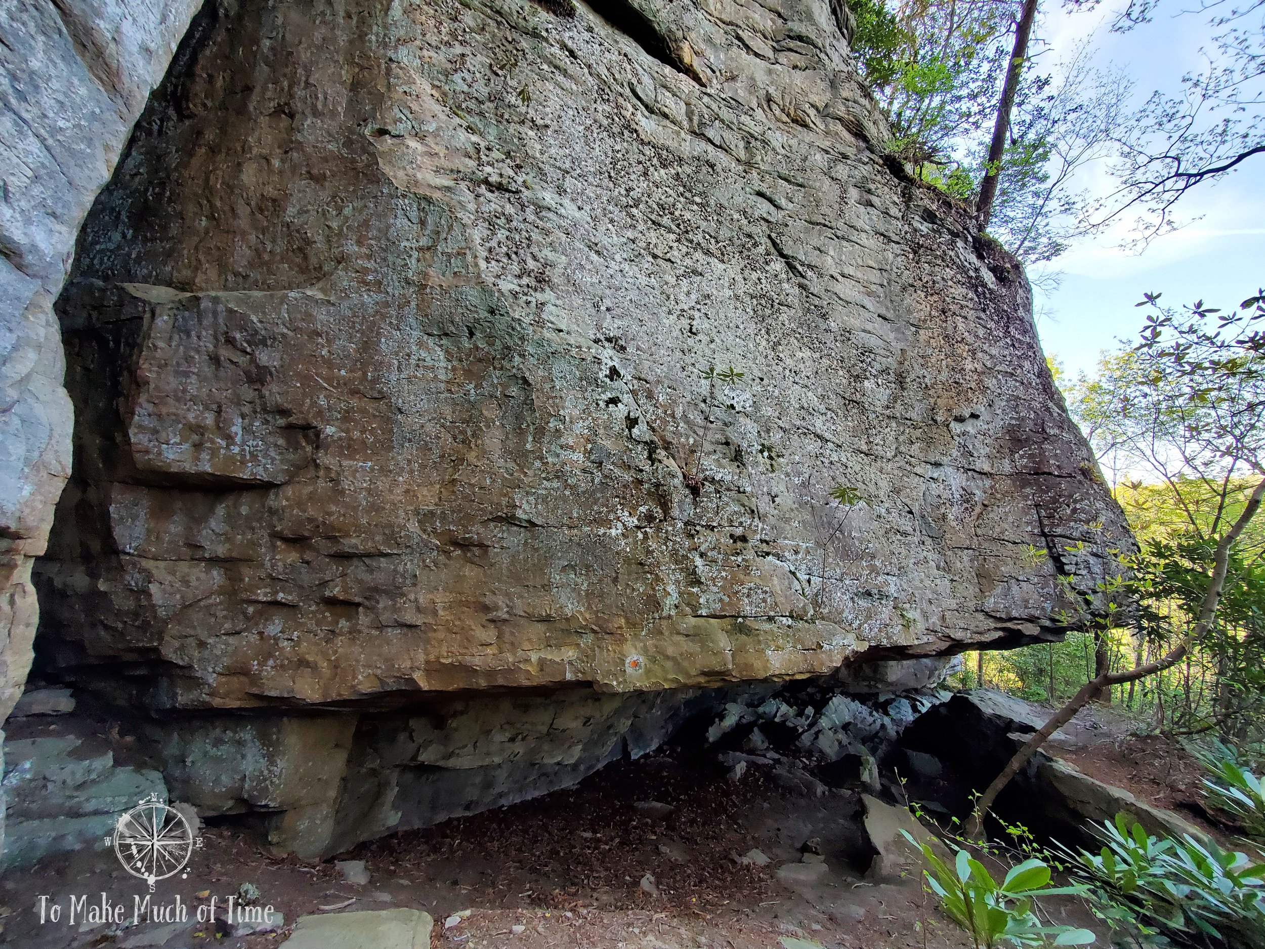
Large rocky outcrop along Prospector Trail Breaks Interstate Park

Me under the rock at Prospector Trail Breaks Interstate Park for scale

Prospector Trail Breaks Interstate Park

The Prospector Trail at Breaks Interstate Park goes right through these rocks

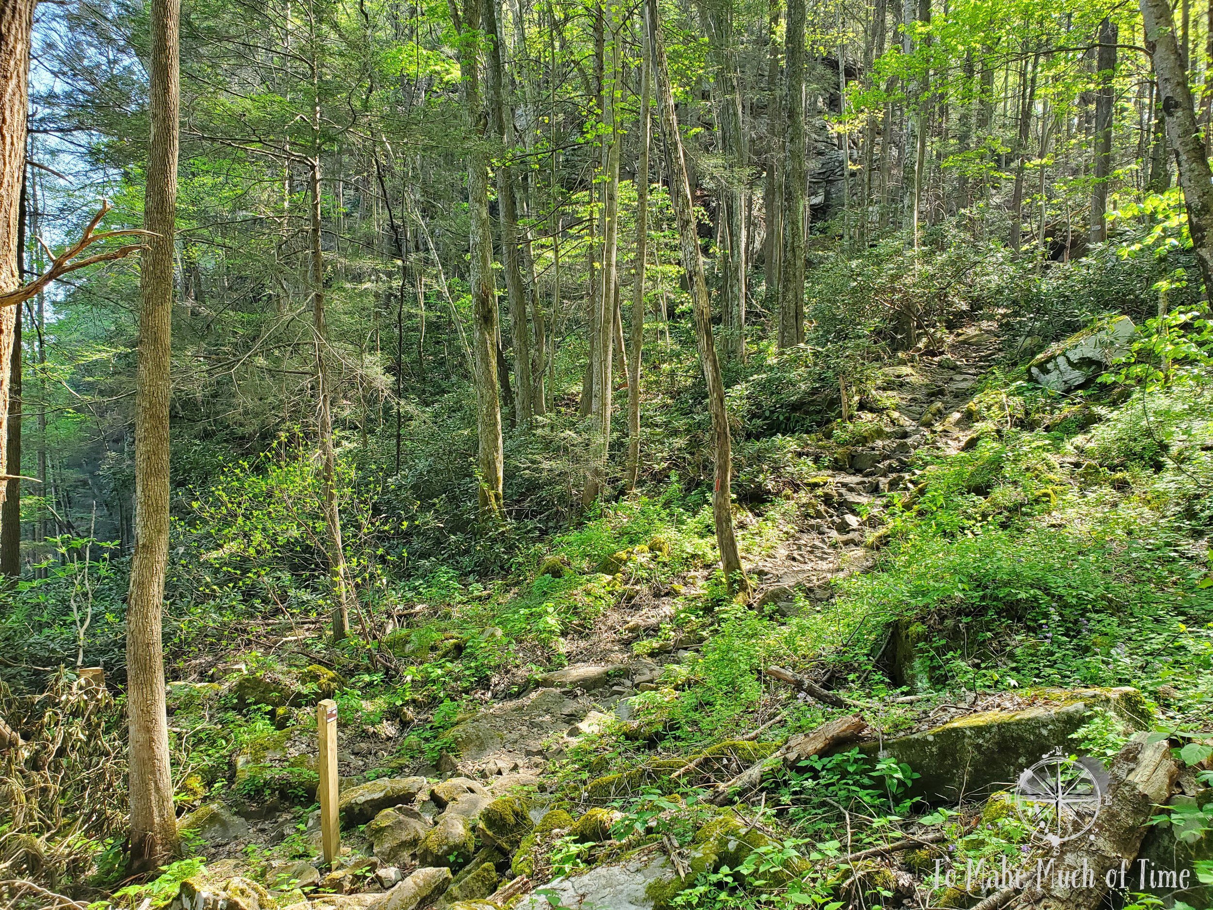
The Prospector Trail runs along a steep hillside
We quickly met enormous rocky slabs, walls, and boulders, and the trail actually crossed through the middle of a few of them, not something we experience often hiking in this part of the country but is more common in the Western United States. We were very aware that this could be prime bear territory, which many signs near the trailheads reminded us, so we made sure to be alert.
The trail description said that after the first descent, the first half of the trail was pretty moderate and then the second half would be more difficult due to its rockiness. This is absolutely true. There were sections of the trail that were entirely filled with rocks that we had to climb on. This would be totally unsafe if they were at all wet, but they were dry during our trip. This trail offered fewer views than others we have taken but made up for that with its own rocky beauty. The trail was fairly narrow with a steep mountain down from it, so hikers need to be very aware of their surroundings. At one portion, Dustin noticed that the trail was filled with poison ivy. That was not a particularly long section but worth noting. In one spot, we heard some loud clunking through the woods. We made some noises to announce our presence, which caused more sounds in return. Dustin spotted something brown through the greenery, and we’re not sure whether it was a bear (probably not as that would be more of a black color), a deer, or something else (Bigfoot?). While he was curious to hang back and try to identify it, I was all in favor of continuing on!

This was the spot on Prospector Trail where we spotted something moving up near the rocks

The narrow Prospector Trail

This steep downhill is what shoulders the Prospector Trail

Poison ivy dotted a section of the trail pretty extensively

One of many really cool geological elements along Prospector Trail

A naturally occurring rock cave along Prospector Trail
After scaling the rocky uphill climb at the end, we passed the trailhead to the Geological Trail, which we had taken the prior day, and then shortly thereafter came upon the Ridge Trail, which was the next part of the day’s trek. In the distance, we saw a family starting the Geological Trail, and they were the only others we spotted at all on the entire hike.

Did we mention how rocky Prospector Trail was?

Prospector Trail at Breaks Interstate Park

This is the trail, which was essentially all rocks near the end

Looking back over the rocky section after we climbed through, only to meet up with…more rocks!
The final segment of the Prospector Trail - this is uphill and all rocky
The Ridge Trail was fairly steep uphill initially before becoming an easier walk through rhododendrons and mountain laurels. It deposited us in the parking lot for the Stateline Overlook, from which we walked back on the road to our car. We were surprised how steep the road was, but maybe we were just a tad tired by then.

Mountain Laurel along Ridge Trail in Breaks Interstate Park
cumberland mountain scenic drive
After our midday break for lunch and dog walking, we headed out on our car ride to avoid the afternoon heat, which peaked at 88 degrees! We decided to take the nearby Cumberland Mountain Scenic Drive, about 21 miles in length and designated as a scenic drive in 2009. We caught the route from just outside Breaks Interstate Park and met up with the Route (611). The best way to get the map for this on Google is to get directions from Breaks Interstate Park to Clintwood, VA, with a waypoint in the middle of Blowing Rocks, VA (see our map below). That entire drive is about 27 miles and while it was estimated to take just under an hour, it took us a bit longer.
The start of the drive was dotted with sporadic houses and mobile homes and then became more mountainous and less populated. While the drive didn’t have sweeping views or pull-out areas, it was a pretty, rural, mountainous route that we enjoyed. There were lots of hairpin turns and steep ascents/descents so driving between 15-25 mph was the norm. We barely saw any other cars, though we had to be cautious when we did since the road is a 2-lane road only questionably. I’m very comfortable driving in that setting, but others may not be. Instead of doubling back, we opted for a major road back to the park, route 83 through Haysi. This route was pretty in its own right with mountain and river views throughout much of it. The return trip was under 40 minutes.

river along the scenic drive in Cumberland Mountains
Click the image below to save this post to Pinterest!

Check out other posts in this trip series:


