
To Make Much of Time
Home About Us Recent Adventures Adventures in Travel Adventures in Reading Adventures in Life Travel Tips Shop
HomeAbout UsRecent AdventuresAdventures in TravelAdventures in ReadingAdventures in LifeTravel TipsShop
To Make Much of Time
a blog about travel, life, and the pursuit of the unknown

Hiking Horsepen Trail at Carvins Cove in Roanoke, VA


Horsepen Trail at Carvins Cove in Roanoke, Virginia


Related posts: Want to read more about Virginia? Check out all our Virginia posts here. Or, looking for more Roanoke-area hikes? Check out our Compendium of Hikes in and near Roanoke.

Note: Some links throughout our site are affiliate links, which means we may receive a small commission at no cost to you.


WHERE IS Horsepen trail LOCATED?

Horsepen Trail is part of the large Carvins Cove Natural Reserve in Roanoke, Virginia. The cove is comprised of over 12,000 acres and includes a 630-acre reservoir. It is nestled in the Roanoke Valley near Tinker Mountain and has pretty mountain and water views, depending on your exact spot. The Reserve is half in Roanoke County, half in neighboring Botetourt County (pronounced bot-uh-tot).

While much more can be said about Carvins Cove overall (a topic for another post), it has a vast array of trails - some geared toward hikers, bike riders, and horses. While there are over 60 miles of trails, many can only be accessed through taking other trails, some of which are considered very difficult.

Horsepen Trail signage
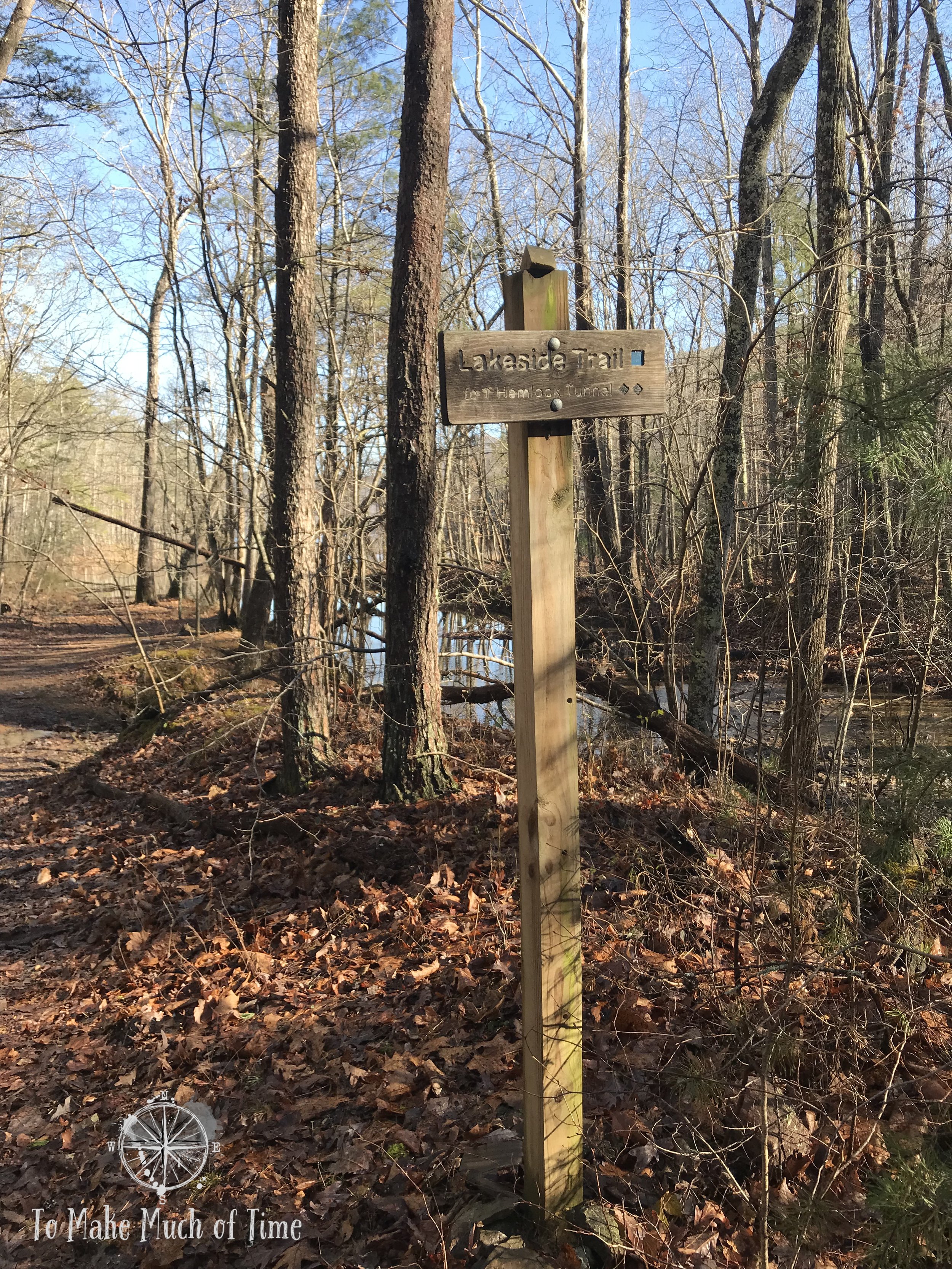
At the end of Horsepen Trail is Lakeside Trail and the first glimpse of Carvins Cove.

Carvins Cove in winter

Carvins Cove has three parking lots to access different parts of the reserve. To access Horpsen Trail, the trailhead meets up with the Timberview Parking lot, just a short drive down Timberview Lane near Interstate 81.

horsepen trail’s BEST KEPT SECRETS

During all our previous visits to Carvins Cove, we have always gone to the main entrance, which is right on the reservoir itself. It is a spot that can get fairly busy on weekends and days with beautiful weather. We had always been curious about the more remote sections, and Horsepen Trail is definitely that.

One of my favorite parts of the trail was that right at the end of it, it meets up with the next trail - Lakeside Trail - right at the reservoir and after walking through the tree covered woods, it is a pleasant surprise coming out to the shimmering water and surrounding mountains.

Several small streams run along Horsepen Trail on their way to Carvins Cove

All the leaves at Carvins Cove are a reminder that fall isn’t that far behind us
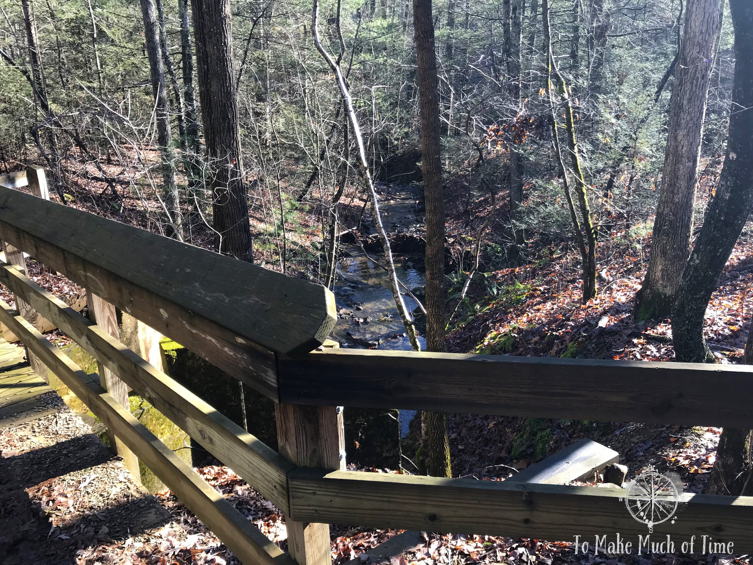
A bridge traverses one of the creeks on Horsepen Trail

WHAT TO DO AND WHAT TO EXPECT WHEN HIKING AT horsepen trail

Horsepen Trail itself is 1.24 miles in length, which would be 2.48 miles round trip. The trail is graded downhill, which makes sense because it ultimately meets up with the reservoir. While not steep at all, it does mean the return trip to the parking lot is uphill.

The trail is quite wide - think semi fire road - so it feels more like a casual stroll in the woods. One major downside is that high power lines run nearby and the buzzing sound from them is audible for portions of the hike.

In our case, we decided to continue on to the Lakeside Trail for a little ways to enjoy the views. There is also another trail, called First Deck, that is a loop that spurs off from Horsepen if you wish to add 0.92 miles to the hike. While Horsepen Trail is considered to be an easy level of difficulty, these other two trails have higher difficulty ratings: First Deck and Lakeside are both More Difficult (a step up from Easy in their system).

The water at Carvins Cove is so clear - a good thing for a reservoir providing water to local residents!

We watched some tiny tadpoles swimming in the shallows of Carvins Cove

From atop the Lakeside Trail, Carvins Cove looks green, reflecting the winter light

Wear hiking boots - Horsepen Trail fords a few creeks such as this one

horsepen trail - ACCESSIBILITY

Horsepen Trail is not wheelchair accessible given that it is a rocky, dirt path. The trail is generally fairly wide and would be fine for children and leashed dogs. We passed a couple that were likely in their late 70s or 80s liking the trail with hiking sticks for added stability, though age is of course not an indicator of fitness ability.


Click the image below to save this post to Pinterest!


Check out our other posts about Virginia

Featured
3 Days in Virginia's Staunton River State Park
Adventures in Travel, Virginia
3 Days in Virginia's Staunton River State Park
Adventures in Travel, Virginia

Staunton River State Park has 11 distinct trails, though a few are only accessible via others.  They range in length from a small cut-over and accessible trail at 0.2 miles to a 8.6 mile River Bank Trail.

Read more →
Adventures in Travel, Virginia
A Spooky Ghost Tour of Roanoke
Adventures in Travel, Virginia, Series: Roanoke VA
A Spooky Ghost Tour of Roanoke
Adventures in Travel, Virginia, Series: Roanoke VA

We are not part of the roughly half of Americans who believe in ghosts. (Various surveys report between 40-60% of Americans believe in ghosts.) So, when US Ghost Adventures contacted us to see if we’d like a complimentary ghost tour in one of several cities, my natural inclination was to decline. But then I thought, what the heck, why not?! Neither of us has ever gone on a ghost tour before, so we had no preconceived idea of what to expect.

Read more →
Adventures in Travel, Virginia, Series: Roanoke VA
3 Days in Virginia's Hungry Mother State Park
Adventures in Travel, Virginia
3 Days in Virginia's Hungry Mother State Park
Adventures in Travel, Virginia

This was truly an entirely hiking-filled vacation, and the highlights were the gorgeous views of the lake within the park and surrounding mountains, particularly from Molly’s Knob, offering a sweeping view.

Read more →
Adventures in Travel, Virginia
3 Days in Virginia's Smith Mountain Lake State Park
Adventures in Travel, Virginia
3 Days in Virginia's Smith Mountain Lake State Park
Adventures in Travel, Virginia

Smith Mountain Lake State Park is located in southwest-ish Virginia, about 40 minutes east of Roanoke, 2.5 hours southwest of Richmond, 3 hours north of Charlotte. The lake itself is a man-made reservoir of immense proportions. The shoreline measures 500 miles and the lake is 40 miles across. In fact, in 2023, Travel + Leisure magazine, called Smith Mountain Lake (SML to locals) the “Lake Tahoe of the East”. The shoreline is dotted with homes for both locals and vacationers and is a popular spot for people to rent houses.

Read more →
Adventures in Travel, Virginia
Hiking Fallingwater Cascades in Bedford, VA
Virginia, United States, Southeast US, Adventures in Travel, Series: Roanoke VA
Hiking Fallingwater Cascades in Bedford, VA
Virginia, United States, Southeast US, Adventures in Travel, Series: Roanoke VA

Fallingwater Cascades, located off of the Blue Ridge Parkway in Bedford County, is located just a few miles north of the popular Peaks of Otter area. This trail is 1.0 miles in total length (down and back) and runs along the cascades with pretty views of the cascades themselves and small pools of mountain water. The trail is entirely a descent to the base of the cascades followed by an ascent back up with the total elevation change of about 365 feet. This area is particularly pretty in the spring and fall.

Read more →
Virginia, United States, Southeast US, Adventures in Travel, Series: Roanoke VA
Hiking Abbott Lake in Bedford, VA
Virginia, United States, Southeast US, Adventures in Travel, Series: Roanoke VA
Hiking Abbott Lake in Bedford, VA
Virginia, United States, Southeast US, Adventures in Travel, Series: Roanoke VA

Abbott Lake Trail is located about 50 minutes north of Roanoke, VA, in Bedford in the heart of the area known as Peaks of Otter, and is located right off of the Blue Ridge Parkway. For more information on the 469-mile Blue Ridge Parkway, which travels through Virginia and North Carolina.

Read more →
Virginia, United States, Southeast US, Adventures in Travel, Series: Roanoke VA
Hiking Sharp Top Mountain in Bedford, VA
Virginia, United States, Southeast US, Adventures in Travel, Series: Roanoke VA
Hiking Sharp Top Mountain in Bedford, VA
Virginia, United States, Southeast US, Adventures in Travel, Series: Roanoke VA

Sharp Top Mountain Trail is labelled - appropriately - as strenuous. The trail does flatten out a little bit at points along the way but it is a steep upward climb, gaining over 1300 feet in elevation in 1.5 miles. Large segments are basically carved rock stairs. One way to think about this in a different scale: this is basically like climbing 130 flights of stairs over a 1.5 mile distance.

Read more →
Virginia, United States, Southeast US, Adventures in Travel, Series: Roanoke VA
Touring Smith Mountain Lake Dam in Virginia
Adventures in Travel, Virginia
Touring Smith Mountain Lake Dam in Virginia
Adventures in Travel, Virginia

The Smith Mountain Lake Dam is one of the largest dams in the United States, and the process to build it required extensive engineering and time. Six years passed between the start of construction and the first generation of electricity (1959-1965), though the lake itself didn’t fully fill until the following year. The dam itself is over 800 feet long and 235 feet long. It’s tall enough to have a 17-story elevator built into the dam itself!

Read more →
Adventures in Travel, Virginia

Virginia, United States, Southeast US, Adventures in Travel, Series: Roanoke VALindseyJanuary 16, 2023hiking in roanoke, day trips from Roanoke VA, winter hiking near Roanoke VA, Carvins Cove hiking in Roanoke Virginia, Horsepen Trail at Carvins Cove in Roanoke Virginia, hiking Horsepen Trail at Carvins Cove in Roanoke Virginia, what is the Horsepen Trail like at Carvins Cove, forested hikes in Roanoke Virginia, less popular hikes in Roanoke VirginiaComment
Facebook0 Twitter Tumblr Pinterest0 0 Likes
Previous

Pacific Northwest and Western Canada Road Trip: Vancouver (Days 1-3)

British Columbia, Canada, Adventures in Travel, Road Trip - PacNWLindseyJanuary 21, 2023road trip from Vancouver to Washington to Banff, 11 day road trip Pacific Northwest, road trip in British Columbia, road trip in Canada, two days in Vancouver, how to spend two days in Vancouver British Columbia, where to stay in Vancouver Canada, West End Guest House Vancouver British Columbia, original B&B in Vancouver, Victorian B&Bs in Vancouver Canada, what to do at Stanley Park in Vancouver, visiting Stanley Park in Vancouver, Brockton Point Trail in Stanley Park, trail to lighthouse in Stanley Park, trails near Coal Harbor in Vancouver, Espana Restaurant in Vancouver, tapas restaurant in Vancouver, sunset at English Bay Beach in Vancouver, hiking at Lighthouse Park in West Vancouver, how far is Lighthouse Park from Vancouver, visiting VanDusen Botanical Gardens in Vancouver, photos of VanDusen botanical gardens in Vancouver
Next

Pacific Northwest & Western Canada Road Trip: 11 Days - British Columbia, Washington State, and Alberta

Washington, Western US, United States, British Columbia, Canada, Alberta, Adventures in Travel, Road Trip - PacNWLindseyJanuary 8, 2023best road trips in the US and Canada, road trip in Washington, road trip in Canada, road trip in British Columbia, road trip in Alberta, road trip from Vancouver to Washington to Banff, what to do in Vancouver, what to do in Banff, what to do in Washington State, what to do in Spokane Washington, 11 day road trip Pacific Northwest

Copyright To Make Much of Time 2025. All rights reserved.

Our Latest Adventures

Some links throughout our site are affiliate program links, which means we may receive a small commission at no cost to you. We only link to products and sites we personally use and recommend. We appreciate any support you provide as it enables us to continue to share our travels.