
3 Days in Virginia's Staunton River State Park
Camille’s first vacation and hike at Staunton River State Park
Note: Some links throughout our site are affiliate links, which means we may receive a small commission at no cost to you.
Planning our Trip to Staunton River State Park
First, a lesson in southern elocution. In Virginia, “Staunton” is pronounced as if it doesn’t have the ‘u’ at all. The correct pronunciation is “Stanton” (not “Stawnton”). We learned this early in our Virginia residence since there is a small city called Staunton just over the mountains west of Charlottesville. It took some getting used it.
what makes staunton river state park special?
Staunton River State Park is Virginia’s first designated International Dark Sky Park, meaning it is far enough away from population centers and the ‘noise’ from light pollution that night sky viewers are in for a starry sky. (Watoga State Park in West Virginia, which we’ve visited twice, also has this designation.) You can learn more about DarkSky International here.
While we’re not horse people ourselves, Staunton River State Park was designed with equestrians in mind. Almost all trails are horse friendly, and there is even a separate equestrian campground.
Staunton River has views of three bodies of water: Staunton River (the local name for what is also the Roanoke River), the Dan River, and Buggs Island Lake, the largest lake in Virginia, which was formed by the building of a reservoir, which submerged a portion of the park (they’ve since added more adjoining land).

Hiking Twin Loops Trail at Staunton River State Park
Lake at Staunton River State Park
HOW WE DETERMINED OUR DESTINATION: staunton river STATE PARK
A few years ago, we discovered the joy of staying in state park cabins to put ourselves within walking distance of many hikes. We visited West Virginia’s largest state park, Watoga, and stayed in a rustic CCC cabin. In fact, we liked that so much, we took a second trip to Watoga. Read about both our first and second trips to Watoga here. Since then, we have visited many state parks in Virginia and surrounding states, including Breaks Interstate Park (read about that trip here); Carters Cave in Kentucky (read here), Smith Mountain Lake State Park (read here) and Hungry Mother State Park (read here), both in Virginia.
Honestly, we ended up going to Staunton River State Park based on availability. The two other state parks in the running - Fairy Stone State Park and Douthat State Park - were both already booked by the time we decided our new puppy was mature enough to travel with us. Occoneechee State Park and Staunton River State Park are only about 45 minutes from each other. Neither had a large swath of availability but they had consecutive days. So, we booked two nights at Occoneechee and three nights at Staunton River. As it turned out, our oldest dog, nearly 14-year old Tara, had an upset stomach so we had to take her to the vet and ensure she was healthy to travel so we ended up missing the Occoneechee leg of our trip entirely and instead headed straight to our three nights at Staunton River State Park.

Staunton River State Park in Virginia
where is staunton river STATE PARK?
Staunton River State Park is located in the portion of Virginia known as Southside. It is in the southern part of the state, right near the border with North Carolina and in the middle - neither coastal nor as far inland as the Blue Ridge and the start of Southwestern Virginia.
From Roanoke (where we live), the Roanoke River flows to the coast. Along the way, the same body of water becomes known as the Staunton River to the locals for about 80 miles of its journey. The Staunton River passes right near the town of Scottsburg (not to be confused with Virginia’s town of Scottsville, just south of Charlottesville) and at the confluence with the Dan River sits some jutting land that holds Staunton River State Park. This area was once a prime producer of tobacco, an economically important crop for Virginia. Staunton River State Park is about a 2 hour 10 minute drive from Roanoke; about 3 hours from Charlotte, NC; and about 2 hours from Richmond.
Because it is a rural area, the routes that carry visitors from these larger cities are typically fairly windy country roads. No major interstate goes through the area.

Staunton River State Park

Staunton River State Park hiking
WHERE WE STAYED: CABIN ACCOMMODATIONS IN staunton river STATE PARK
Staunton River State Park hosts 8 cabins that vary in size from efficiencies to 1- and 2-bedrooms. Additionally, there is a campground and a separate equestrian campground.
We stayed in Cabin #3, a one-bedroom. Cabin #1 is ADA accessible. And all the cabins sit in a row alongside each other (some other parks scatter cabins in multiple areas). They sit along the Staunton River, though the view of the water is somewhat obstructed by trees along its banks.

Cabin #3 at Staunton River State Park

Cabin #3 family room at Staunton River State Park

Bedroom in Cabin #3 at Staunton River State Park

Kitchen in Cabin #3 in Staunton River State Park

Bathroom in Cabin #3 in Staunton River State Park
The cabins are spaced out enough that while you’re aware of your neighbors, you also feel you have reasonable privacy with some cabins a little closer than others.
We usually try to book a two bedroom cabin to have extra space for storage and for the pups, but in this case, we went with what was available, which was the one bedroom. In general, most state park cabins are fairly cozy with limited to no closet space so for trips that include a cooler, hiking backpacks, days of dog food, etc. extra space is worth the cost to us.
The cabin at Staunton River State Park is possibly the cutest of the state park cabins we’ve stayed in. It appears that their cabins were all renovated about 2020 so even though they are original CCC cabins, they felt new-ish) inside.
The layout of cabin #3 was as follows: after two steps up into the front door, you enter the family room, which has a large stone fireplace to the left. Along the same wall as the front door is the bathroom. Immediately to the side of th bathroom is the bedroom, accessed via the family room. Looking straight ahead from the front door is one of two back doors out onto the park back porch that overlooks the lake. And to the back left of the cabin is the kitchen, which contains the second door to the porch. There is no separate dining room, but the family room contains a small bistro table that worked well for the two of us. Technically this cabin can accommodate four people (two would need to sleep on an air mattress or similar in the family room).
Outside, to the right of the porch, is a gravel picnic area that includes a picnic table, fire pit ring, and camping grill.
We were able to rearrange some furniture in the family room to make room for our two dog enclosures. (Normally we travel with one enclosure but with an 8 month old puppy and two senior dogs (nearly 13 and nearly 14), we thought it would be wise to let them get some rest away from the other dog generation.
As with other Virginia state parks, visitors must bring their own sheets and towels. The kitchen is outfitted with standard kitchen accessories - coffee maker, toaster, utensils, plates, bowls, cups, pots and pans, and various things like tongs. Unlike private home rentals or some other vacation homes, there are no food items available in Virginia state park cabins - this means there isn’t salt and pepper or the like.

Driveway near cabins at Staunton River State Park
The park has 20 cabins for rent. They are a combination of the older CCC cabins and newer ones built out of cinder block. Having stayed in a CCC cabin in West Virginia and found it to be a bit drafty, we opted this time for the new cinder block build, which has less aesthetic appeal, though it’s absolutely functional with two bedrooms, a bathroom, a kitchen, and a family room/dining area around a fireplace. Of the various state park cabins we’ve stayed in (in VA, WV, and KY), this one was the least visually appealing on the inside.
The appeal of the park is, for us anyway, hiking!

Entrance to Staunton River State Park
WHAT WERE THE HIGHLIGHTS OF OUR TRIP TO staunton river STATE PARK?
This was our first true trip in 15 months between contending with health concerns with our older dog, Sophie, who we lost last December; our new puppy, Camille, who we welcomed in April; and a mixture of home projects and a job change thrown in for good measure. Just getting away to relax and hike for a few days was something we don’t take for granted.
Hiking in the fall in Virginia is fantastic and the weather performed perfectly. We had beautiful bright blue skies, some leaf color (due to drought in Virginia, this year isn’t as spectacular as other years), and the calming views of the rivers and lake throughout the hikes.
The hikes in the park were varied to keep things interested and generally pretty low-key in the fairly flat terrain. This seemed more like gentle walks in the woods versus more intensive hiking up and down mountains, which we tend to do more of in our home of Roanoke.

Hiking Staunton River State Park
Hiking Staunton River State Park
Hiking in Staunton River State Park
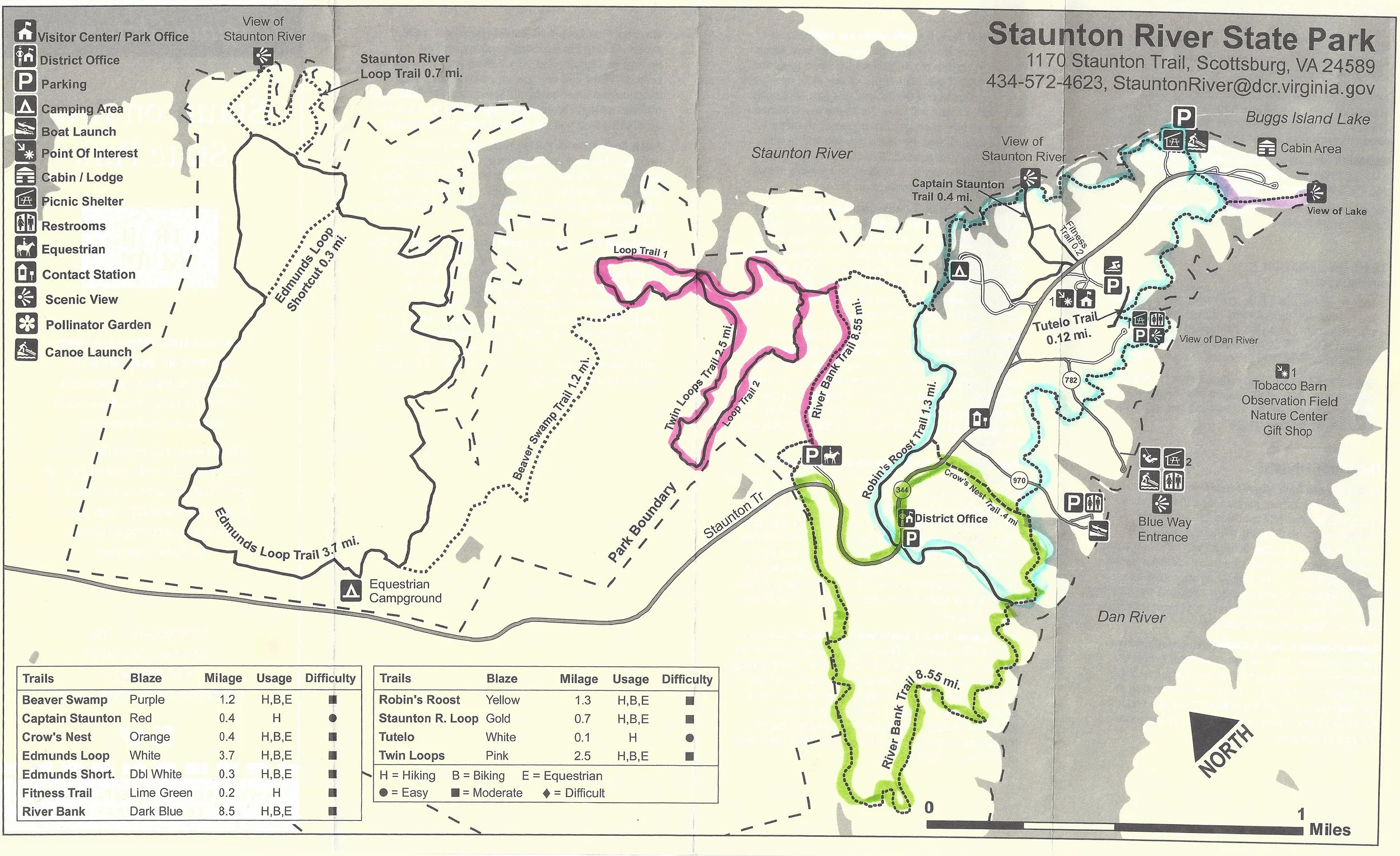
The highlighted colors on this Staunton River State Park hiking map show the way we combined trails to create loops without repeating ourselves much. Our descriptions below refer to the colors on this map to depict our descriptions visually.
trip overview of staunton river state park
Staunton River State Park has 11 distinct trails, though a few are only accessible via others. They range in length from a small cut-over and accessible trail at 0.2 miles to a 8.6 mile River Bank Trail. Other than three tiny trails (0.1, 0.2, and 0.4 miles), all are open to hikers, horses, and bikes. Only two of the very short trails are listed as easy, the rest are classified as moderate. Moderate, as defined by this park trail guide, is defined as trails from 1-5 miles where at least 60% of the trail is fairly flat.
With two full days in the park, we decided to map out the various hiking routes we planned to take. Since several of the trails are only accessible by first taking another path, or you can use a few to form a loop, we determined four individual hikes we could take that would cover all of the trails in the park. Our standard schedule when visiting and staying at a state park is to go for a morning hike, return to the cabin to walk the dogs, eat lunch, and refill our water, then go on an afternoon hike before returning for dinner and to relax in the evenings. Ultimately, we decided to take three of these four trails and spent the afternoon of our second day relaxing at the cabin.
The park was quiet during our visit, which was a Wednesday through Saturday in mid-October. While there were other guests at the campground and cabins, we only saw one other group of three hikers our first morning and a duo riding horses on another trail that afternoon. Other than that, the trails were ours to explore!

Hiking Staunton River State Park
checking in at staunton river state park
We arrived around 4:30pm (check-in begins at 4pm). This was 8-month old puppy Camille’s first vacation, so we weren’t sure what to expect. She was fantastic during the 2-hour car ride, snuggled in the backseat with her big sisters, Tara and Gretchen, who are pros at state park vacations. Gretchen typically gets a little nervous on car rides but having two calm sisters seemed to help. (Our prior dog, Sophie, tended to be a bit more high strung like Gretchen so clearly they fed off of each other!)
The state park was easy to find. Upon entering, the “district office” building has a sign telling guests to head to the newer visitor’s center for check-in. Just a short drive further up the road is a larger visitor’s center that has a gift shop and some basics for campers. Check-in was a breeze.
We were able to park close to the cabin so unpacking and getting our three Labrador retrievers settled in was a breeze.
Day 1: river bank trail to robin’s roost trail to river bank trail and twin loops trail via river bank trail
River Bank Trail, which is 8.6 miles, is the longest trail in the park and is the trail by which many other trails can be accessed. As a result, we cut up the River Bank Trail into segments to create multiple loop trails; this means that you’ll see a lot of reference to the River Bank Trail but each time is a different segment. We did hike that entire trail via this different routes. In order to more clearly follow the paths we took, see the color-coded map further down.
Morning total hiking time and distance: This is the hike highlighted in blue on our map above. For our morning hike, we walked from our cabin to a nearby trailhead to take the River Bank Trail to Robin’s Roost Trail and then connected back to a different portion of River Bank Trail before walking back to the cabin. In total, we traversed 5.32 miles (per my Garmin GPS) over the course of 2 hours and 14 minutes.
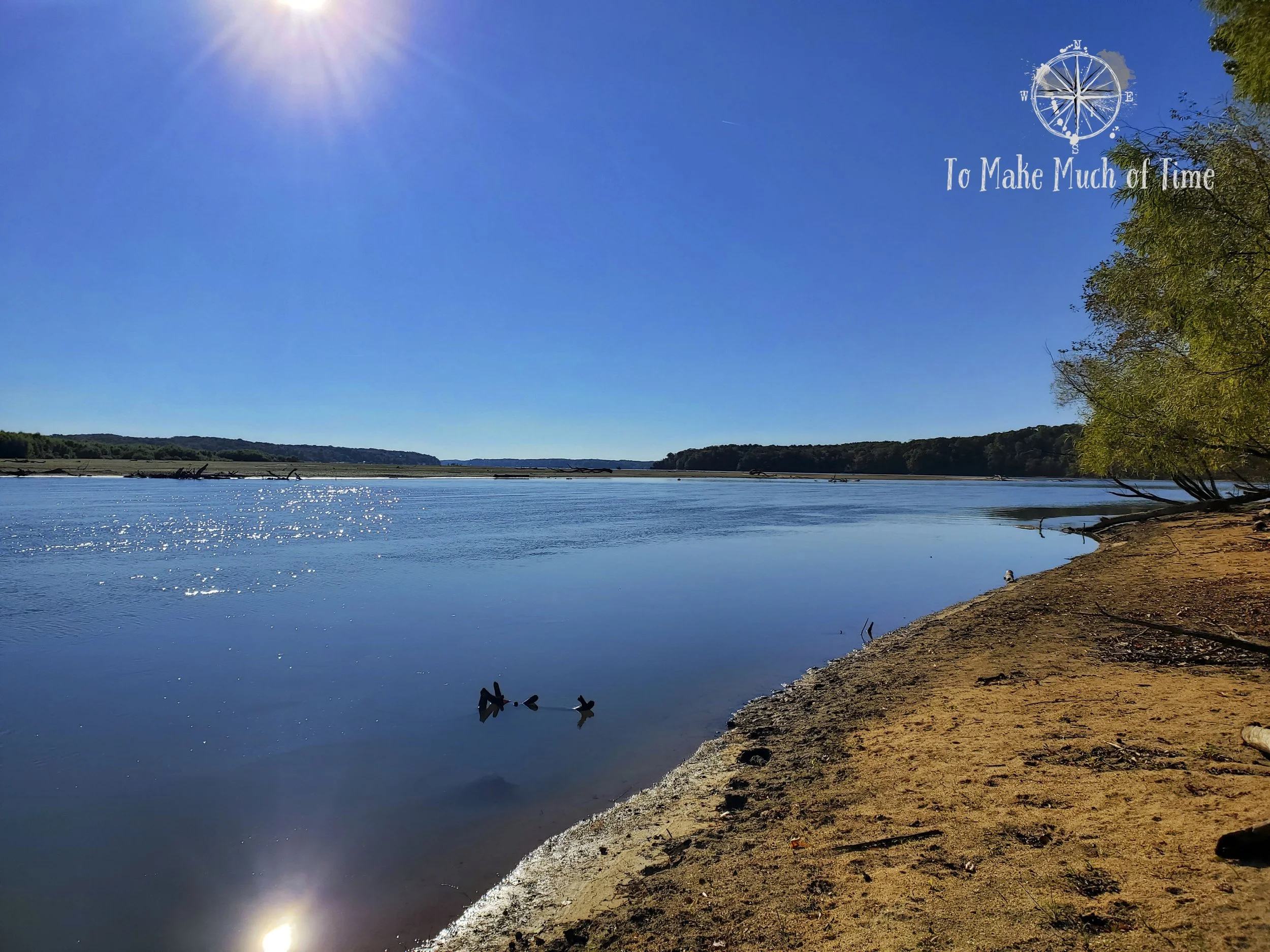
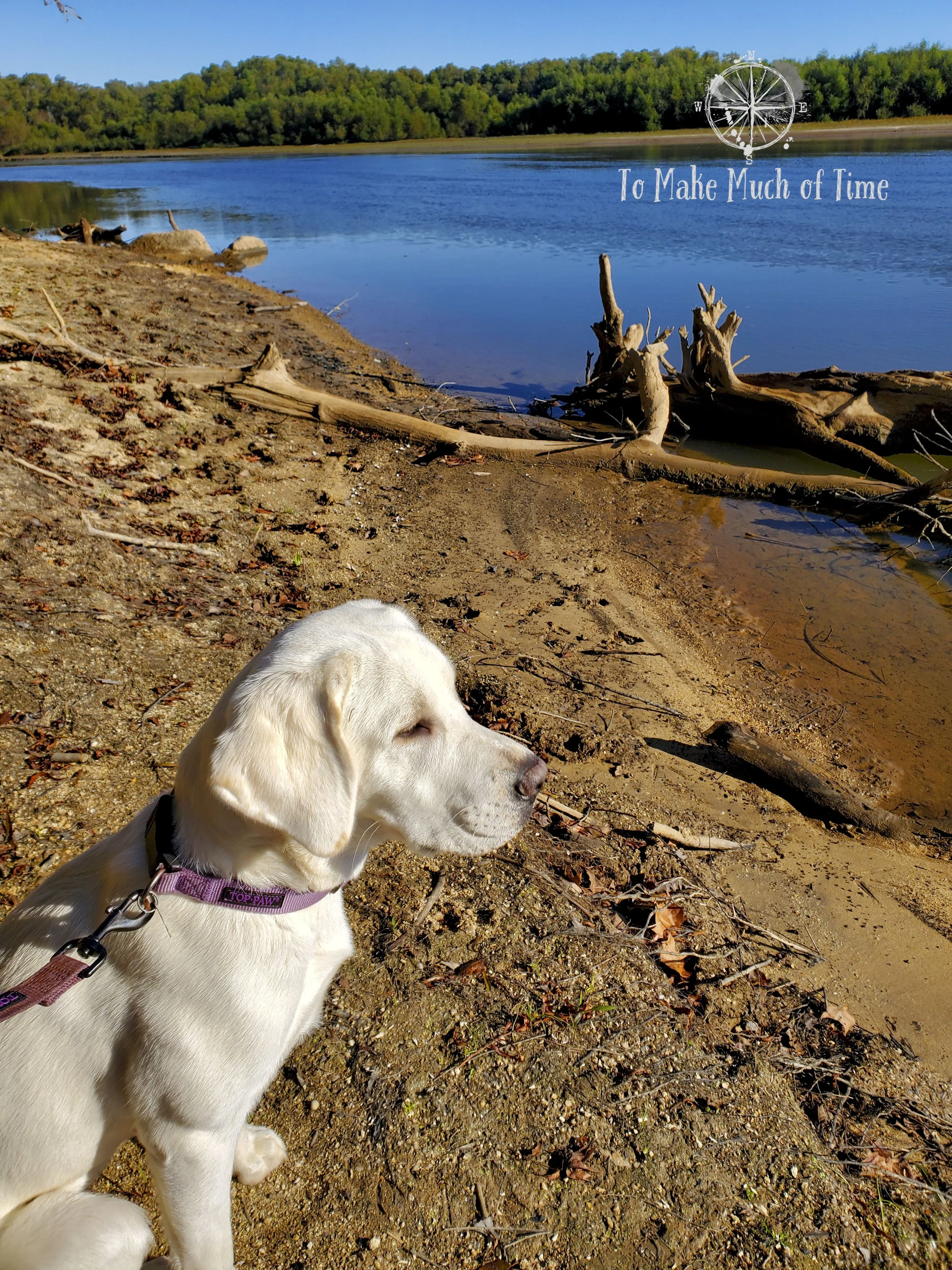
From our cabin, we walked down the road about 0.15 miles to catch the first trailhead: River Bank Trail. We would take River Bank Trail to Robin’s Roost Trail, and back over to a different portion of River Bank Trail. Robin’s Roost Trail is 1.3 miles. We selected this as our first hike in the park because it has multiple viewing spots of the two rivers that run alongside the park: Staunton River and Dan River. Where they connect there is also a lake, which is also a reservoir. Buggs Island Lake (and John H. Kerr Reservoir) is the largest lake in Virginia!

Hiking Staunton River State Park
Hiking Staunton River State Park
Hiking Staunton River State Park
Hiking Staunton River State Park
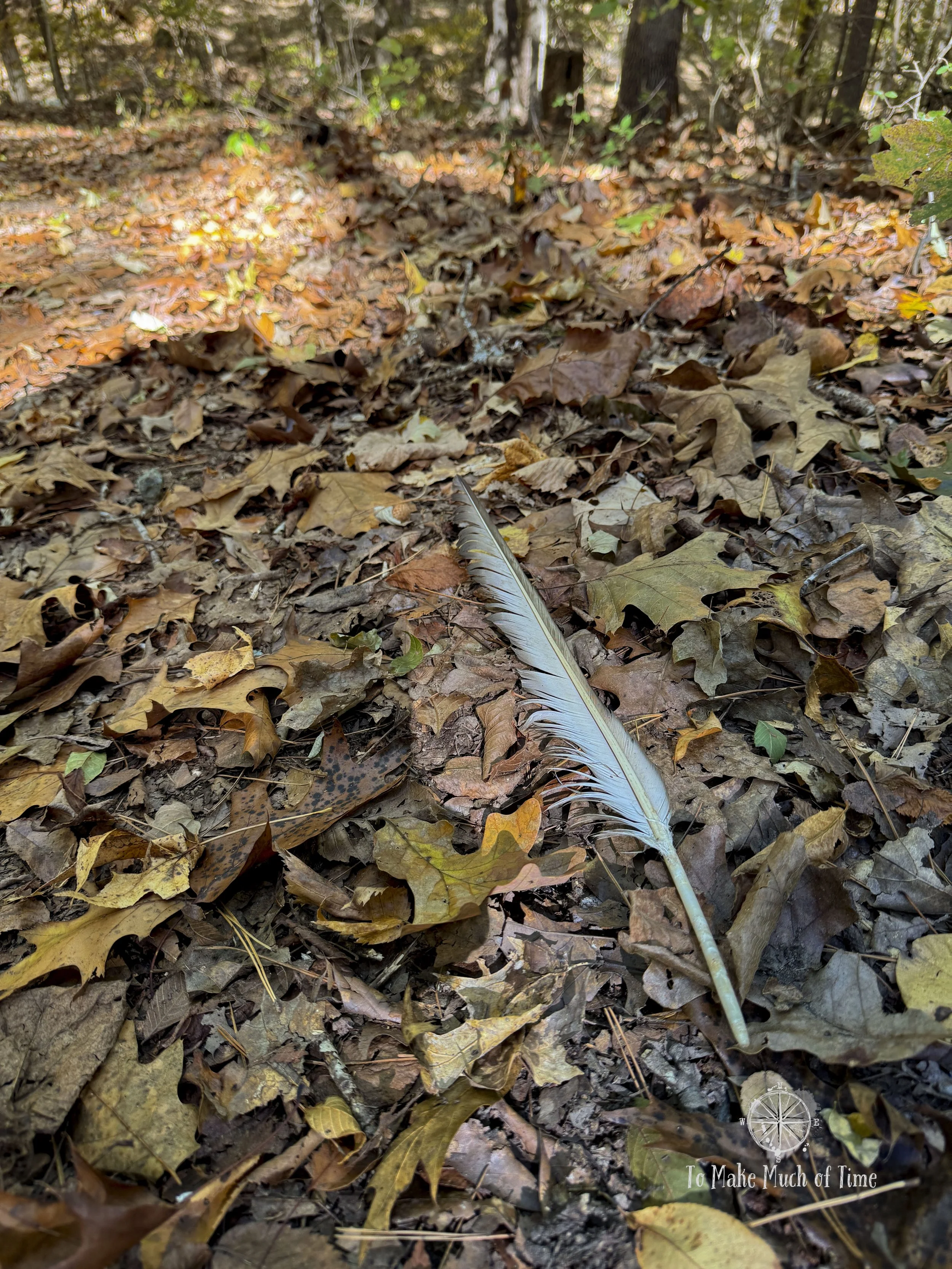
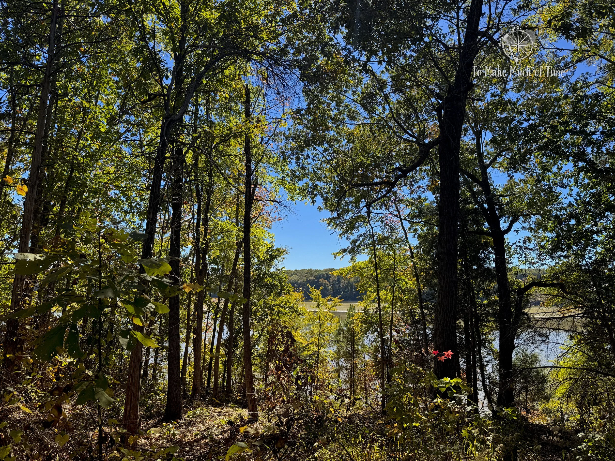
Early on in the hike, we saw a number of various sized bird feathers strewn on the ground, so there clearly had been some sort of aerial bird battle the night or day before. We walked along the Staunton River for a large portion of the trail initially, though often the trail was just inland enough or the trees were thick enough that it didn’t lend itself for large, sweeping water views. Still, we had enough glimpses of pretty blue and green water on a bright blue sky day.
There is a viewing spot along the river that we were able to enjoy. That viewing spot can also be accessed directly via a 0.4 mile Captain Staunton Trail. Even there, there were some trees in the way of a truly open water views. A bit further along the River Bank Trail, we did come upon open views of the water and even a small beach on the banks – at least with the current water levels.

Hiking Staunton River State Park

Hiking Staunton River State Park
And I guess it is worth noting that it has been an unusually dry spell in Virginia, which is both good and bad for hiking. It means that small, seasonal creeks are often fully dried up. It also allows us to avoid muddy trails. Staunton River State Park is an equestrian park, which means people can bring their horses (there is an equestrian campground, too) and that essentially all trails are horse-friendly. From prior experience, we know that horses + trails + even a little rain can equate to deep troughs of water and a muddy hike. So, we lucked out in this case that the ground is pretty dry and we could co-exist peacefully as hikers and equestrians.
Eventually we came upon Robin’s Roost Trail (1.3 miles), which cut inland. We really enjoyed Robin’s Roost Trail, which was very different than the other part of the park. According to the trail guide, this area is a native Oak Hickory Forest and represents the original ecosystem in the area before humans influenced the growth.
Upon meeting up with the River Bank Trail, we had more sightings of the river, this time the Dan River, and got to enjoy a particularly open area with views of the huge river/lake and a wide river bank.

Hiking Staunton River State Park
Afternoon total hiking time and distance: This is the route parked pink on our map above. After lunch and a short rest, we decided to tackle Twin Loops Trail (2.5 miles) with access via a different segment of the River Bank Trail. All-in this hike was 4.38 miles and took us about an hour and 50 minutes.
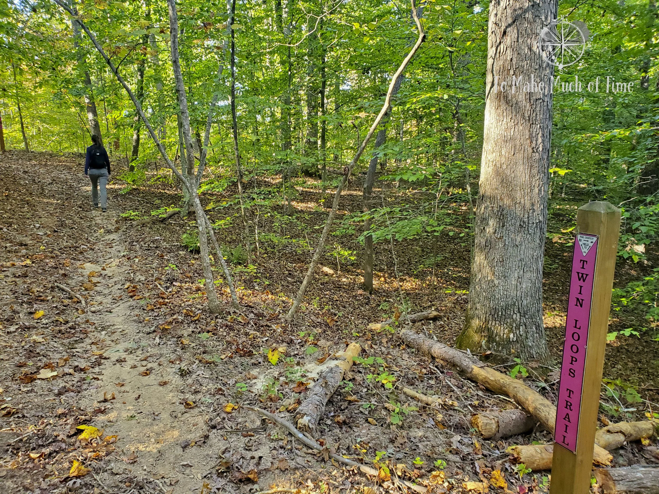
There is a parking lot and horse trailer lot off the main park road that is a great access point to this trail, so we hopped in the car for a short drive down the road to find the trailhead. We did actually pass two people riding their horses on the trail shortly after we began our hike.
In the parking lot, we found a trail map that showed an extra leg of the Twin Loops Trail that wasn’t on our trail guide. Upon starting the hike, we saw that additional segment was closed, so our assumption was that it has been closed long enough that they updated the park trail guide brochure to remove it but have left it on the map at the trailhead since that one would be harder to update.
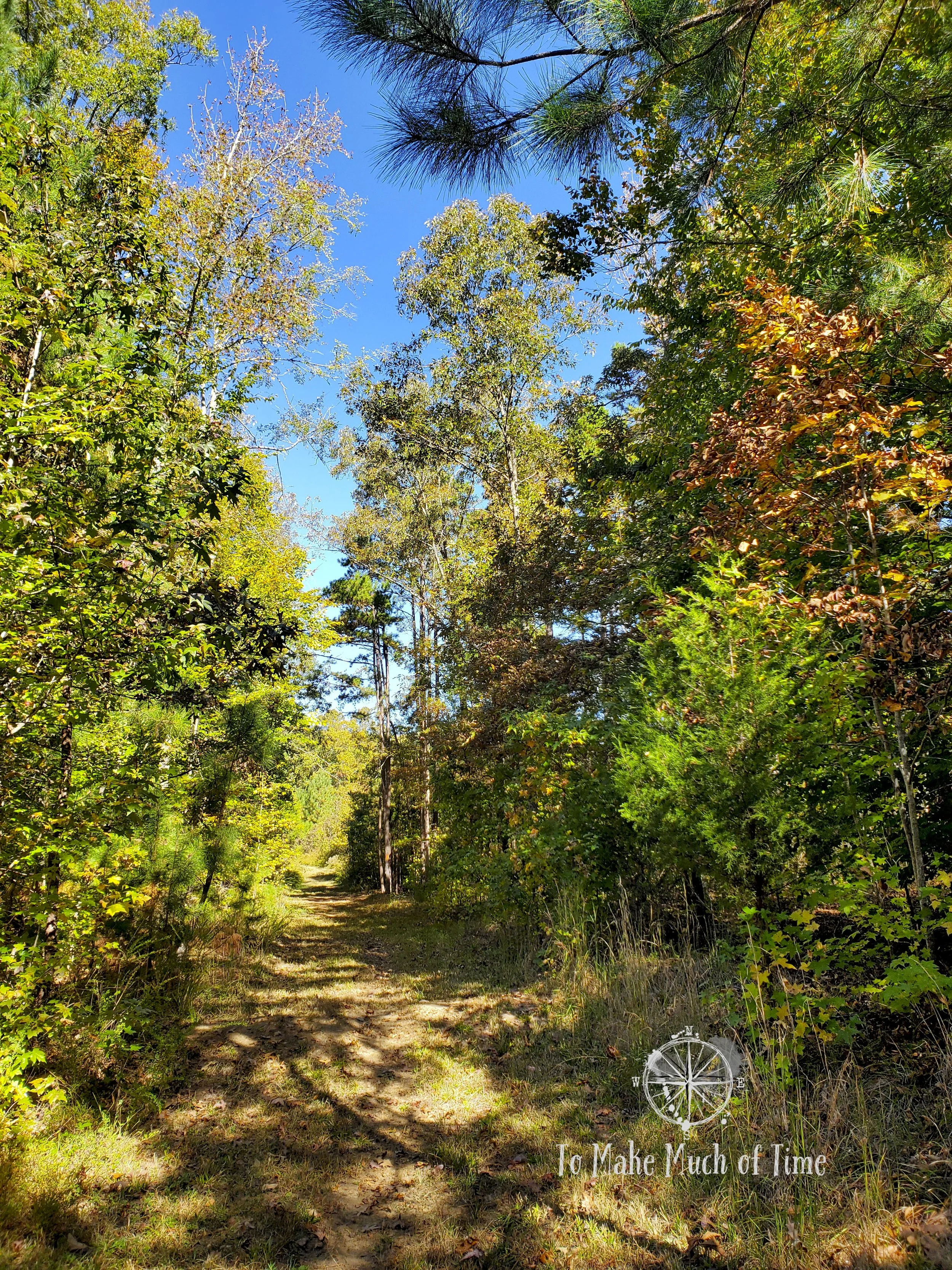
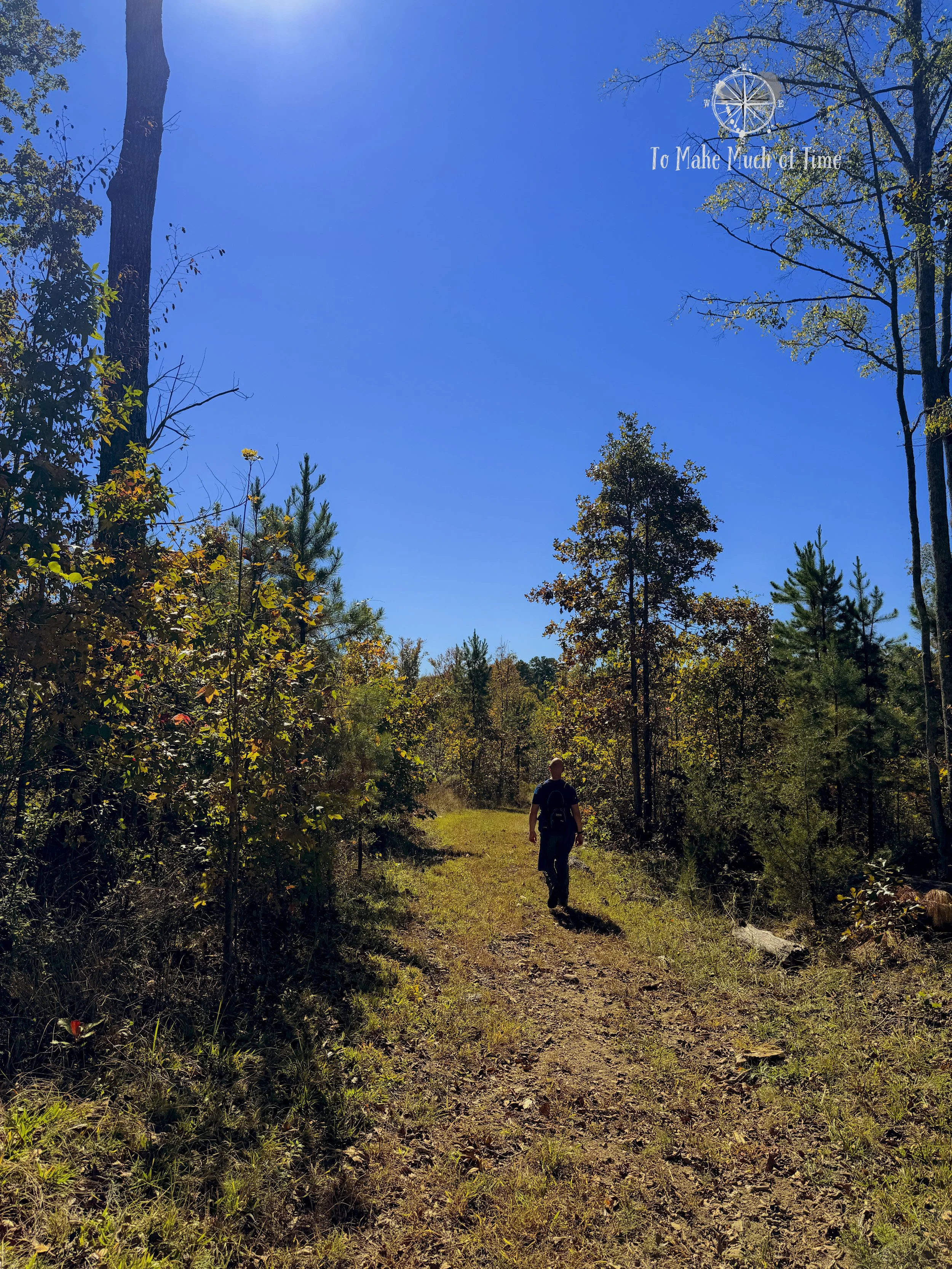
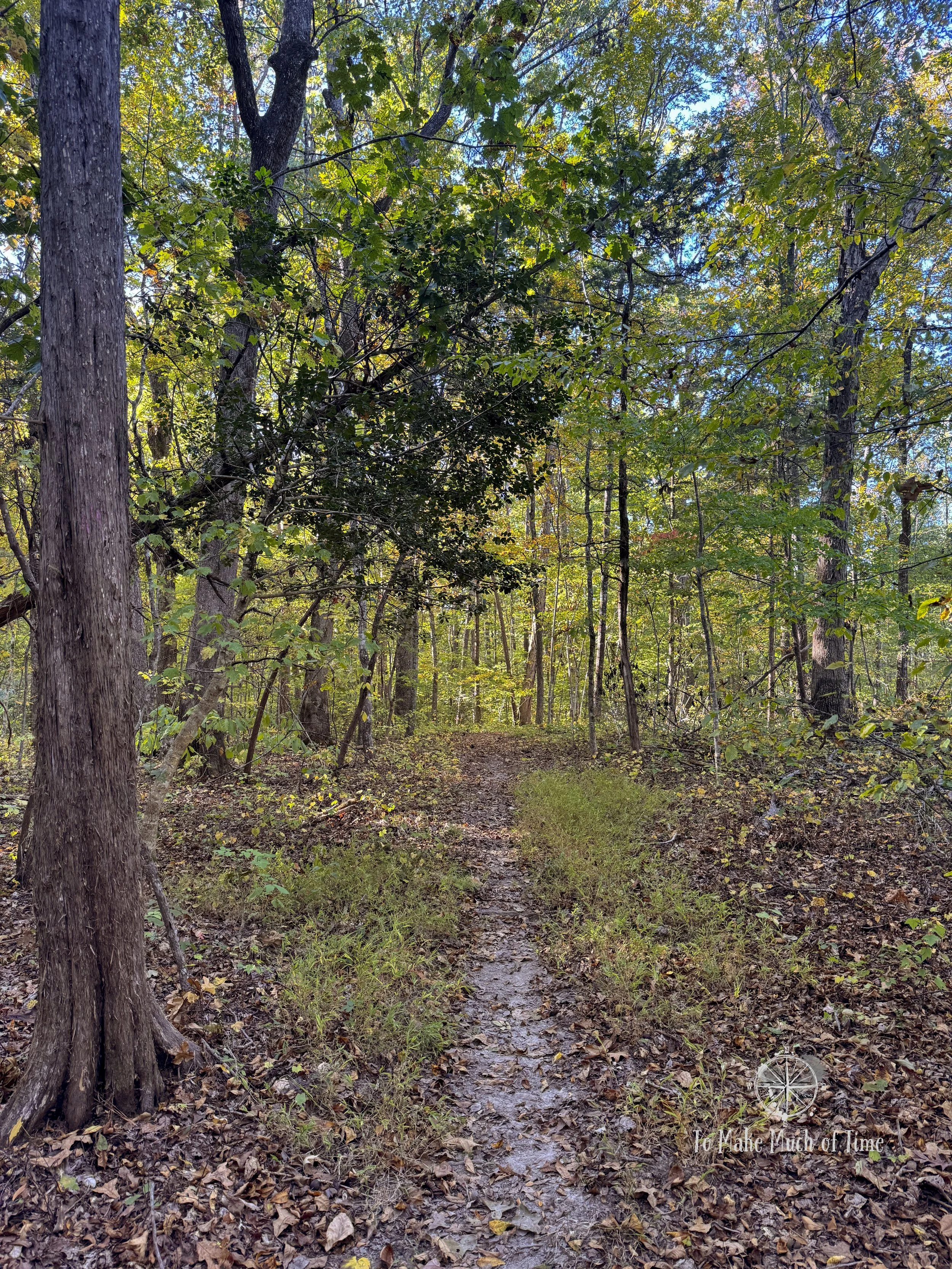
So, we headed up the River Bank Trail, which is quite wide through this area, and met up Twin Loops Trail. Twin Loops Trail is, as you might expect, a trail with two separate loops. Think of a weirdly shaped figure eight. Because of the way they connect and veer off a few times, we got ourselves a tad confused about where we were and which way we should go, even when looking at the trail map. Not very confused but enough that we had to think about it more than we usually do.
Hiking Staunton River State Park

Hiking Staunton River State Park

Hiking Staunton River State Park
{Hiking tip: In addition to using my Garmin watch with a GPS to track our hiking, I also use the Runkeeper app on my phone. One thing I love about the Runkeeper app is that it charts our course on a map. It gives me an extra sense of where I am in an area. In this case, we used that app to look at the path we’d walked and compared it to the trail guide to confirm where we were. We’ve also used it on a long very rural hike in West Virginia where we were never fully sure we were on the right path. When the app showed us starting to veer back to our car, we felt comfortable for the first time that we’d get back as planned!}
Twin Loops Trail was very much a forested one with undulating hills, and a combination of wide and narrow track. We had a few run-ins with spider webs on the trail, and I finally had Dustin walk in front. He ended up with a terrifying/pretty (depending on who you ask) orb-weaver with a giant yellow triangle on it (an arrowhead orb-weaver). He handled it much better than I would have so it was a good thing he was in the lead for that moment. In my defense, I was quick to grab a stick to try to brush the spider off of him. He was disappointed he didn’t get a better look at it. I have since googled this spider and found the online picture to be ample viewing for my needs.
DAY 2: crow’s nest trail to river bank trail
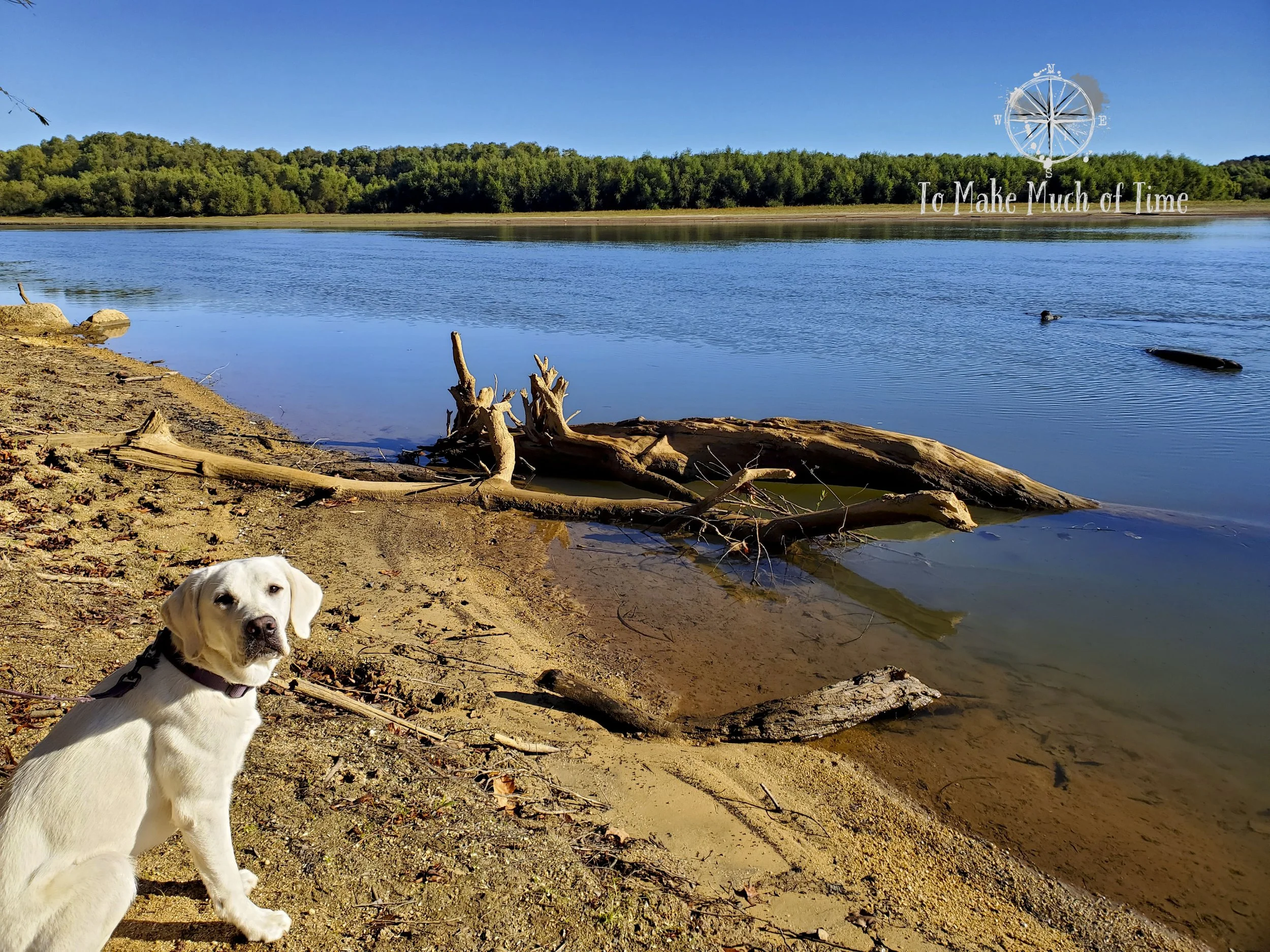
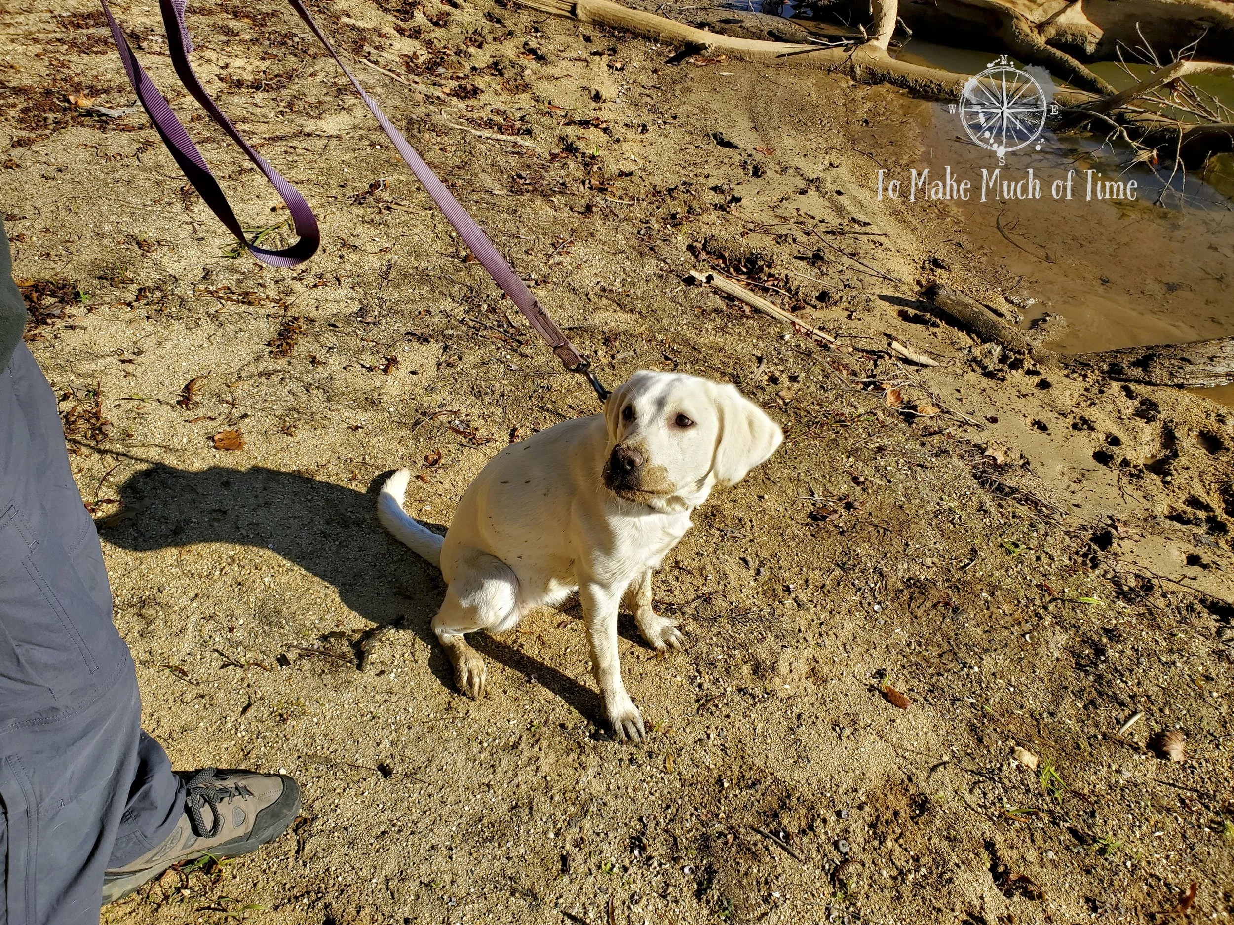
Before embarking on our main hike for the day, we decided to take puppy Camille on her first ‘hike’. We walked from the cabin to a ‘view of lake’ spot indicated on the map. This trek was a bit over a mile in total and took us down to a pretty beach at the confluence of the Staunton and Dan Rivers and with the lake straight ahead. The size of the lake surprised us (and no wonder it is the largest lake in Virginia). Camille had a joyous time romping into the water, where she stuck her snout in to grab submerged sticks (of course). All of this excited her so much that she started running in fast loops around Dustin (the closest she could get to running like a maniac on a leash). She ended up with a sandy, dirty snout and dirty paws and legs, none of which she regretted. This was definitely her highlight of the trip, and the photos are pretty hilarious. This is the hike marked purple on our map above.
Lake at Staunton River State Park
Camille’s dirty face after playing in the water and sand

Lake at Staunton River State Park

Lake at Staunton River State Park
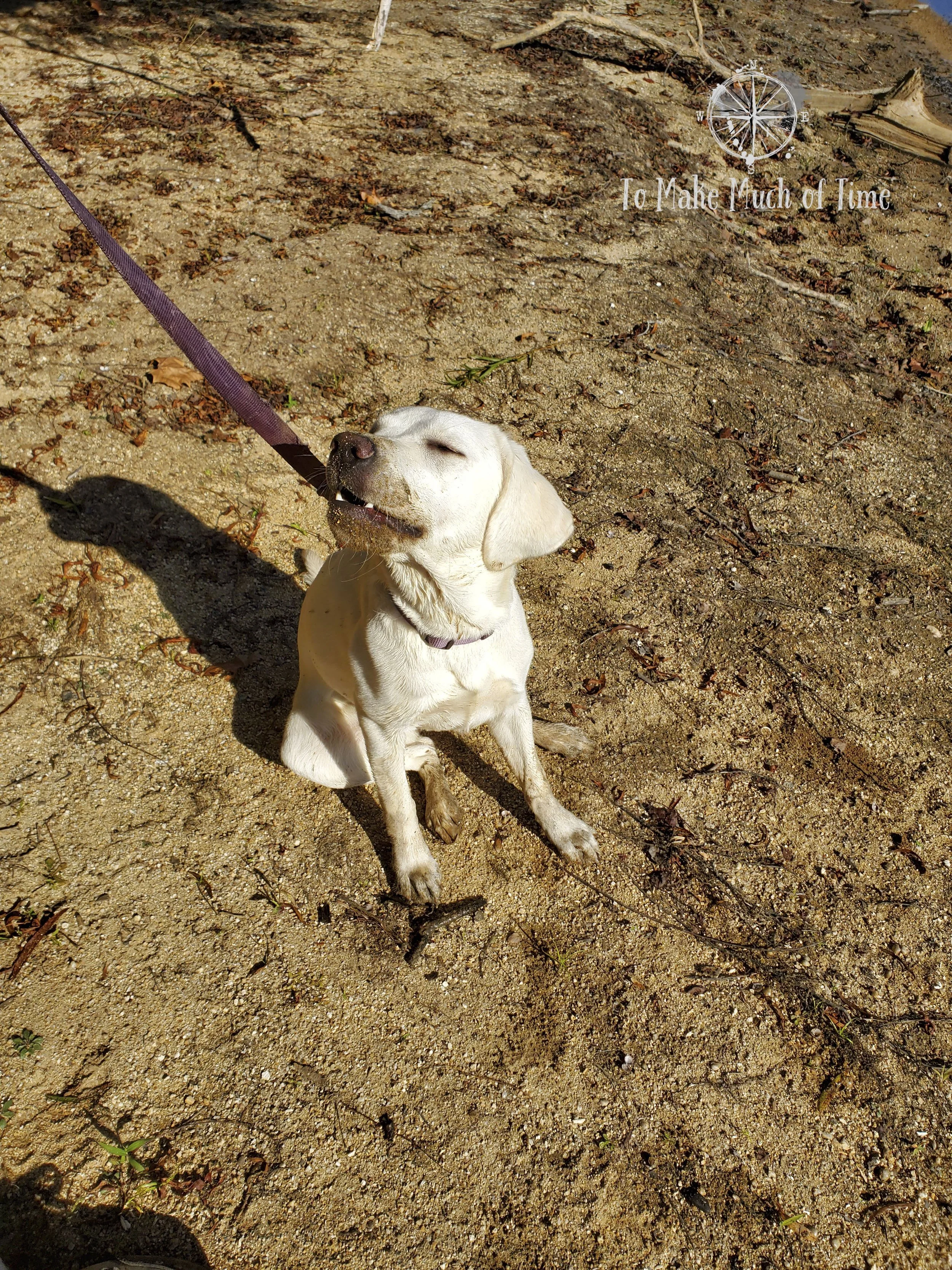
Camille showing off her dirty snout

Lake at Staunton River State Park
Morning total hiking time and distance: This is the hike marked green on our map above. In the morning, after our mini hike with Camille, we decided to take Crow’s Nest Trail to the southern portion of the River Bank Trail, the final segment we hadn’t yet explored. All-in, this total hike was 3.68 miles, and we went this one a little more slowly due to a sore foot so spent about an hour and forty minutes.
We set out to explore the other chunk of River Bank Trail in a way to not back-track the portions we hiked the previous day. To accomplish this, we drive to the “District Office” (not to be confused with the newer, larger Visitor’s Center). From there we walked up the road a little bit to access the Crow’s Nest Trail, a trail of about 0.4 miles in length that cuts over to the bank of the Dan River. The trail guide brochure shared that Crow’s Nest Trail was the site of a 2011 tornado, which left the area more open than other parts of the park. It is a great place to observe a forest’s recovery about a decade and a half onwards.
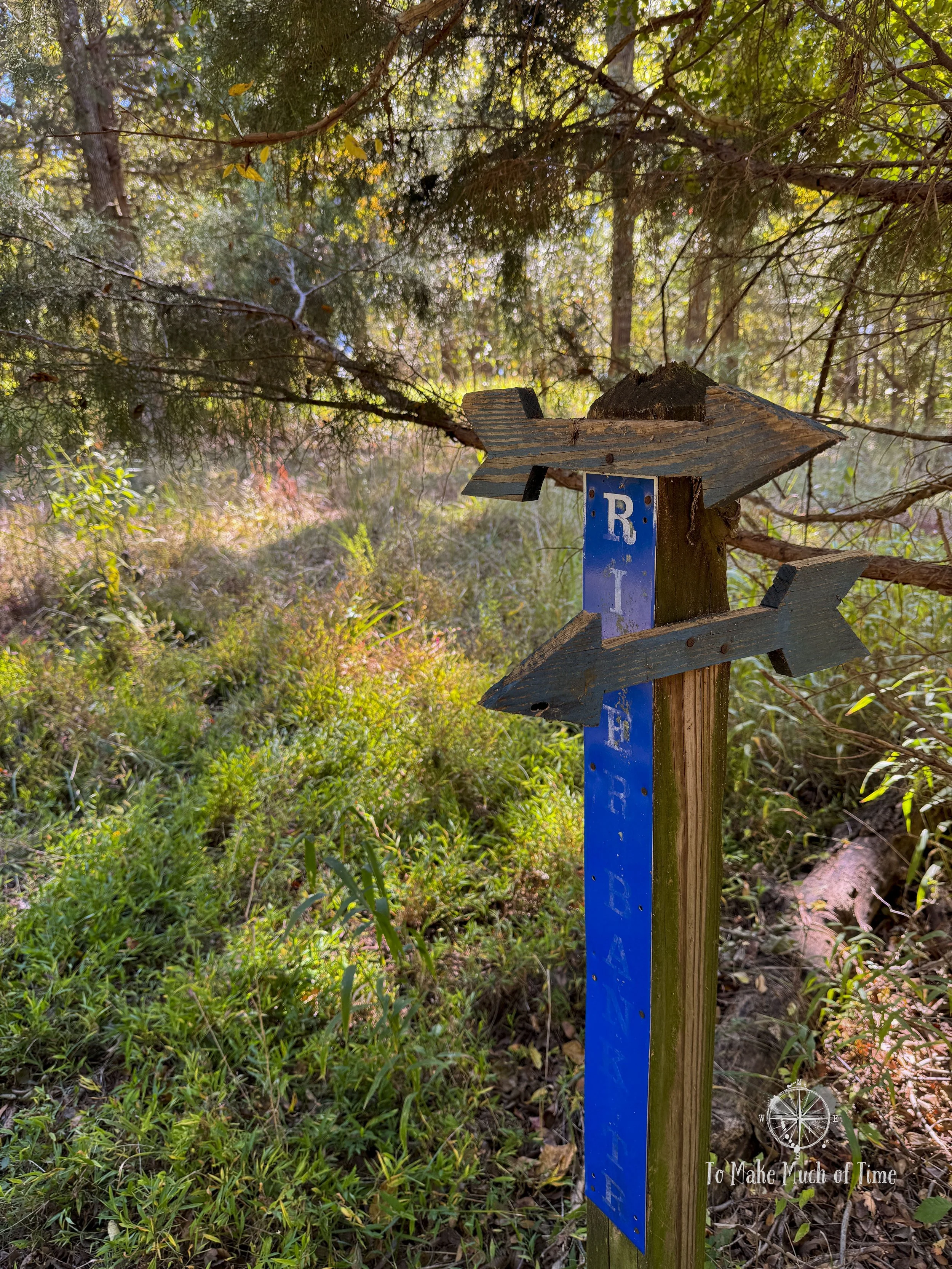
Fun arrows on the signs for River Bank Trail at Staunton River State Park

Lake view at Staunton River State Park
Crow’s Nest Trail comes to an end when it meets up with the River Bank Trail, which we took south along the Dan River before it looped inland again and eventually met back up with the main park road. We could walk along that road back to our car at the District Office.
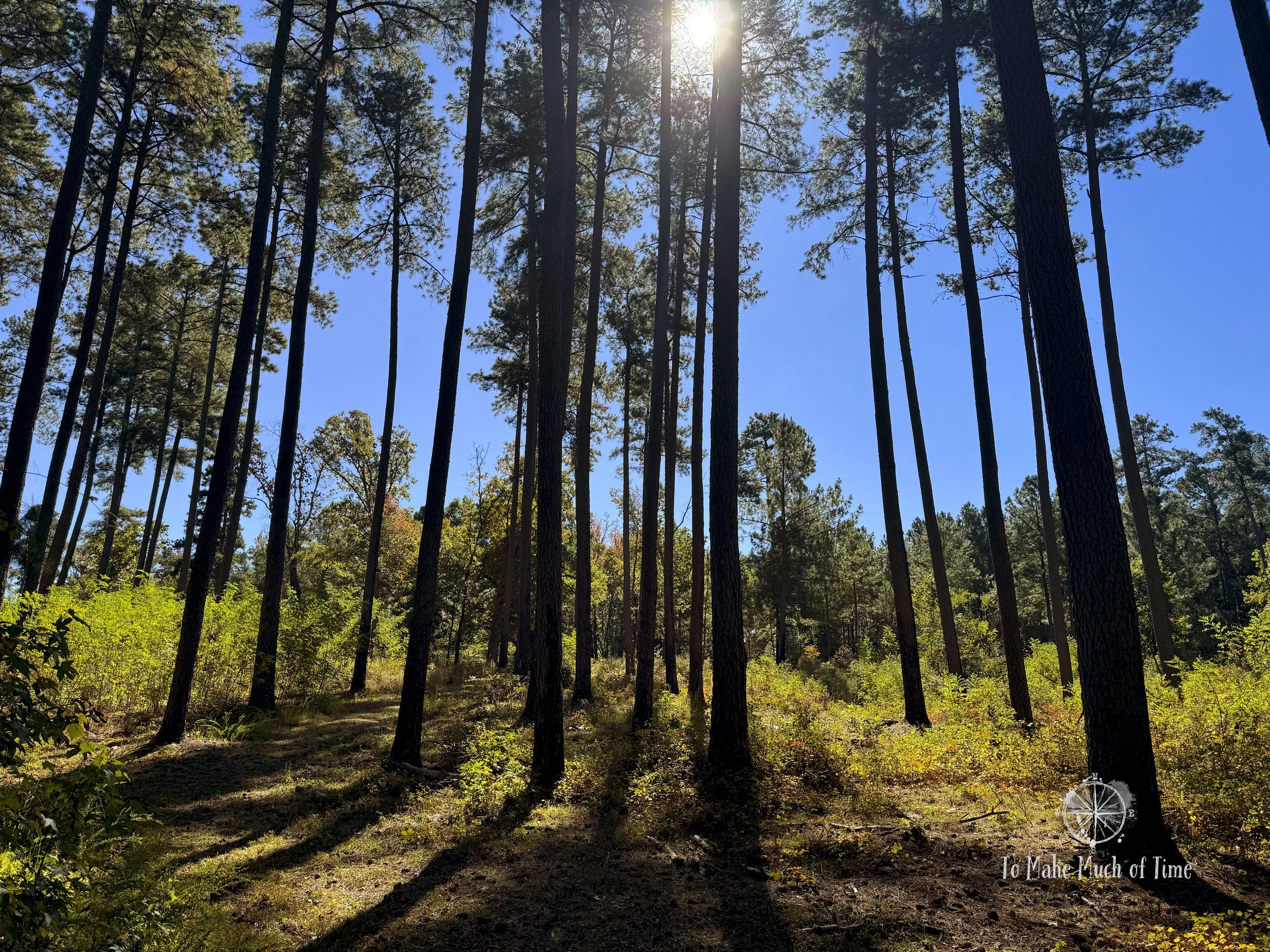
We very much enjoyed the hike. It meandered up and over small hills, close-ish to the river bank with the water visible through the trees, and a variety of different trees. The path was fairly wide at times and narrow at others, and at one point it went through a pine forest that appears to be managed to allow for culling and containment of the understory.
In the afternoon, we decided to relax at the cabin and enjoyed sitting outside to read and write on a beautiful fall day.
Staunton River State Park hiking
Staunton River State Park hiking

Staunton River State Park hiking

Staunton River State Park hiking

Staunton River State Park hiking

Staunton River State Park hiking

Staunton River State Park hiking
Click the image below to save this post to Pinterest!

Check out other posts in Virginia:


