
Hiking Smith Mountain Lake State Park - 3.7 Mile Loop Trail from Walton Creek Trail

Horsepen Trail at Carvins Cove in Roanoke, Virginia
Related posts: Looking for more Roanoke-area hikes? Check out our Compendium of Hikes in and near Roanoke.
Note: Some links throughout our site are affiliate links, which means we may receive a small commission at no cost to you.
WHERE IS smith mountain lake state park LOCATED?
Smith Mountain Lake State Park is in Bedford County, Virginia, about halfway between Roanoke and Lynchburg. The park is situated on the north end of the large body of Smith Mountain Lake, which itself spans both Bedford and Franklin Counties with a small bit in the southeast falling in Pittsylvania County. We live on the east side of Roanoke, closer to the lake, and the drive is roughly 45 minutes, so it is a very doable trip to get some hiking in or otherwise enjoy the amenities on a beautiful day.
what to do at smith mountain lake state park
While the purpose of this post is to share a recent hiking excursion, it’s worth noting that the park has a lot of other activities. It offers camping, cabin rentals, a lakefront beach for swimmers, fishing, and several launches for boating. We drove by the rental cabins while there, and they look like pretty standard state park cabins with dedicated outdoor space for grilling and eating. Some of them sit close to the lake and have water views but others are further back so if you’re booking a cabin, be sure to select one with the setting you want!
the history of smith mountain lake
Smith Mountain Lake, like many of Virginia’s lakes, is not naturally occurring but formed as an electrical dam. What today sprawls across a length of 40 miles, covers 22,000 acres, and provides 500 miles of shoreline was - in living memory - Virginia farmland and small rural communities.
The idea of creating a dam in the area dates back about one hundred years to 1924. A now-defunct business called Roanoke-Staunton River Power Company formed with the idea of creating a dam in the region. The power company began buying up land and amassed about 5,500 acres. Unable to gain a foothold on the dam build, in 1954 the power company dissolved and Appalachian Power, today’s owner of the dam, purchased these assets. Finally, in 1960, government approval finally went through and in 1963, Appalachian Power began filling the area behind the dam. It took until 1966 for the lake to finally be filled - quite the big bathtub to fill!
Because of the decades that passed from idea to fruition, many people sold their lands (whether willingly or because they saw no alternative), but even so, 55 families were still displaced by the time the company was ready to install the dam and lake. For more details on the history of Smith Mountain Lake, check out this article, and to get a sense of the local sentiment, this 1998 article interviewed some locals who watched the transformation of the area.
hiking at smith mountain lake state park
Smith Mountain Lake State Park offers 14 trails, which range from several that are shorter than half a mile and are really more connection paths to a couple of trails about 3 miles in length. What’s great, though, is that multiple trails can be combined or taken in succession to create longer hikes for those wishing to do so.
Using Virginia State Park’s standard key for difficulty, all of these hikes are classified as easy or moderate, none are considered difficult. And all of the trails are for both hikers and bikers.
For the full trail map and description of each, check out this guide on the park’s site.
Note that there is an entry fee to the park, consistent with Virginia’s state park rates. During our visit, the cost for entry was $7. The entry was payable at an un-staffed entry point under an honor code system; however, visitors hang a portion of the entry fee envelope in their car windows. The state does offer an online state park pass on an annual basis for frequent state park visitors. There were different fee amounts that varied for people accessing the lake with their boats, etc.
a loop of our own creation: hiking walton creek trail to osprey point to striper cove to turkey foot
As mentioned above, visitors can create their own trail path by combining multiple trails for longer hikes or - in this case - a loop hike. The full distance of the hike we took was 3.36 miles, and we spent about 2 hours on the trail, taking in the scenery and enjoying ourselves.
The first map below is a zoomed in view of the portion we hiked; the second map shows the broader array of trails in the park. On the first map, our route took us from the “you are here” visitor’s center parking area along the dark yellow Walton Creek Trail. We then took the green trail at the end of the peninsula out to Osprey Point before returning to the parking area and meeting up with the light yellow Striper Cove Trail. That trail is much longer and continues past where we hiked. We took the Turkey Foot spur (blue to green) that returned us to the parking area.
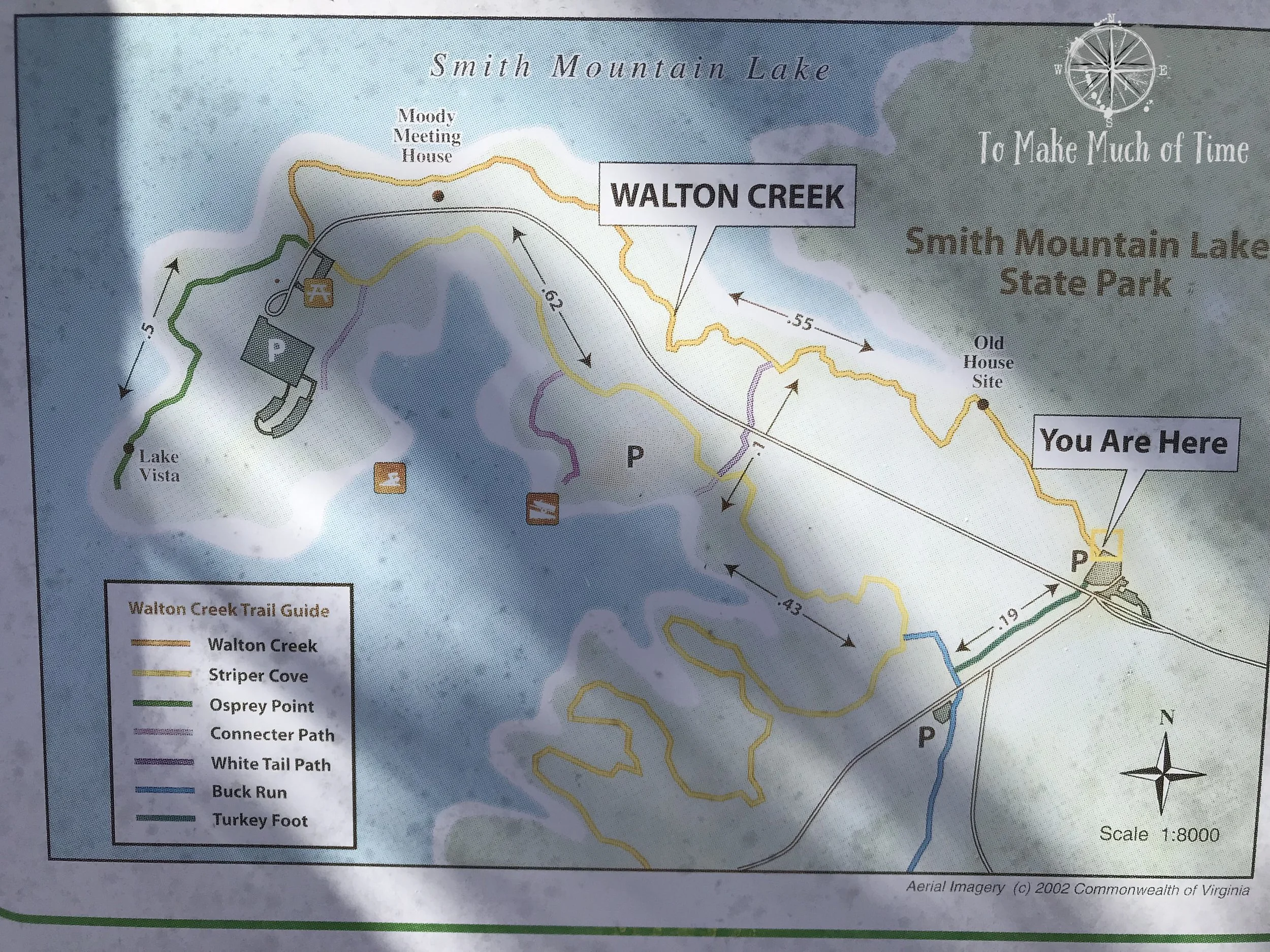
Map at the Walton Creek trail head showing the route we took.

A map of all the hikes at Smith Mountain Lake State Park
We parked near the visitor’s center, ate a picnic lunch, and headed off down Walton Creek Trail. This trail features some historic remains - an old house site, which supposedly has a stone chimney, and the Moody Meeting House foundation markers, dating to 1843. I will admit that we noticed neither along the trail, though we did see some sizeable stone walls along Osprey Point. If other hikers wish to find these, I’d recommend you pay attention to the information at the start of the trail that indicates roughly where each is located so you can be on the look-out with keener eyes than we had.
In general, we found the trail to be well marked, but we did have a slight difficulty finding the next trail when departing our original trail. Below you’ll find descriptions and photos to help describe what to look for so you can have an easier go of it!

We had a crisp blue winter sky at Smith Mountain Lake State Park while hiking Walton Creek Trail.

Periodic trail signs provided a lot of helpful information.

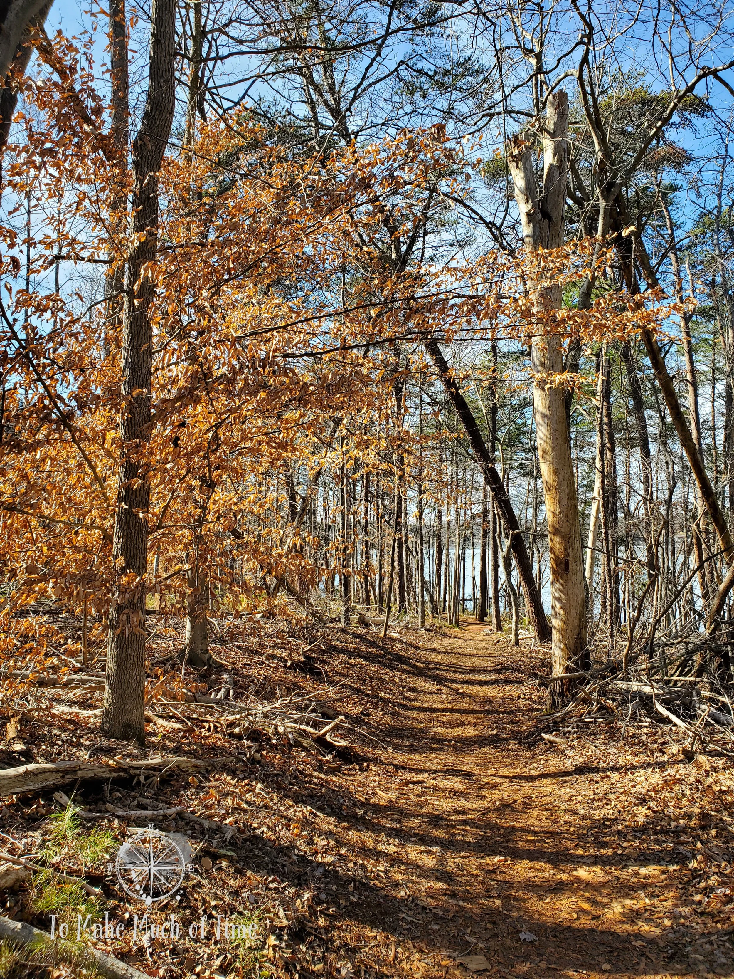
The early part of Walton Creek Trail

A short distance into the Walton Creek Trail at Smith Mountain Lake State Park
Walton Creek Trail is easy to access from the parking lot at the visitor’s center. When looking at the visitor’s center, it is to the left right at the entry point to the woods. The first portion of the trail begins to wind through the woods with a gentle downhill curve.
Because we went on a warm day in February, mid-week, we saw no other hikers on the trail. Wildlife was also particularly quiet, as they’re apt to be midday. We heard and saw a few birds, though.
After a short while, Smith Mountain Lake is visible through the trees, and then the path comes pretty close. There is a wooden bench along the shore for those wishing to take a break or take in the scenery.

Take in the scenery and rest at this pretty spot along the Walton Creek Trail
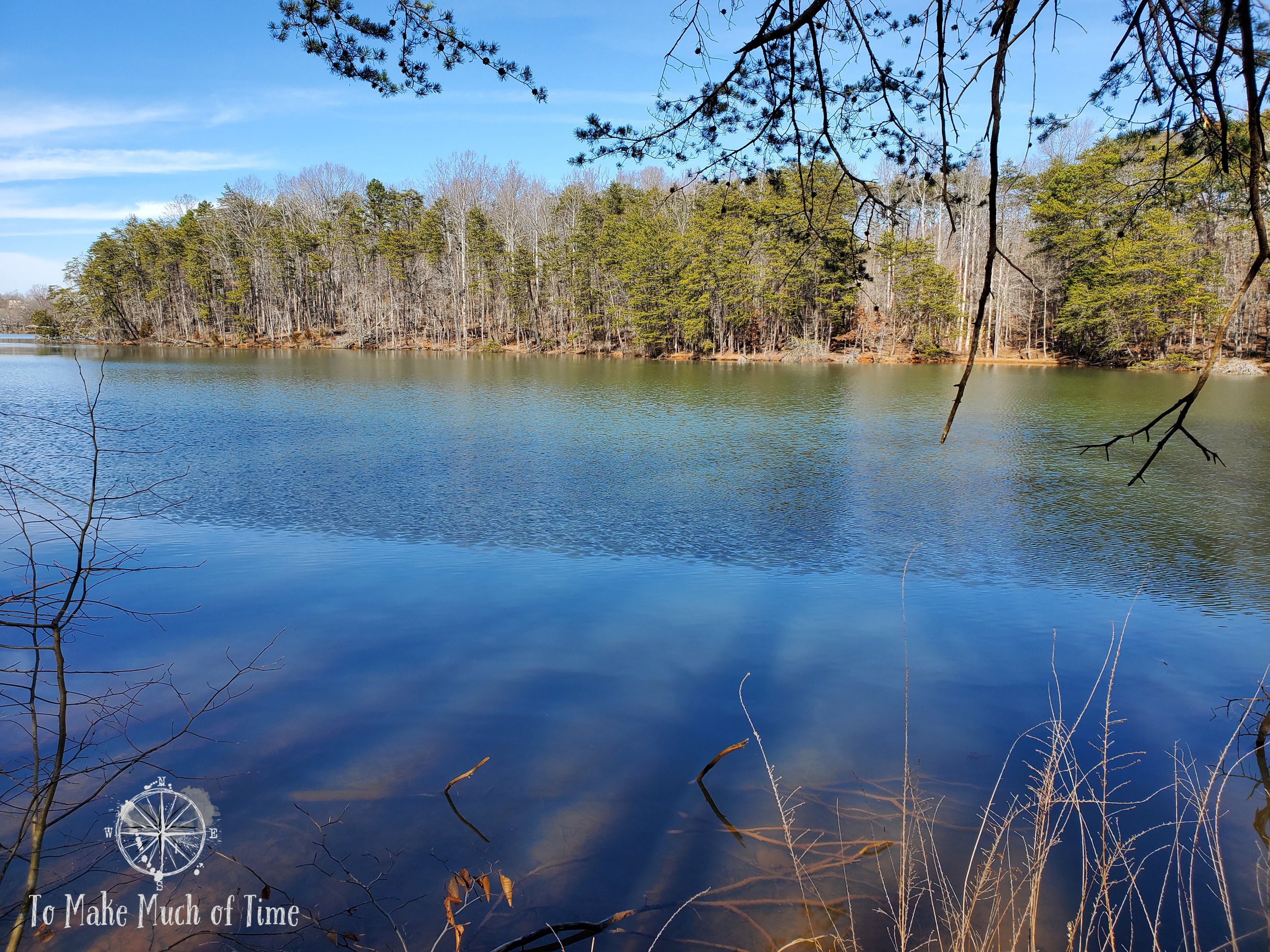
View of Smith Mountain Lake from Walton Creek Trail


While it didn’t show up well in the photo, the rocks along Walton Creek Trail had a component that glistened brightly when the sun hit it.
Walton Creek Trail comes to a conclusion at a picnic area, near a boat launch site. In the photo below, the area to the right of the picnic table is where Walton Creek Trail comes out into the picnic area. The second photo, to the left of the bear box and near another picnic site is where Osprey Point begins. This took us a bit to spot.
Also, a word of warning when you start down Osprey Point, a 0.4 mile trail that is out-and-back for a total of 0.8 miles: We started down the path and focused on a sign maybe 30 feet ahead. We got confused at that point since there was no obvious trail. The trail itself takes a sharp left turn shortly after starting, but we missed it because we aimed towards the sign that was simply warning people from the edge.
Osprey Point has some interesting rock walls from earlier residents - a pretty impressive feat to think about people building them rock-by-rock, especially given how long they are. We didn’t see any explanation for them so feel free to make up your own story! It was interesting to think about that while these rock walls are near the water now, whomever built them did so far away from any water and in a central Virginia field.

The end of Walton Creek Trail sits to the right of the picnic table

The start of Osprey Point sits back behind and to the right of the picnic table

Osprey Point Trail at Smith Mountain Lake State Park

Rock wall next to Osprey Point Trail at Smith Mountain Lake State Park

Rock wall next to Osprey Point Trail at Smith Mountain Lake State Park

Rock wall next to Osprey Point Trail at Smith Mountain Lake State Park
After we finished hiking Osprey Point, we ended up back at the same picnic area and started scanning around for Striper Cove Trail, our next leg. Based on the map, we headed across the street to the area near a playground and spotted a road that continued on behind some wooden fencing (photo below). While there was a ‘do not enter, authorized vehicles only’ sign that threw us off for a moment, I could spot ahead a trail sign for Striper Cove an decided the sign was just for drivers, not walkers. Sure enough, the trail did start here. Some updated signage would be helpful!
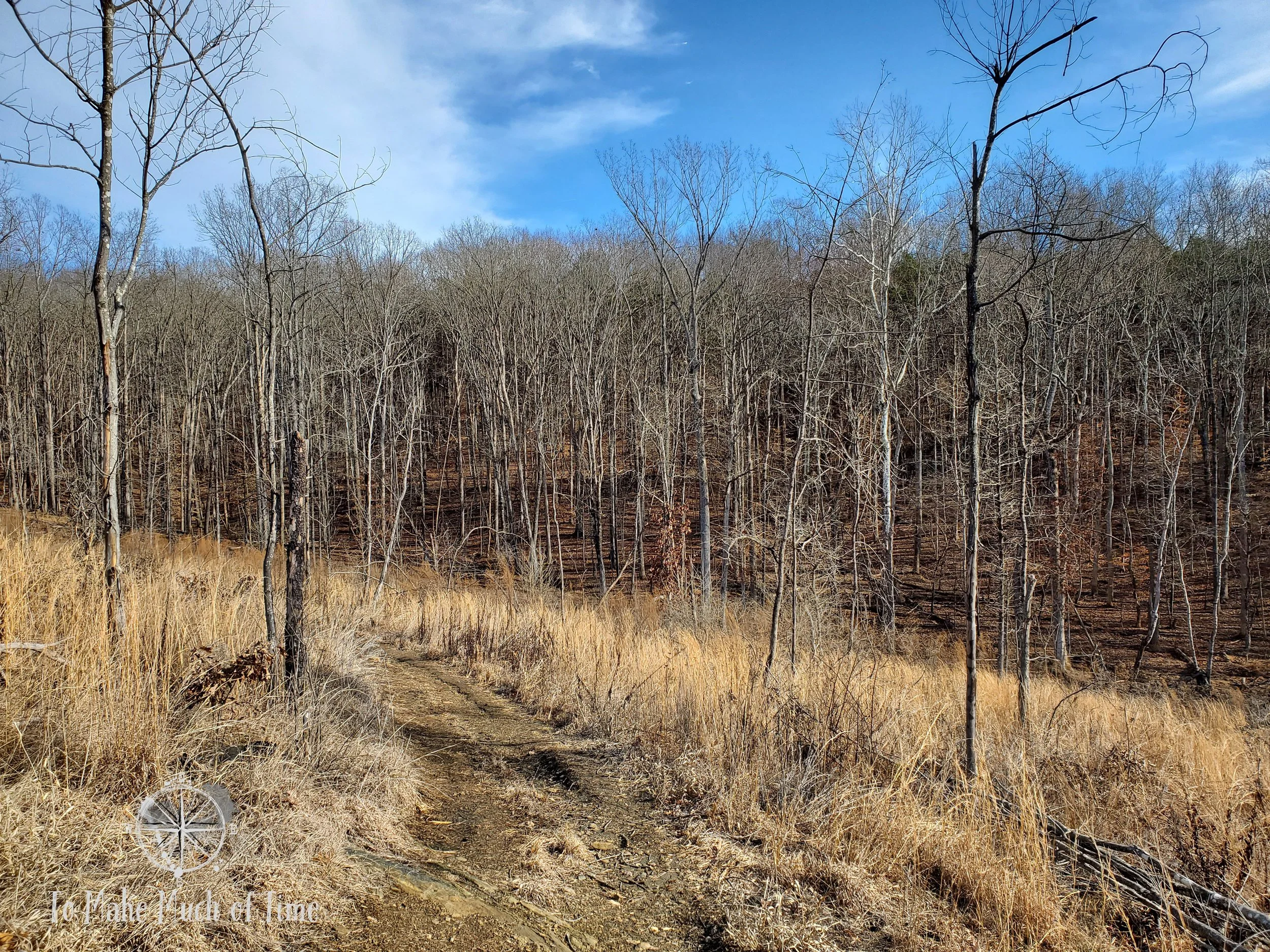
Striper Cove meandered a bit along some fingers of the lake and then turned more inland. This was a very different path than the others since the trees had been harvested. There were fields of golden grasses and young trees around us, and we spotted the paw prints of an animal in the bit of mud on the trail. Our guess is that it was from a raccoon or fox based on the size. We ruled out a dog since it seemed to cross in one section of the trail only.
There was a placard explaining the timber harvest as an effort for conservation to more native trees. When the local area was depopulated, most of this land had been agricultural and ended up filled with pine trees, which do not create a healthy diversity of flora. By intentionally clearing small portions of the land at a time, the goal is to allow a more native mix to regenerate and also to space out growth to avoid pest risks like the pine beetle.

The trail head to Striper Cove Trail at Smith Mountain Lake State Park is a tad challenging to find but is down this gravel road just a little ways

To access Striper Cove Trail, walk through the opening in the short fence and continue along the path that looks like a fire road

Intentional clearing of the land along Striper Cove Trail created a very different vista than the other portions of our hike.
Striper Cove Trail at Smith Mountain Lake State Park
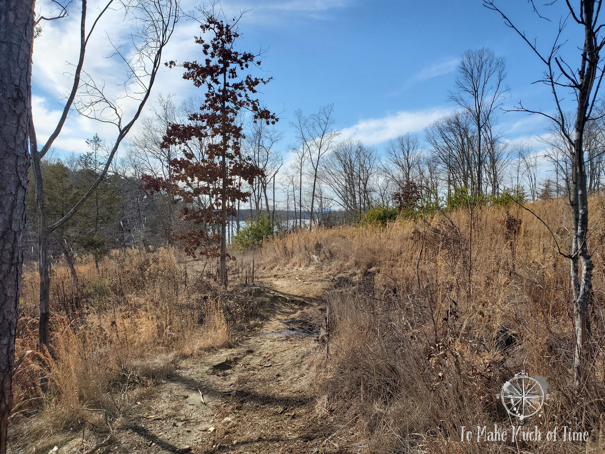
Striper Cove Trail at Smith Mountain Lake State Park
walton creek trail - ACCESSIBILITY
The loop trail we took is not accessible; however, the picnic area is easily accessible by car and could be an enjoyable way to experience the area for those with accessibility considerations.
Click the image below to save this post to Pinterest!

Check out our other posts about Virginia


