
Pocahontas County, WV: Cranberry Glades and Bog (Day 3)

Related blogs: Want to read more about our travels in West Virginia? Also, this post is part of a 5-part series. Check out the overview of this four-day West Virginia trip here!
Note: Some links throughout our site are affiliate links, which means we may receive a small commission at no cost to you.
Having ended our second day in Watoga State Park utterly exhausted (read that post here), we woke up on the third day with no specific plans set – maybe we would bike the Greenbrier River Trail, maybe we would head out to the Cranberry Natural Area to tackle a 7.5 mile walk.
After weighing the weather report for the day and the following day, the Cranberry Glades area won out. Everything we had read about the area sold us on this decision. The Cranberry Glades are a unique bog environment, not typically found so far south. A more common location of a bog is Canada or far northern areas in the United States, not a spot a 7+ hour drive south of there. A bog is a freshwater wetland area with an soft, spongy ground because it is filled with peat, partially decayed plant matter.
The Creation of a west virginia bog
The unique topography of Cranberry Glades, which covers 750 acres, has created this rarely southern bog area. The bog sits at about 3,400 feet elevation, surrounded by a series of mountains - the Black, Cranberry, and Kennison Mountains. This creates a microclimate that locks colder temperatures in to the area between the peaks. The peaty soil is comprised of multiple layers that can run as deep as twenty feet! On the surface sit the visible grasses, cranberry plants, and other small shrubs. Below that layer is the peat, where the plant matter on the surface is breaking down in a year-round watery environment. Some of the plants common to Cranberry Glades include the Purple pitcher plant, milkweed (which butterflies love!), Sphagnum moss, Canadian mayflowers, some orchids, and birch trees. The peat itself has been accumulating here for over 19,000 years, leading to a unique data source for scientific study. To learn more about bogs and its cousin environments, I'd recommend a book that was released in September 2022 and that I read through an advanced reading copy earlier this year: Annie Proulx's Fen, Bog, and Swamp: A Short History of Peatland Destruction and Its Role in the Climate Crisis.

The start of the Cranberry Bogs Boardwalk loop trail.
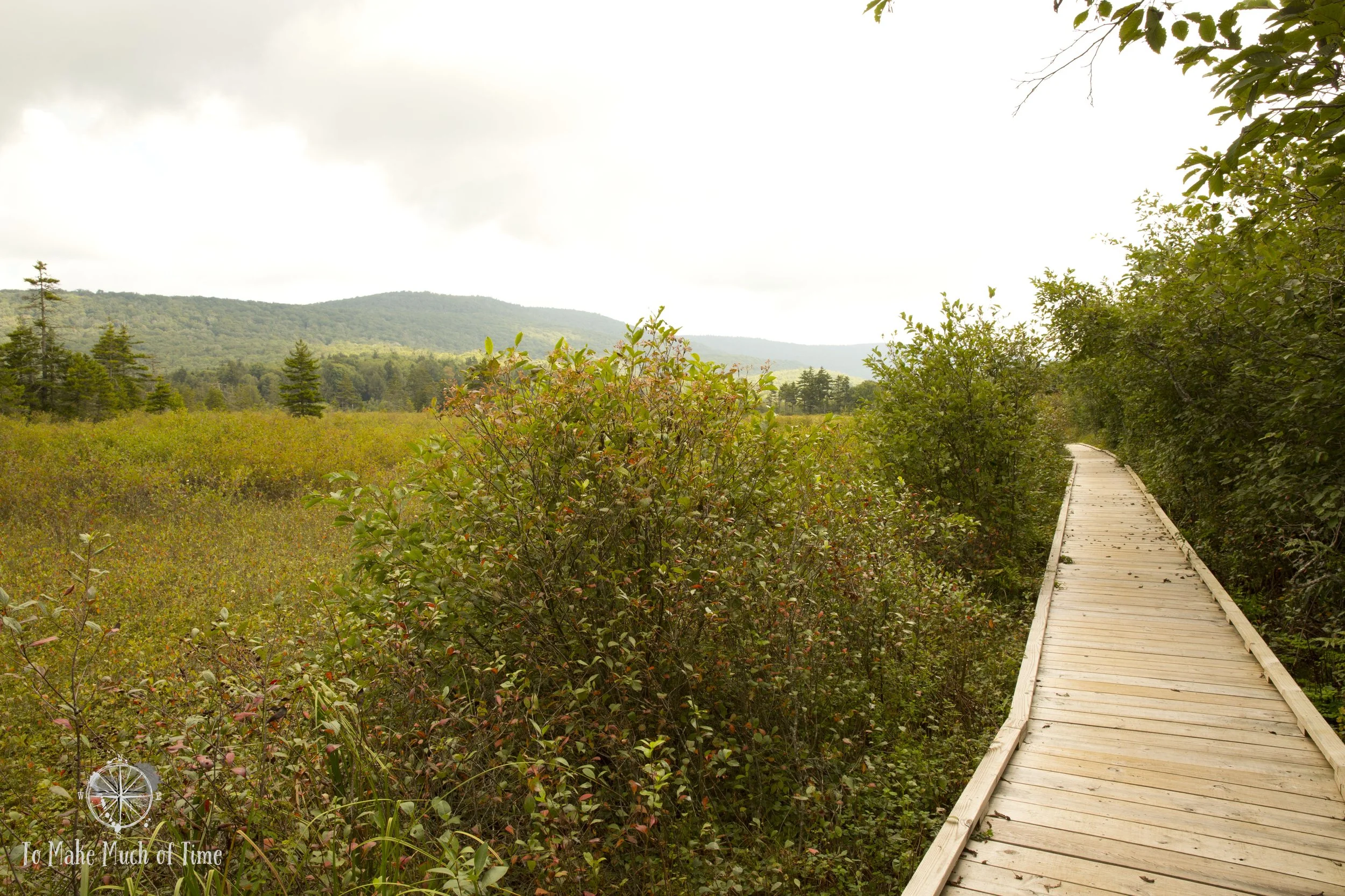
The first segment of the Cranberry Bogs Boardwalk had views of the surrounding mountains and cranberry plants.

In some parts of the bog, the standing water was visible in pools.
Exploring Cranberry Bogs Boardwalk
The drive from where we were staying in at Watoga State Park to the Cranberry Glades Botanical Area was a short 30 minute. We decided to check out the short 0.6 mile Cranberry Bogs Boardwalk first. We had no difficulty finding this spot, and there was a small parking lot with a port-o-potty. There was only one other car when we arrived, and they were on their way out so we had the place to ourselves.
We took a meandering stroll along the boardwalk and spent about 30 minutes there. The boardwalk spans four different bog areas and has many interesting plants, including pitcher plants (which eat insects). The path took us through areas with views of the larger surrounding area as well as sections which were hidden within plants and felt almost tropical. In one area a number of felled trees were semi-submerged, deteriorating into the bog, and this area is, not surprising, enjoyed by a variety of birds.
We had brought a picnic lunch with us, so we ate that in the car after hiking the boardwalk. While it was a tad early for lunch, our next activity was the 7.5 mile Cowpasture Trail, so we needed ample energy!

Cranberry Bogs Boardwalk

Cranberry Bogs Boardwalk

Trees decaying to become part of the peat.

Various grasses and shrubs dotted the watery Cranberry Bog trail.

The skies alternated between blue and gray and provided beautiful reflections when the sun peeked through.

Many insects played on the surface of the water at Cranberry Bogs.

Without the boardwalk, this area would be difficult to explore!
Hiking Cowpasture Trail in Cranberry Glades
The Cowpasture Trail was not as well marked. We ended up driving back down the road that had taken us to the boardwalk and next to a giant pile of dirt (as if awaiting a landscaping crew), there was a little sign and a path into the woods. We parked our car on the side of the small road, which appeared to be perfectly fine, though there was no parking lot per se.

This small sign and the narrow gravel path are the entrance we used to access the Cowpasture Trail.

The first part of the trail was tree-covered and had a fire road vibe.

Between fording this small creek and other muddy parts to the trail, hiking books highly recommended!
Dark clouds had started rolling in, but we were not due for rain, and so we grabbed the camera, water, and set off, hoping we were headed on the right trail (spoiler alert: we were).
The first part of the Cowpasture Trail took us along what appeared to be somewhere between a fire road and a trail, tall trees sweeping up and over the trail itself. We started to feel some rain drops but were mostly protected by the trees.
After a while, we left the tree cover and entered a gorgeous, sweeping mountain meadow. If you picture an ideal West Virginia mountain meadow, you’ve got the right image. There were grasses, wildflowers, various solo trees and small copses of trees, and the ground was - in places - quite muddy! There were a few spots where bike tires were visible (the path is intended for walkers and bikers) and created some pretty deep ruts into the boggy ground.
What we were not expecting to come across in the middle of the beautiful meadow were a slew of informational placards, including ones that described the former federal prison that had been housed in the meadow. Um, what?! Mill Point Federal Prison once existed in this beautifully desolate area and was in use from 1938 to 1959.

Meadow near the former Mill Point Federal Prison

Meadow near the former Mill Point Federal Prison

I enjoyed the color contrast between the black butterfly and the bright purple thistle.

This isolated meadow made us feel far from civilization, no wonder given that we saw no other people on our 3.5 hour hike on Cowpasture Trail.

The muddy trail to the right shows how much water was hidden beneath tall grasses in the meadow. We went through some very muddy spots.
The prison itself was minimum security and did not have fences to keep inmates in because there was essentially nowhere for them to go. The closest bit of civilization was far to travel on foot through a boggy area. Prison workers would drive along the rustic roads, come across prisoners, who gladly gave up their escape back to the prison. Records show about 20 such attempts to flee.
The prison was home to about 300 prisoners who were put to work, including as builders of what became the Highland Scenic Highway. In particular, some contentious objectors were housed there, including Howard Fast, a novelist whose most famous work was Spartacus, purportedly influenced by his time at the prison.
Today, there are no signs of the prison buildings. They are long torn down, and nature has moved back in as quickly as it is apt to do. Descriptions and some photos on the placards show the vista today and, in the same spot, a view of the former prison in the same spot. One that was particularly interesting included two trees that still stand.
After making our way through the meadow and the fascinating, unexpected history of the prison, the path turned uphill a bit, into the woods.

After the meadow, we entered and hiked through a dense forest trail where gnats were quite the harassers!

As we left the meadow and headed into the forest, we first passed over a bridge.

Meadow near former Mill Point Federal Prison

Quite the colorful mushrooms!
It was here that we started getting harassed by gnats. For some reason, we have learned that gnats are particularly attracted to my eyes. As in, they attempt to dive bomb their way in to my eyes. I spent large segments of this part of the hike squinting to at least pose a challenge to these infiltrators. Unfortunately, one did make its way into my eye, which is quite uncomfortable. With many miles ahead of us and no mirror to help me get a look at this ridiculous bug, Dustin was able to hold up my phone with the reverse camera on, so I used that as a mirror and while the image wasn’t great, it was ample to finagle the gnat out of my eye finally. Yuck.
But did they quit there? No, they did not! A short while later, another gnat landed in my eye. That one we could not get out. No about of trying to get my eye to water did any good and in my attempt to remove the fellow, he ended up pushed out of site. So, ew, the gnat was just going to remain stuck in my eye for an indeterminate amount of time. (This story ends well for me, but not for the gnat. The following morning, my eye expelled the gnat in what appeared to be some sort of mummification process. Fortunately, there is no photographic evidence and my eye was no worse the wear.)

As we left the lengthy forested part of the trail, we spotted sunlight and a meadow ahead.

The Cowpasture Trail was a mix between forested portions and beautiful, sweeping meadows with the occasional bridge dotting the view.

View of the meadow and mountains from the bridge.

We passed innumerable bodies of water on this hike.

This shoe print that went many inches into the mud demonstrates just how wet this area was, even though it hadn’t rained recently.

One of the many rocky creeks on the trail.

We experienced endless skies overhead - from dark and gray to thick or spotty clouds.

In some areas the path was cut through grasses, sometimes narrow, sometimes wide.

The ferns, grasses, and trees created an interesting texture.
Other than these gnats, the hike was not particularly buggy, but it was quite muddy in various parts. We’re talking about doing our best to walk around wet areas but still ended up with shoes sinking 5+ inches into the mud multiple times. Hiking boots are definitely a must! Also, I would not recommend hiking this trail in the rain or after a large amount of rainfall. In our case, we had a few spots of drizzle along the hike as clouds moved through, but there was no real rain. I think the trail is just really wet because of the boggy area.

This tree arched perfectly over the trail.

This narrower portion of the path led us through ferns.

After being shaded by trees, we spotted a sunny spot ahead.

The trail moves from the bottom left to upper right quadrant of this photo - yep, muddy!

While the photo didn’t do it justice, this section of the trail near the end had multiple streams of sun streaking through the trees, creating a misty look to the air. We were thrilled to be out of the mud and on gravel!

Towards the end of the trail

We spotted this fast moving blue crawfish - apologies for the blurry photo but it was the best we could take quickly!
We spent 3 1/2 hours hiking the 7.5 mile Cowpasture Trail - stopping along the way to take in the scenery and take photos at times but also keeping to a pretty good clip the rest of the time. The trail carried us through a wide array of scenery - at times we were in meadows, in evergreen woods, climbing up (small) hills. We saw a couple bright orange salamanders (Northern Red Salamanders) and heard deer scampering off into the trees when they heard us.
We saw a total of zero other people on the trail and felt incredibly far from civilization. Because of the way we’d found the trailhead, we continued to be a tad nervous throughout that perhaps we were not on the right path. We were definitely on a path, as there was trail blazing. As I typically do when I hike, I had my Runkeeper app active on my phone, so I was able to watch our path over time and saw that it seemed to fit the trail I was expecting, eventually starting to turn to loop back towards our car. The path ultimately spit us out of the woods onto a rural road that ran through the Cranberry Glades area, and that was the same road that we could follow back to our car. There were a number of other paths, marked with trail numbers, that branched off.

The sign marking Cowpasture Trail at the end where we were deposited back on a road in the park. We were able to walk back down the road to the trailhead where our car was parked.

On the hike back to our car, we passed through this round drive where hikers could park to access multiple trails. The exit to the trail we had just taken is straight ahead near the faint yellow sign.
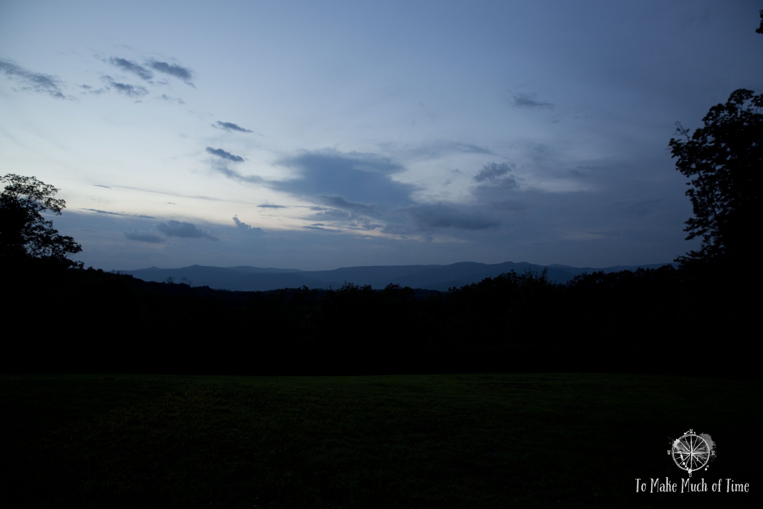
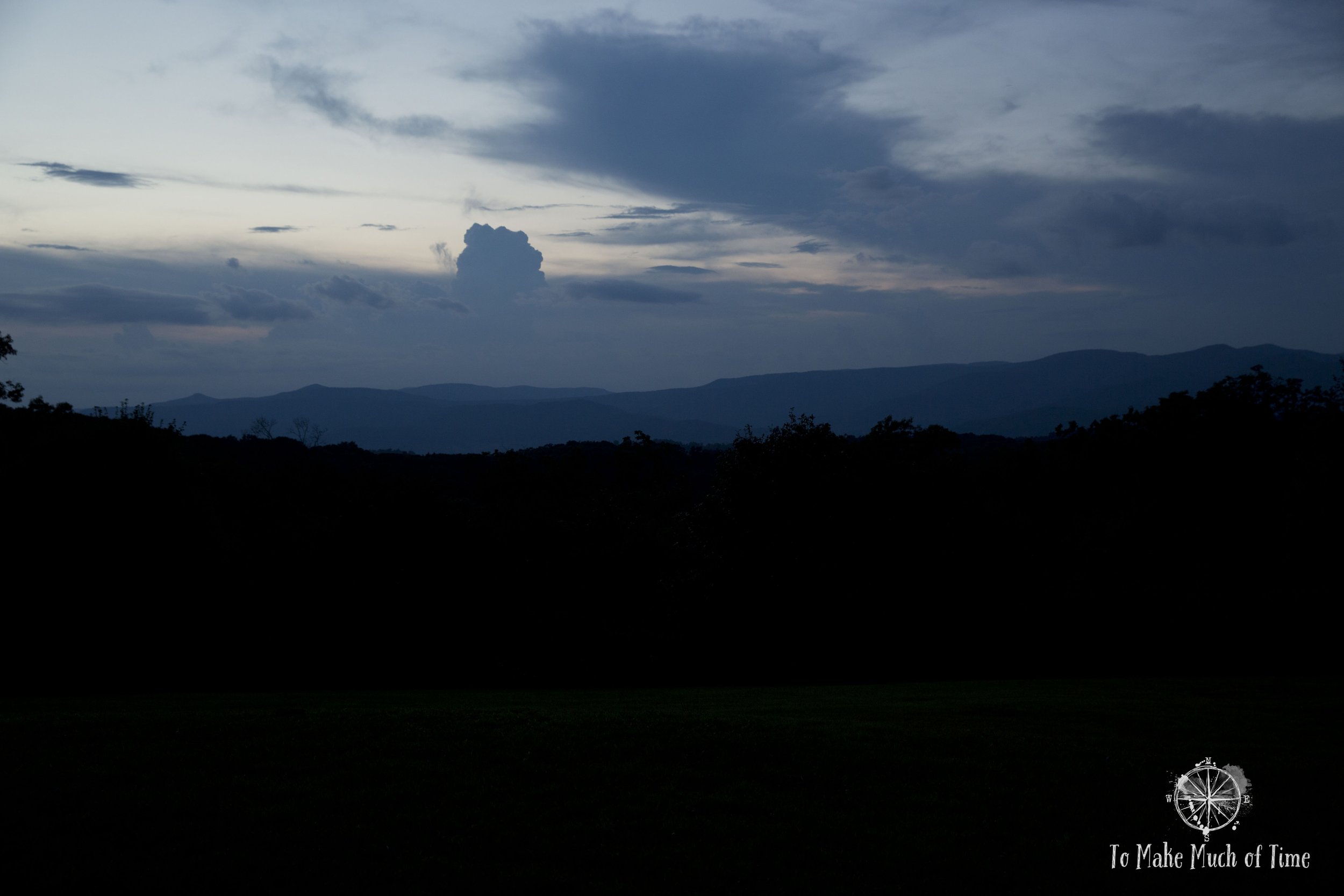
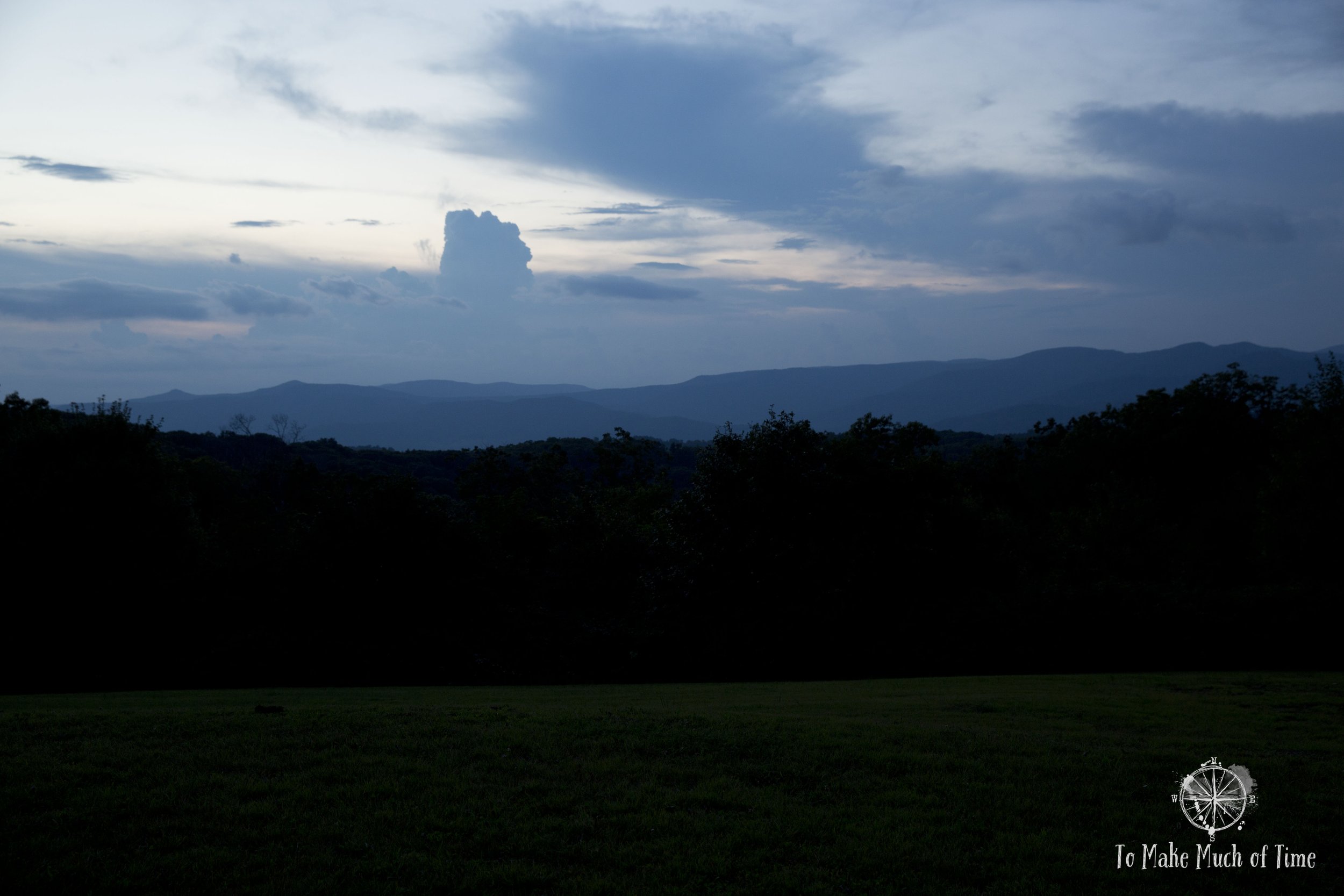
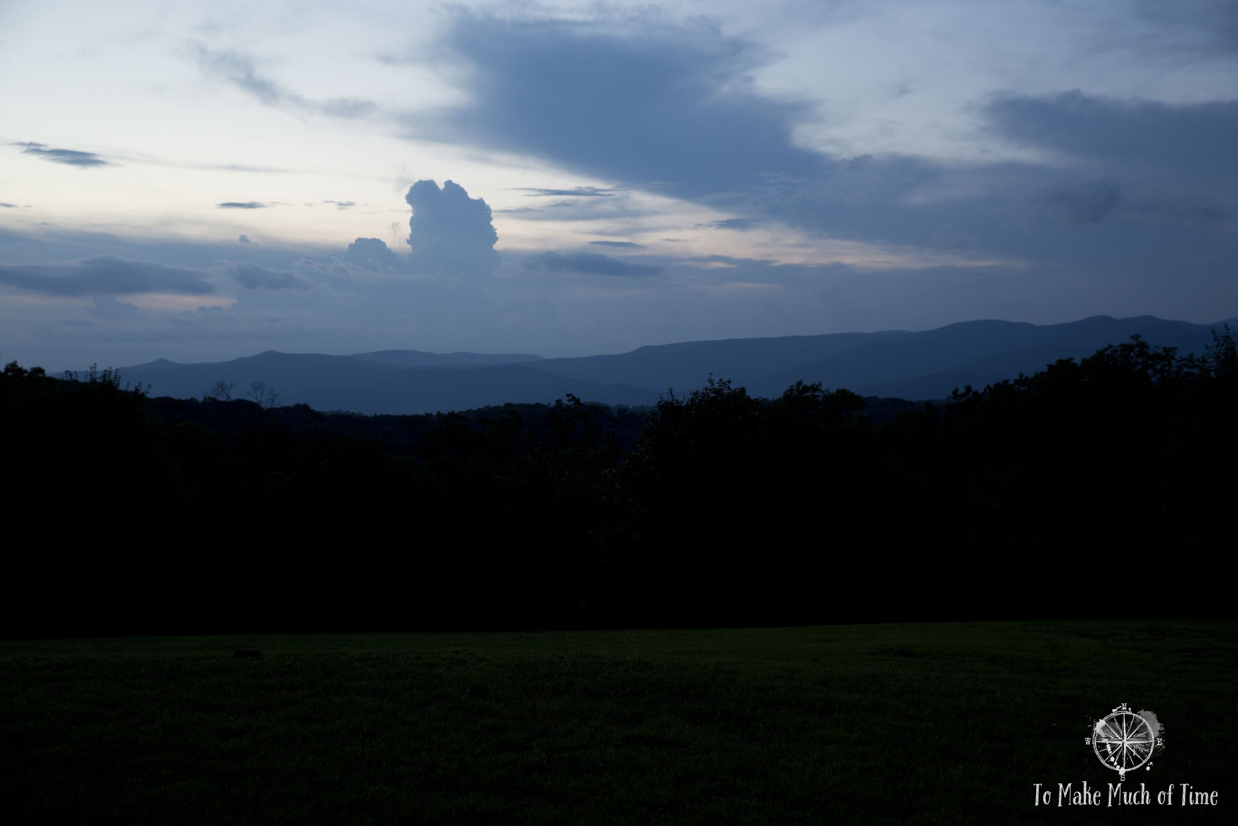
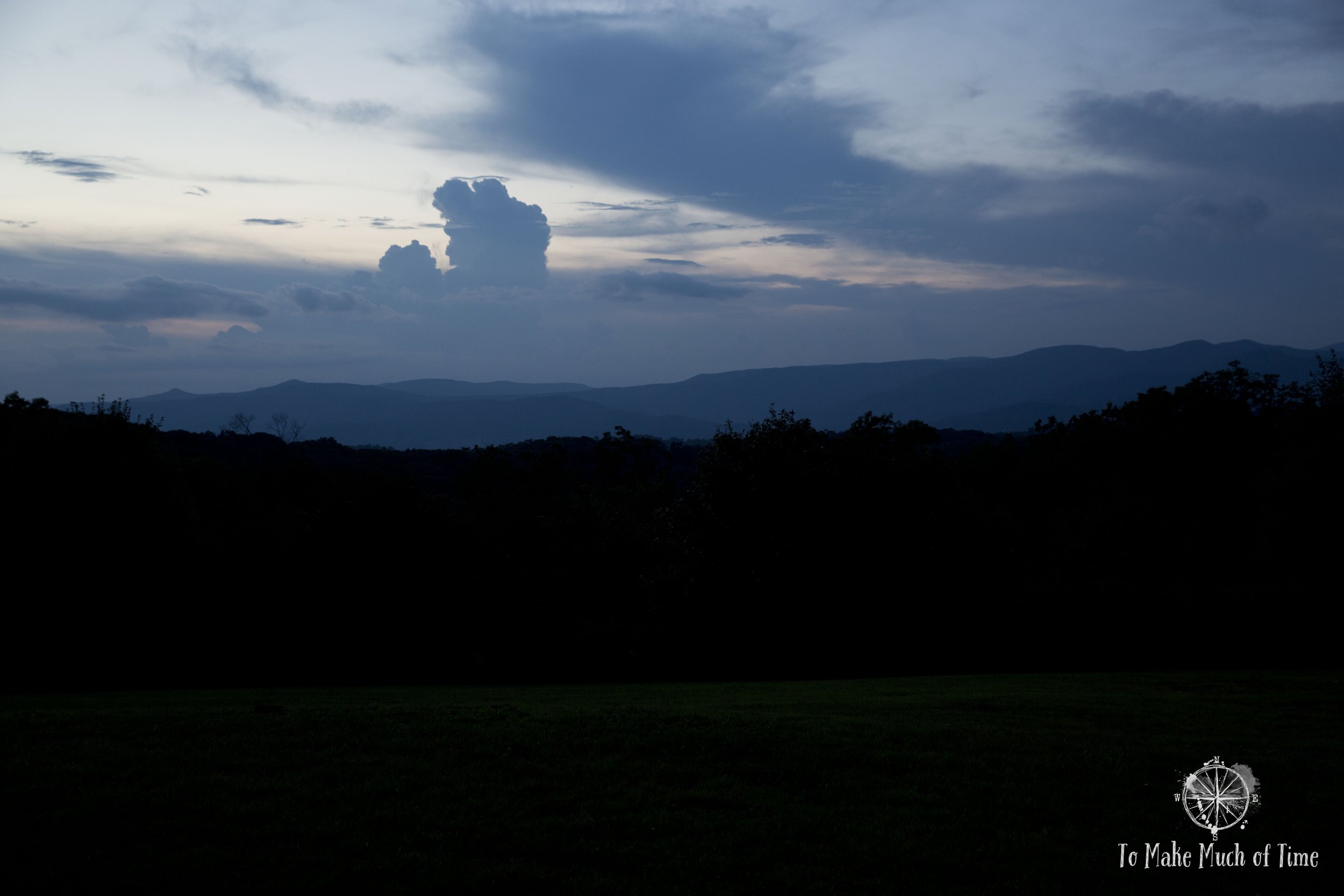
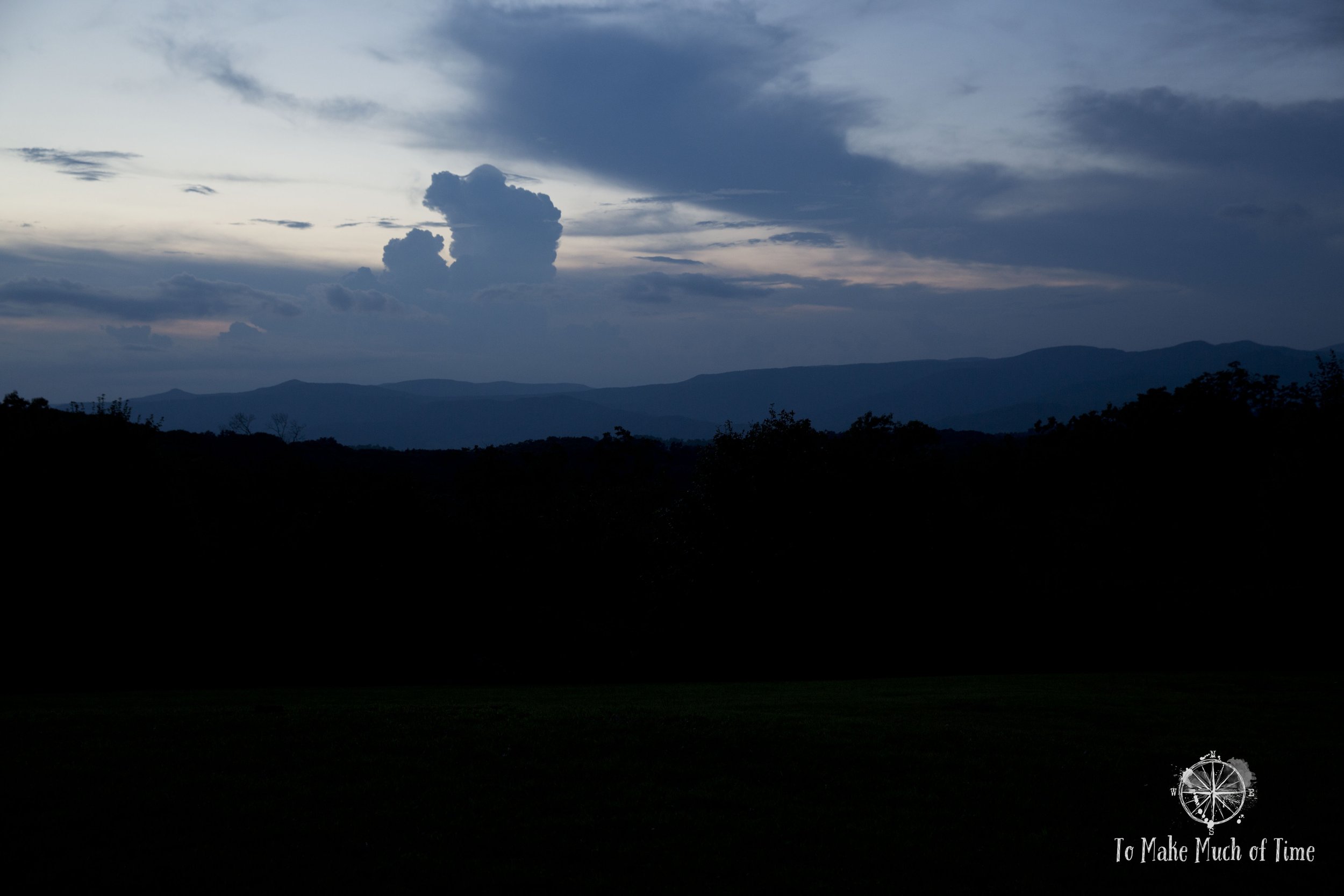
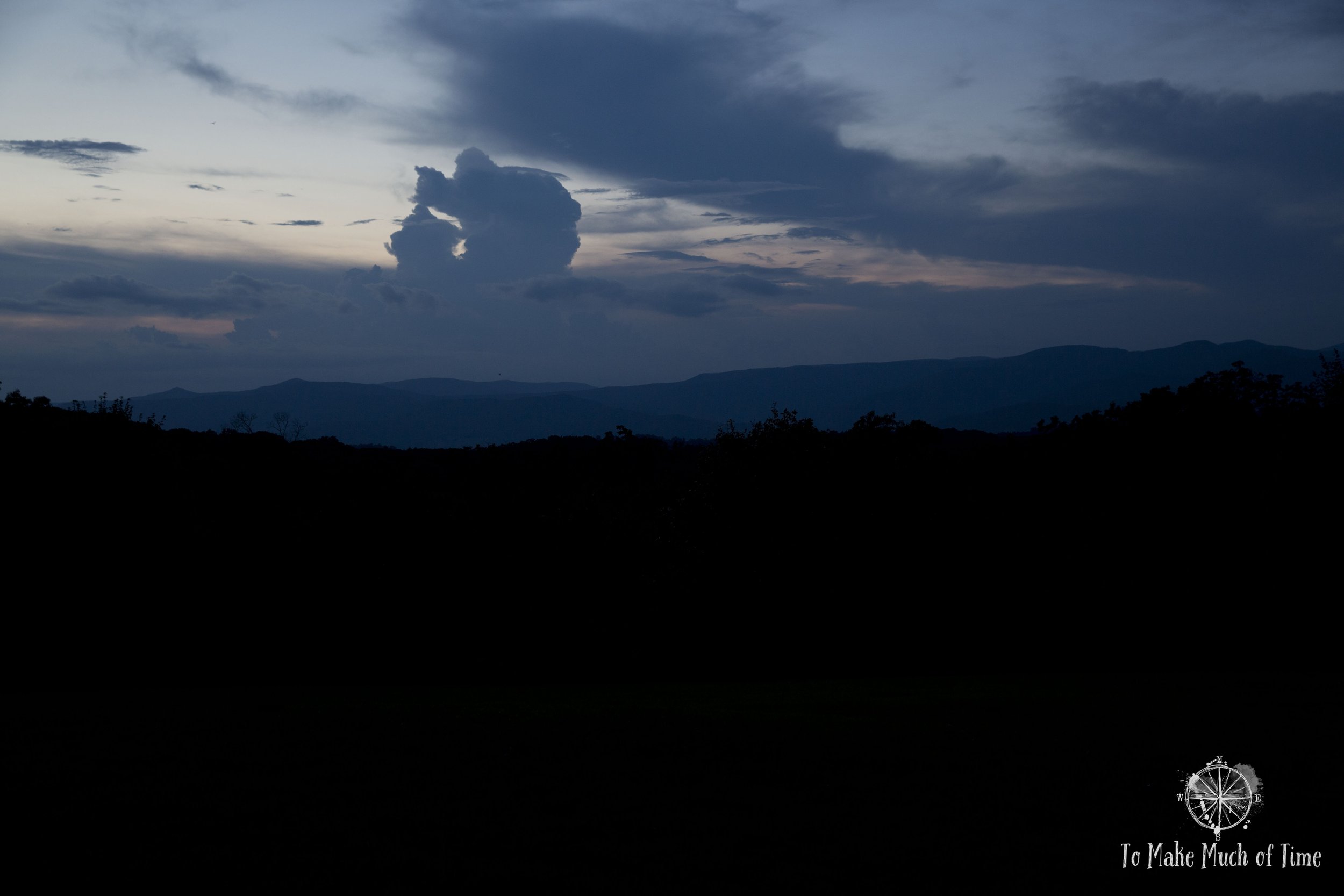
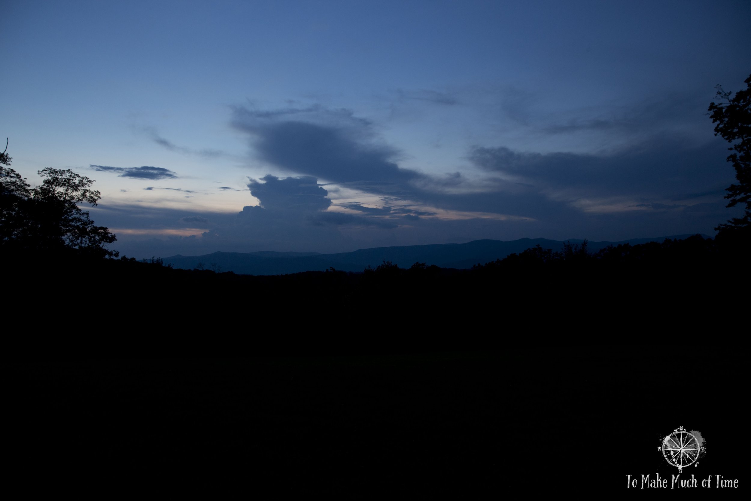
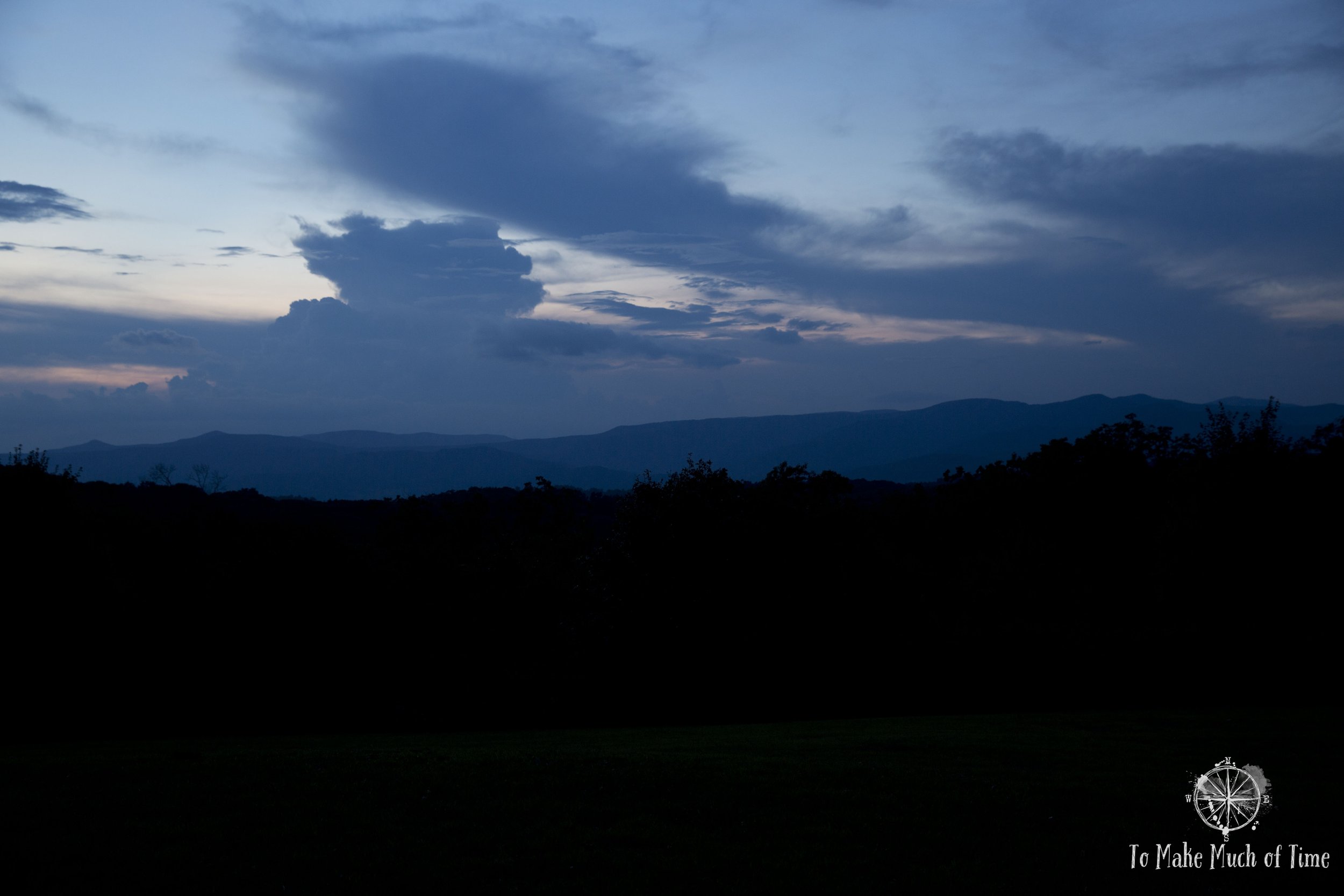
The formation of a thunderhead at Watoga State Park
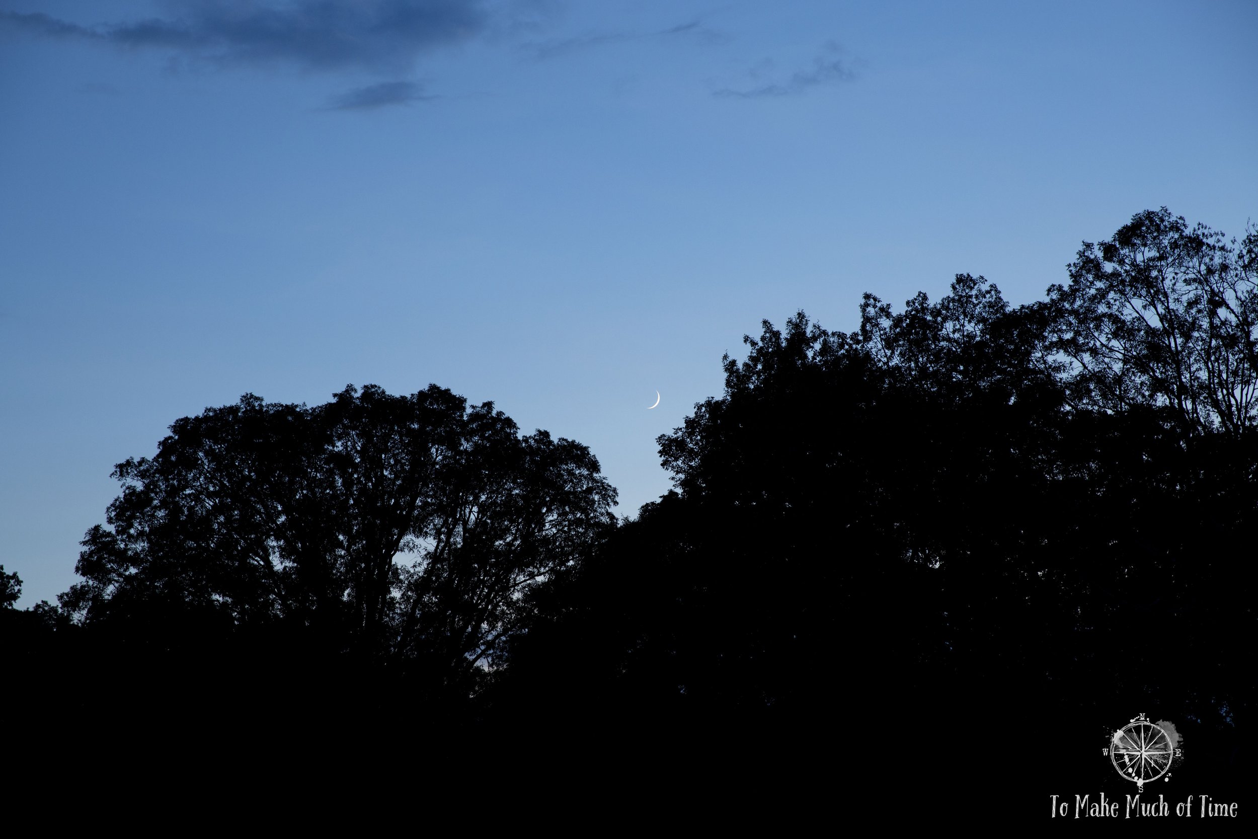
After a full day of hiking, we headed back to our cabin at Watoga State Park and decided to return to the Ann Bailey Trailhead high up in the park to enjoy the impending sunset. Again, this spot was people-free so we had the beautiful views to ourselves. After a few minutes, Dustin pointed to a cloud in the distance that he thought might be a thunderhead in the process of forming. He asked me to take a series of periodic pictures to watch the cloud growth. While none of this was initially obvious to my naked eye, we captured a really cool series of the first thunderhead growing until it petered out at the stratosphere while a second, smaller thunderhead formed next to it. We were mesmerized watching this across the sweeping valley sky below. Eventually the fully formed storm began emitting lightning, which we tried - and failed - to photography successfully!
Click the image below to save this post to Pinterest!
