
Hiking Apple Orchard Falls in Southwestern Virginia

The first, small waterfall we came to at Apple Orchard Falls.
UPDATED: 2/5/2023
Note: Some links throughout our site are affiliate links, which means we may receive a small commission at no cost to you.
WHere is apple orchard falls LOCATED?
Apple Orchard Falls is located in the Buchanan area of Botetourt County, Virginia, about an hour-long drive from downtown Roanoke along the scenic Blue Ridge Parkway. (You can read more about the Parkway on our post here.) While based on our research, it appears the waterfalls are accessible from two locations: uphill and downhill from the falls, we personally accessed the trail from the higher elevation entry point along the Blue Ridge Parkway. That trailhead is easily visible from a scenic overlook spot, about 7 miles north from Peaks of Otter, a well-known spot in the area.
What threw us for a loop is that a lot of sites described the hike as being about 2.5 miles, others listed it as shorter, and we were unclear truly what to expect. The sign at the start of the trail helps to clarify: the hike from the start to finish of Apple Orchard Falls Trail is 3.4 miles with an elevation change of 2,000 feet, which is substantial! The end of the trail is at the North Creek parking area. There are other trails in the area that hikers can use to create their own loop trail options. These include the Cornelius Creek Trail and a segment of the Appalachian Trail.

The view from the Apple Orchard Falls Trailhead and overlook, accessible via car off of the Blue Ridge Parkway.

Trail signage at the trailhead of Apple Orchard Falls.

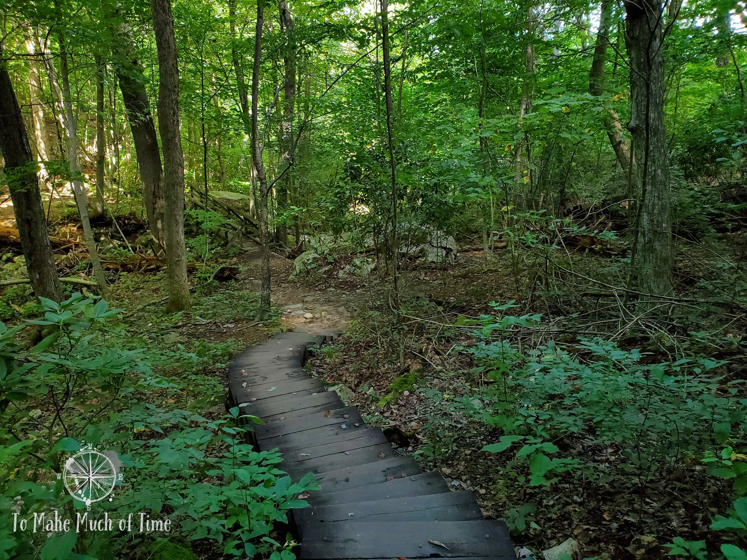
The beginning of the descent to the falls.
apple orchard falls’ BEST KEPT SECRETS
There are plenty of highly popular, crowded hikes near Apple Orchard Falls, but this is a lesser known hike with far fewer visitors. We went on a weekday with nice weather at the tail end of August and passed three couples during the entire 2+ hours on the trail.
The falls themselves have multiple viewing points. At one point, aware that our entire hike had been downhill, we contemplated turning around after the first view of the falls. Luckily we didn’t, as the best views of it occurred further down the trail!

Panoramic view of the upper part of the trail - the low greens are predominantly jewel weed and Canadian nettle.
WHAT TO DO AND WHAT TO EXPECT WHEN HIKING AT apple orchard falls
From the upper trailhead on the Blue Ridge Parkway, the path descended about 1.2 miles - entirely downhill - through a forested area. A particularly pretty area was awash with low green plants - primarily jewel weed with the last hurrahs of its orange flowers and Canadian nettle. We heard the song of a Carolina wren in that area but otherwise, the path was pretty devoid of bird songs, not unusual this time of year.
The path had a couple of water crossings on rocks - not at all precarious like some trails (though it hadn’t rained recently either) - and a number of bridges and raised walkways. There were several spots with either wooden or rock-carved stairs. And in general, the path was incredibly rocky, also normal for a mountain hike in this part of Virginia.

This tree may or may not walk around the forest.

This is an example of a rockier portion of the trail. The trail itself is a climb over these rocks.
There were several sections of Apple Orchard Falls Trail that had stairs to assist with the hilly route.
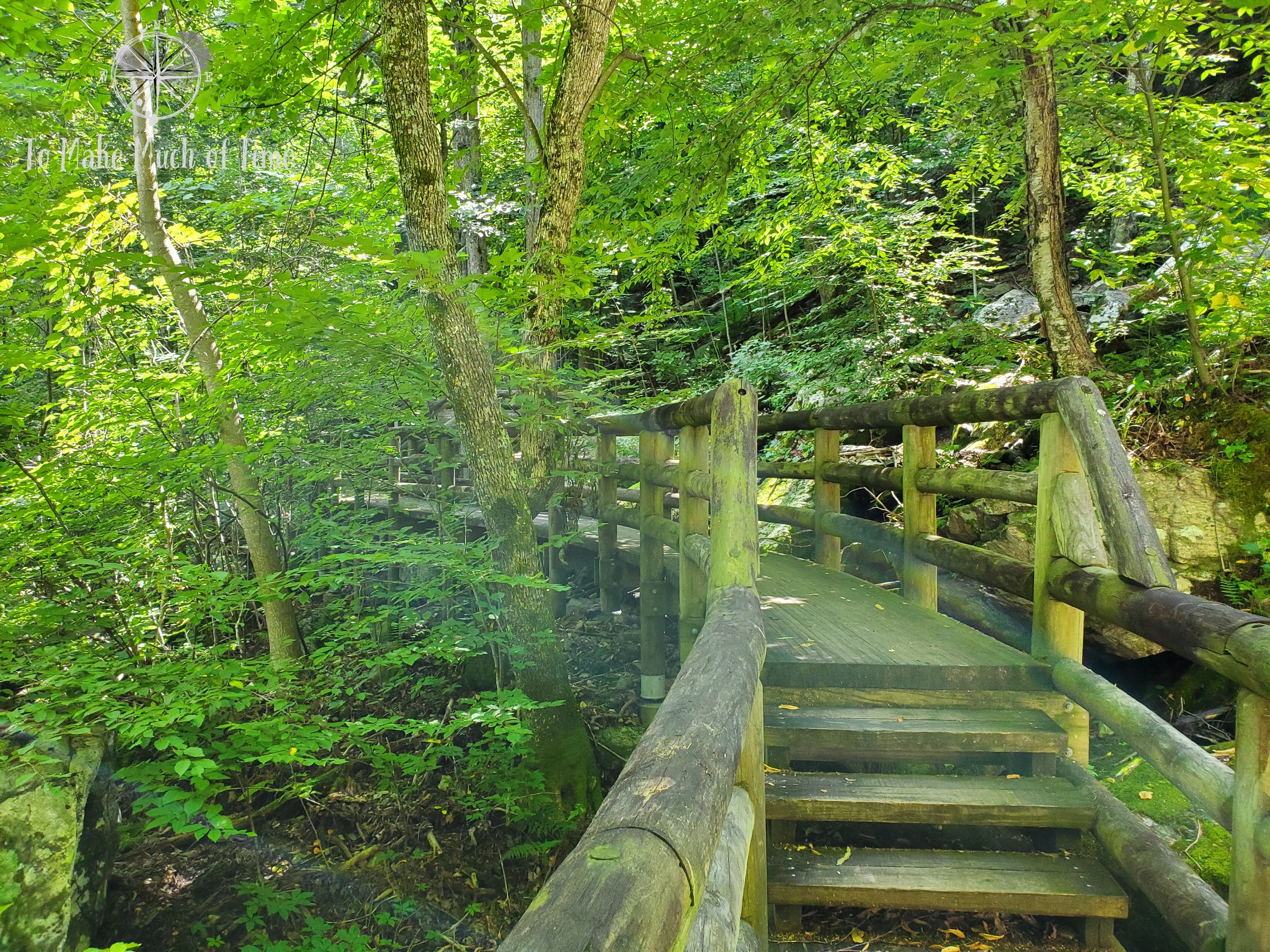
Rainbow sunlight streamed through the trees onto this bridge, overlooking part of the falls.
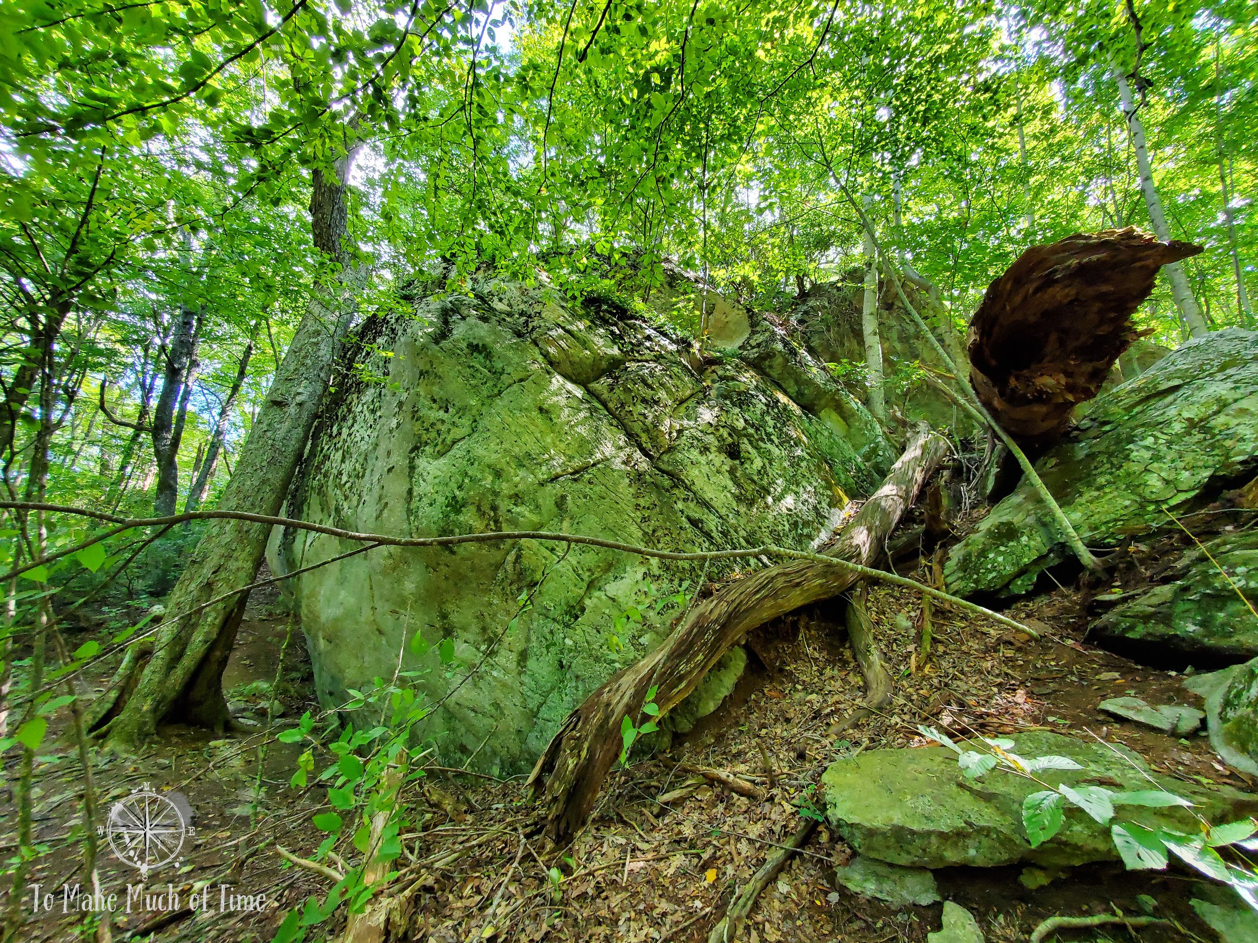
We love coming across some massive boulders and rocky protrusions buried in the Southwestern Virginia forests.
The falls themselves are said to fall 200 feet; however, that only refers to the main section of the waterfall. There are other sections of the waterfall that are more moderate in height. In that tallest section, the water falls from rock into rocky crevice and down into the next segment of the waterfall - a number of shorter falls stitched together compared to other falls that descend in one large drop.

The main waterfall at Apple Orchard Falls.

The rock face here was several stories tall.

It’s hard for photos to do justice to the size of the rocky outcrops like this one, but they’re quite large.

A view of the main waterfall through layers of rocks.

We enjoyed the hike and had a relatively cool day, which made it more pleasurable. While the temperature in Roanoke was in the low 80s, it was about ten degrees cooler and we were actually a tad chilly at the beginning of the hike due to the mountain breeze and shade.
At the top of the trail, the map said it was about 1.2 miles to the falls, and that’s about the distance after which we came upon the first, minor falls. We continued on the path for a total of about 1.6 miles, expecting that we would meet up with the trail head at the other end. After looking at maps, we realized we had quite a ways to go and had spent the entire 1.6 miles walking steeply downhill already. Having just returned from a hiking trip to West Virginia, our legs were ready for a rest, so we turned around at that point and headed back the way we came, 1.6 miles entirely uphill with an elevation change of about 1,400 feet.

Various parts of a stream ran alongside the trail much of the hike.
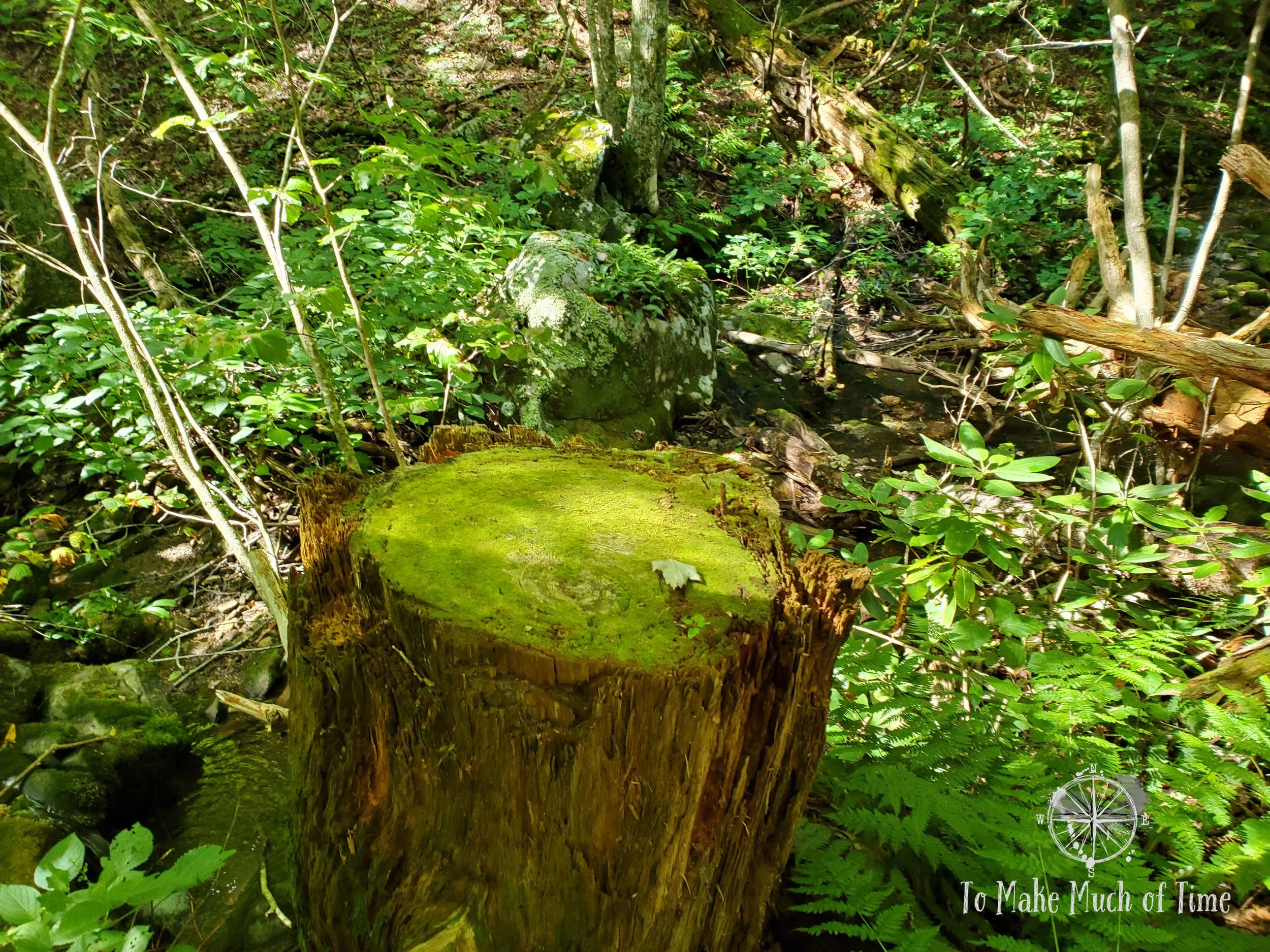
We love coming across cool mosses. This one took over the top of a tree stump and colored it in light green.

A mostly dry section of the creek bed, biding its time until the next rain.
Back at the car, we decided to look for a shady spot to eat our packed lunch. We returned to the Peaks of Otter seven miles down the road on the Blue Ridge Parkway and found a picnic area there that was buried in the trees and that we had never happened upon before. It was a beautiful spot with a babbling creek and a nice end to an unexpectedly hilly hiking adventure!
apple orchard falls - ACCESSIBILITY
Because of personal experiences with this, we make a point of always addressing the accessibility of hikes for those who may have varying degrees of mobility limitations. In the case of this particular hiking area, the trails are definitely not accessible at all and are quite strenuous. There is an overlook from the Blue Ridge Parkway at the top of the trail that offers some pretty scenery of the surrounding environs but not of the falls themselves.
For kids, dogs, and those with balance concerns or prone to twisting ankles or knees sensitive to up- and down-hill climbs, be aware that the hike is filled with lots of rocks, stairs, and tripping hazards. I highly recommend hiking boots that cover the ankle for really any hike, this included, and while we personally do not use hiking poles, that would be a good addition for those looking for added stability.
Click the image below to save this post to Pinterest!

Check out our other posts about Virginia:


Ready for your next hike?
Check out other hikes in the Roanoke, Virginia, area of the Blue Ridge