
Hiking Read Mountain Preserve in Southwestern Virginia - 3.5 Mile Loop Hike to Buzzards Rock
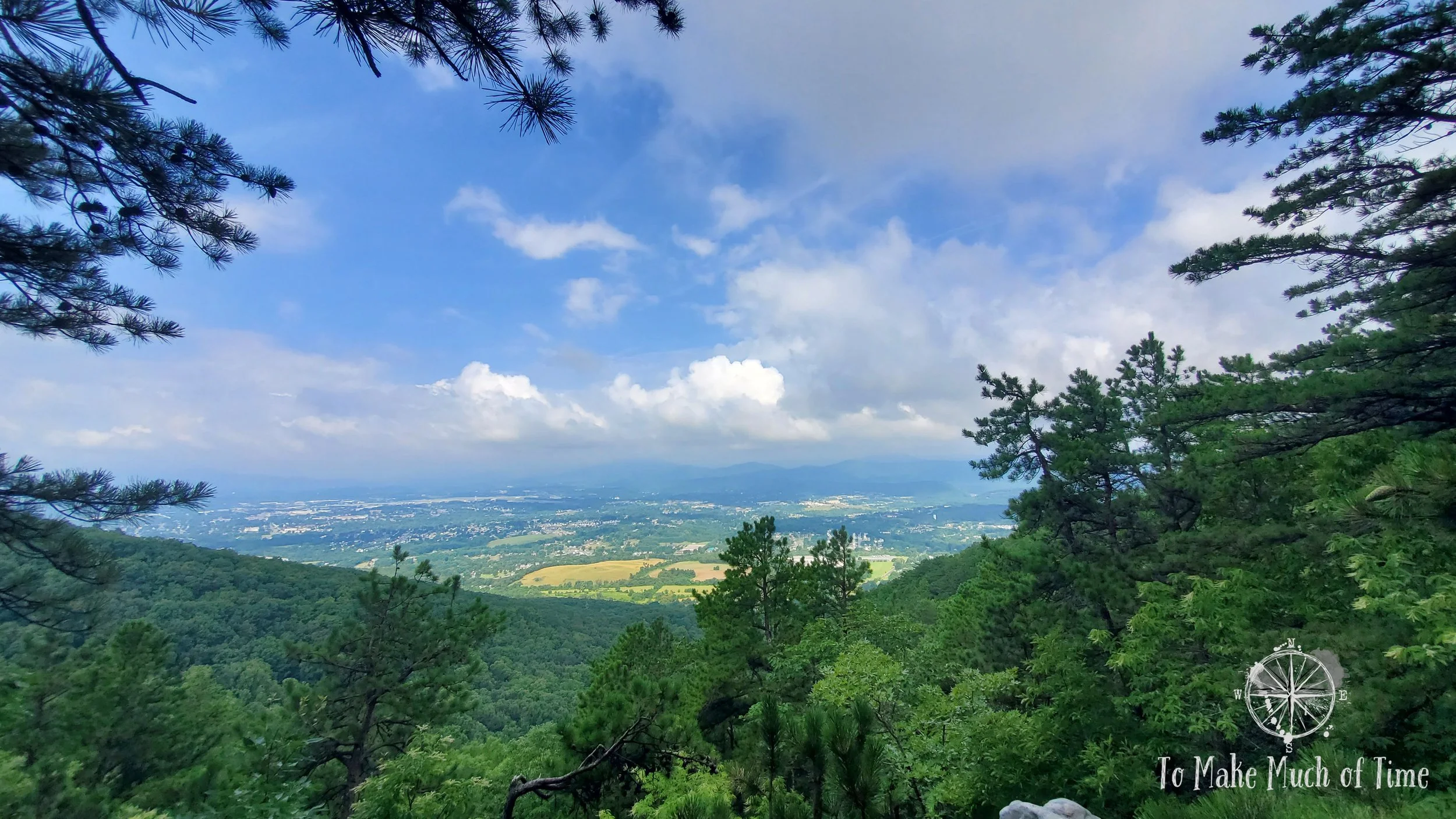
View of Roanoke Valley from Buzzards Rock, at the top of the Read Mountain hike.
UPDATED: 2/5/2023
Note: Some links throughout our site are affiliate links, which means we may receive a small commission at no cost to you.
WHAT IS read mountain preserve AND WHERE IS IT LOCATED?
Read Mountain Preserve is a 243-acre forested area of land placed in a conservation easement to be enjoyed by the public. The earliest trails opened in about 2010. The Preserve is surprisingly tucked away in a subdivision in Roanoke, Virginia. Literally between two houses is a small county park sign with a paved road that looks little different from the neighboring driveways. The road curves up an incline until it evens out into a small parking lot with some picnic tables. Read Mountain Preserve is - as its name suggests - a mountain. This mountain raises to an elevation of about 2,200 feet above sea level. Because of its location in the middle of the Roanoke valley, from the mountain top’s ridge, named Razorback Ridge, the main Roanoke valley is to the west, and a smaller valley containing the community of Bonsack is to the east.
We have lived in the area over a decade and somehow were not aware of this hiking spot at all until searching local maps for a nearby hike. With the summer rain and thunderstorm season full throttle, we were looking for a hike close to home that we could enjoy before midday storms were set to move in.
read mountain preserve’s BEST KEPT SECRETS
Driveway, mailbox, house, driveway mailbox, house, oh hello there county park!, driveway, mailbox, house. While we have grown accustomed to the way so many places eke out every urban green spot possible - this is a good thing! - and rural access roads to hikes in the area, this is the first time we have happened upon a hiking spot that is in the middle of a honest-to-god subdivision with houses built over the past couple of decades. The location of this hiking spot is definitely one of its best secrets. The other is that the top of it - Buzzards Rock - has a sweeping view of the Roanoke Valley and the rest of the Blue Ridge mountain chain on the valley’s western terminus.

Eastward view from the parking lot at the trailhead
WHAT TO DO AND WHAT TO EXPECT when hiking AT Read Mountain Preserve
Shortly after entering the park is a small parking area. We visited on a Friday morning in July - peak vacation season but also a day that started dark gray and threatened rain. When we arrived, there was one other vehicle; by the time we left about 2.5 hours later, there were a few other cars. For the off-the-beaten track nature of this park, my guess is that finding parking here usually is not a problem, though the lot is not excessively large.
Right near the parking area is a port-a-potty, the only bathroom spot in the park, and a kiosk with a map of the park. The large park map is protected by a plastic cover that has not aged well, rendering it nearly impossible to view the map. Luckily, we had printed out a trail map online, and next to the kiosk was also a box with what we think are pretty cool hand-drawn maps of the park. Spots on the map are labelled things like “The Fortress,” “Rock Bridge,” and “Weeping Wall,” rendering it reminiscent of a treasure map kids might draw. I consider this an improvement over most matter-of-fact trail maps. The only flaw is that other than a distance key drawn on, none of the 5 trails have a clear distance indicated on the map. So, perhaps pair this with your pre-hike online research.
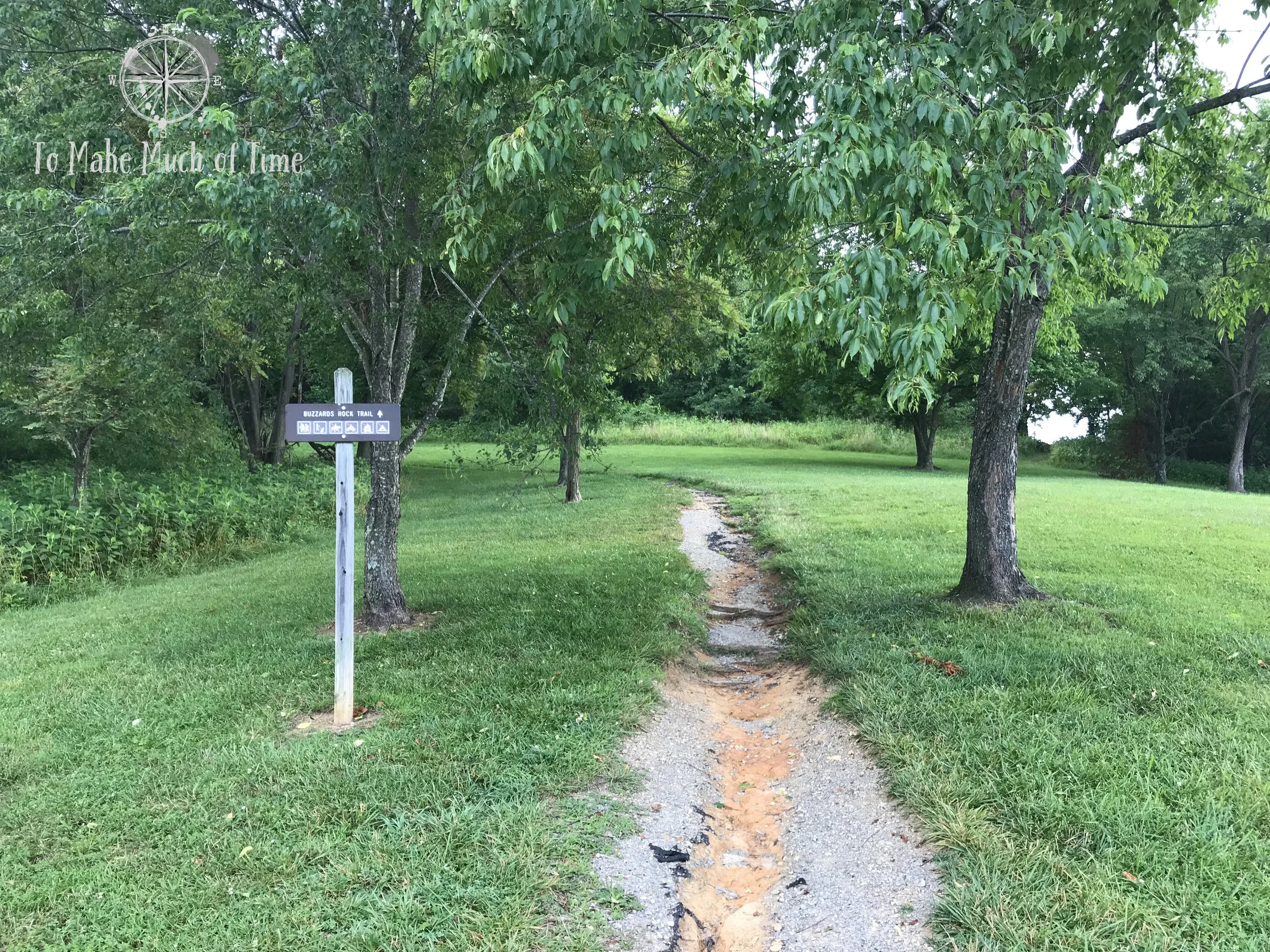
Trailhead from the parking lot
The park purports to have 4.5 to 5 or 6 miles of trails, depending on the source. Keep in mind that this distance is heavily dependent upon how the hiker chooses to connect the different paths.
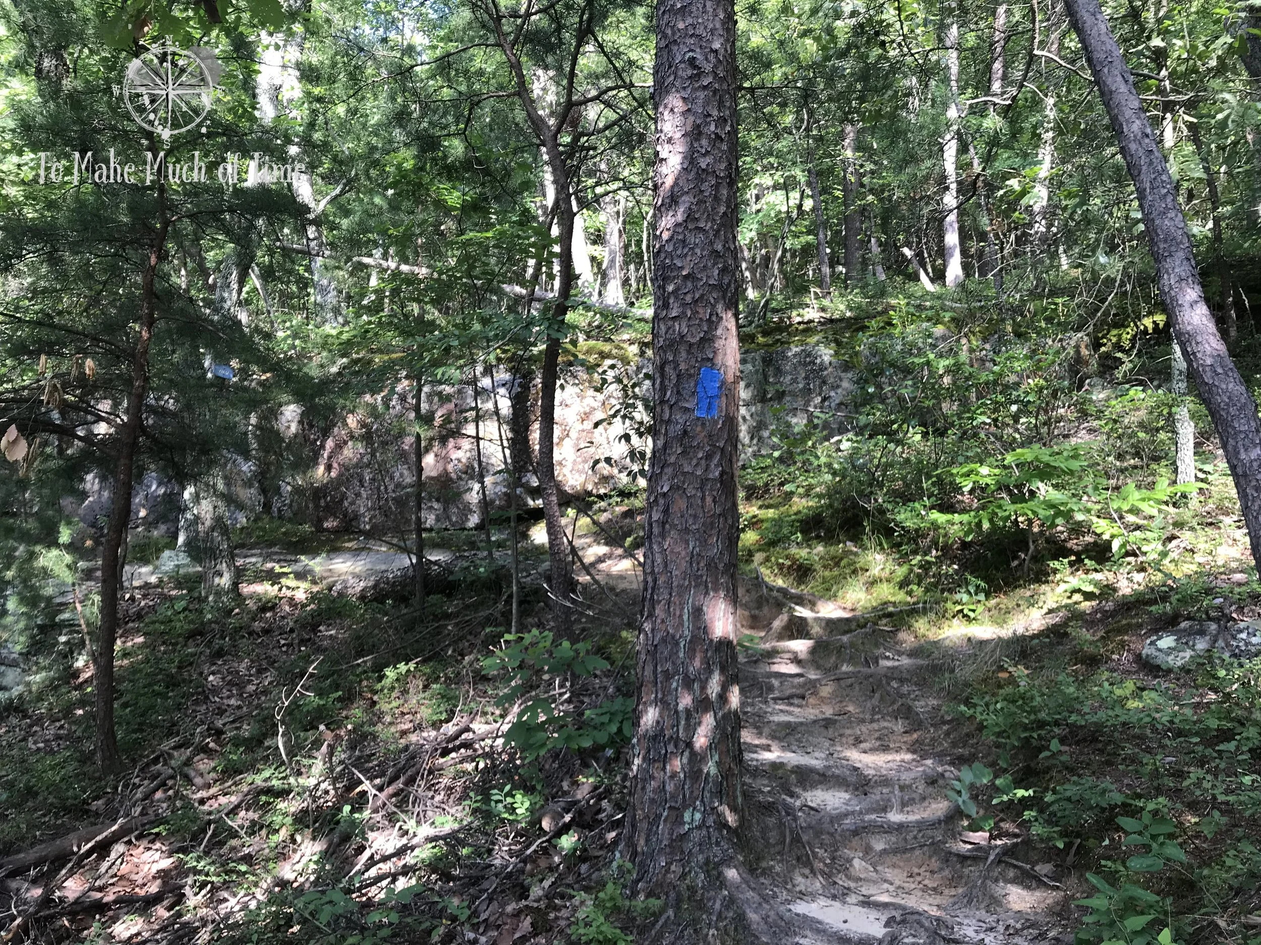
The five trails have both colors (green, blue, yellow, orange, and red) associated with them, as well as names. The trees are blazed with the corresponding colors; the trail signs throughout list only the names of the hikes (with no corresponding colors or distances listed). When taking the blue trail / Buzzards Rock Trail up to the summit, which is the most popular choice, there are periodic signs that indicate 1 mile or 0.5 miles to go to the summit.

The map we picked up at the start of the hike. The route we took started at the picnic area at the very bottom, followed the blue trails out to the far right of the map, followed it up to the summit and then returned on the blue path until it got to the red trail. We followed the red and yellow trails back to the blue and returned to the parking lot from there. We did not have time to explore the orange and the rest of the yellow trails. We did not see the green trail on our hike and think it may be closed or lack signage.
There are a decent number of spots throughout the hike where what appears to be a trail veers off but have been marked with fading white signs indicating that the route is not the hiking trail and to return to the colored blazing. As with any hike, it is important to pay attention to your surroundings to avoid wandering off the wrong way; however, we found this site to be quite communicative.
our hiking route and experience at read mountain preserve: Buzzards rock trail - crossover trail - rocky way trail - back to buzzards rock trail
Or, if you prefer, we took the blue trail 2 miles up to Buzzards Rock and on our return opted the cut-through red trail and yellow trail, which met back up with the blue trail. As usual, I tracked this hike on both my Garmin watch and through my phone’s Runkeeper app. As usual, they provided slightly different stats for our 2 hour 18 minute hike. Runkeeper clocked the hike in at 3.29 with an elevation change of 876 feet. Garmin gave us much more credit at 3.88 miles with a total ascent of 1,147 feet.
The hike is pretty clearly an elevation climb followed by an elevation descent with some small hills meandering up and down along the way.
We started our hike from the parking lot on the only trail available from that location - Buzzard’s Rock Trail (blue) and began an immediate uphill climb. Along the left of the trail was a ravine and after about 0.3 to 0.4 of a mile, we reached the first sizeable rocky area as the trail took a sharp turn to the right. From there, we came across periodic - in some cases quite lengthy - rock staircases. Several of these were rough hewn, more like stepping on random rocks; many others looked like the Flintstones version of a sweeping staircase and were really cool.
The initial incline of the trail
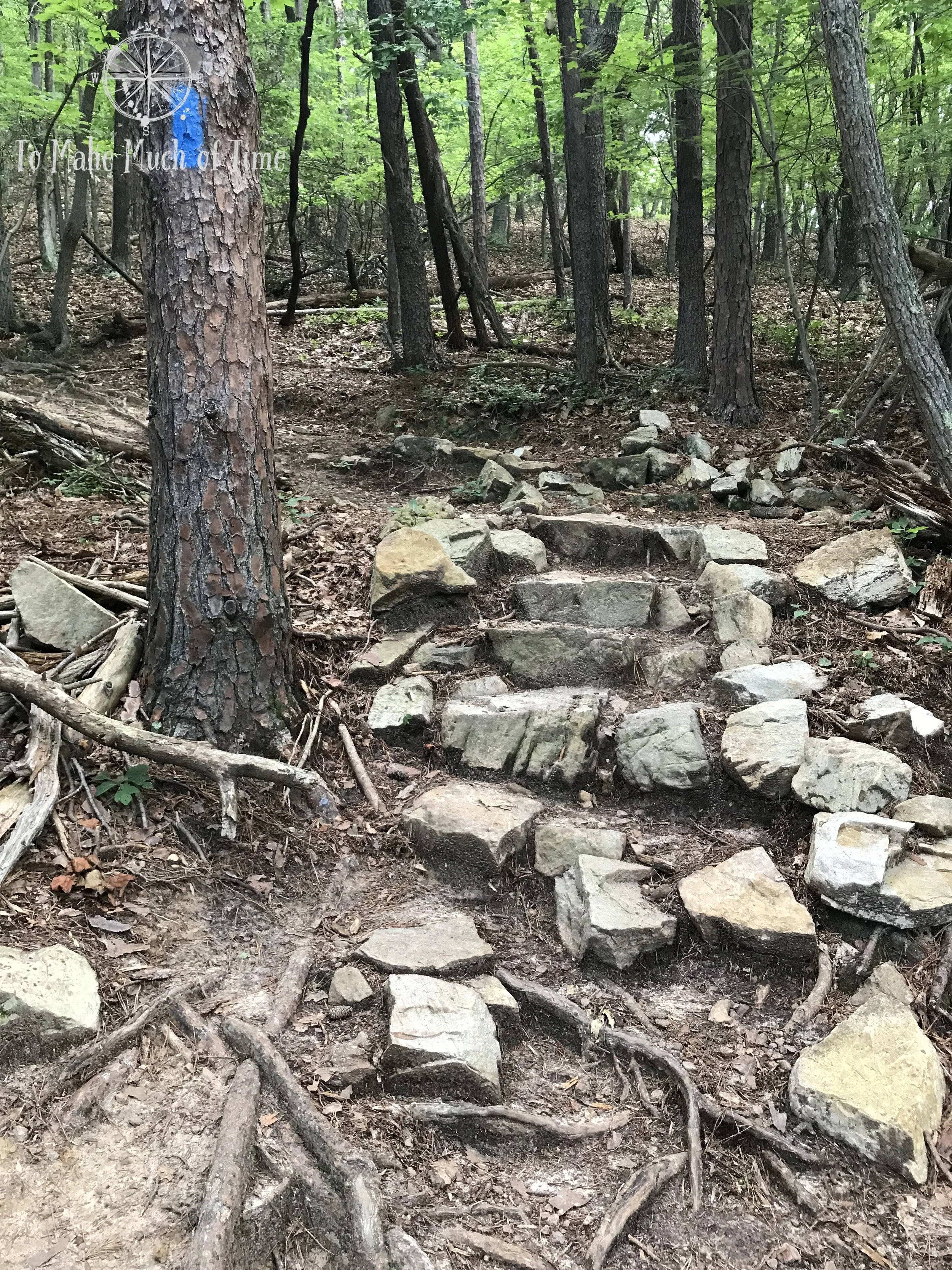
The first series of rock steps
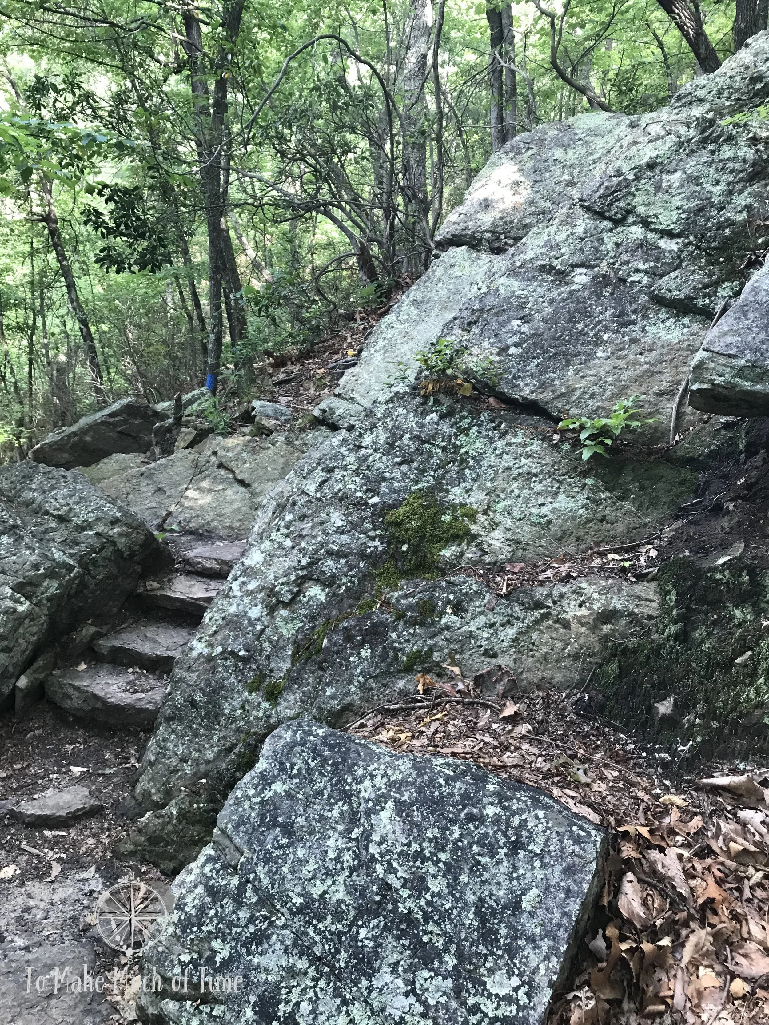
This series of rock steps took us around a fairly sharp right turn about 0.3 to 0.4 miles into the hike
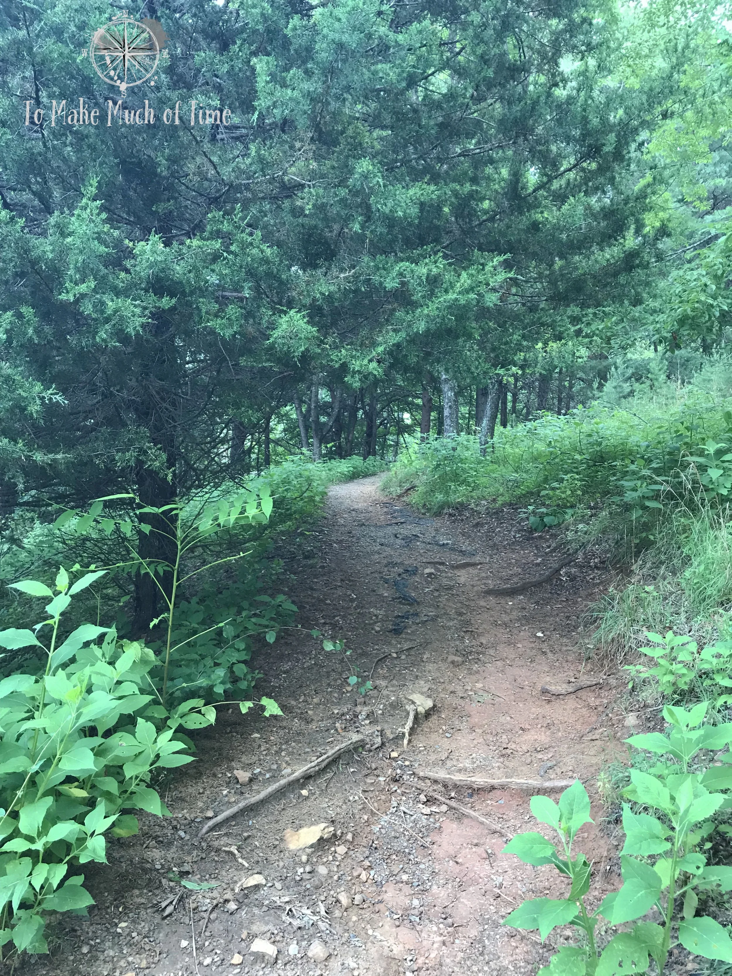
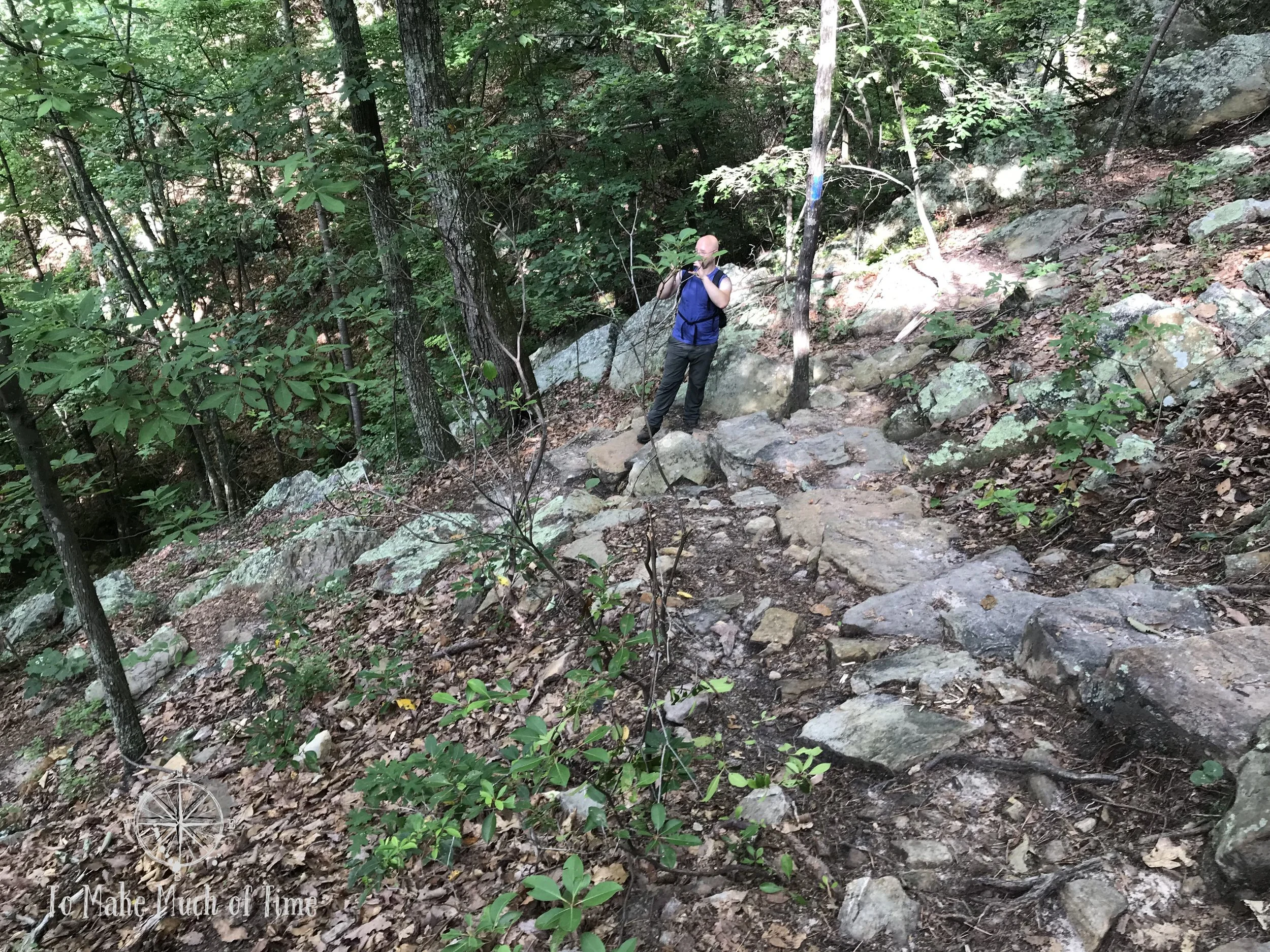
We found some particularly cook, knobby tree trunks along the way, and we had to steer clear of tree roots and random rocks protruding in the path. This is a very standard type of path for this part of Virginia. We are not great at identifying flora, though we have been making some progress in this area recently. One plant we definitely know and spotted a lot of on this hike is mountain laurel. A little ways higher up was a bench for those looking to sit for a bit before continuing the uphill climb and uphill rocky stairs. For most of the uphill climb, the trail hugged the side of the mountain with a ravine down to the other side; however, the path was sufficiently wide so that the ravines shouldn’t be concerning to those who avoid heights. We have had different experiences with some other area hikes with very narrow trails along steep ravines.
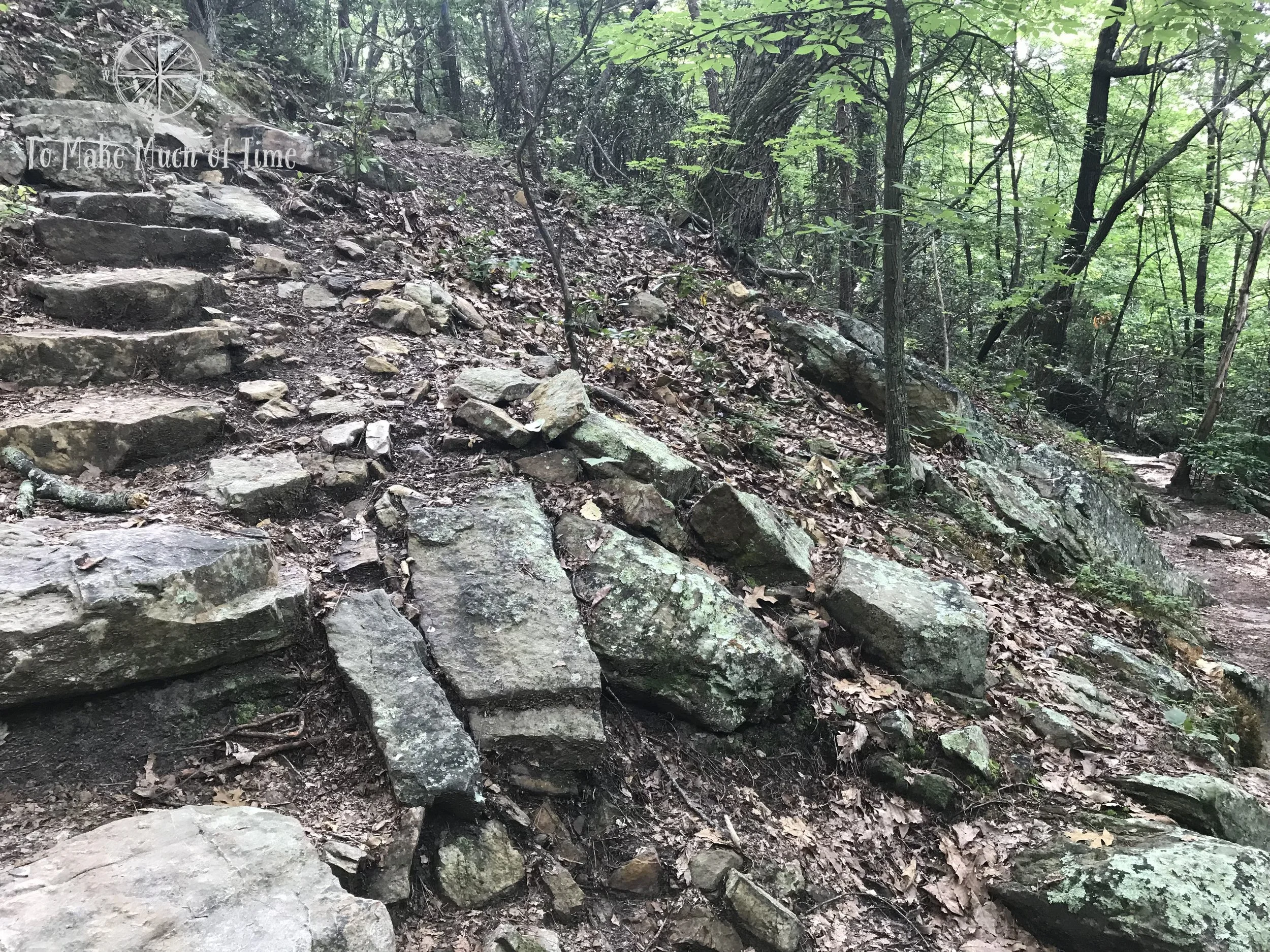
View at the sharp right turn up the rocky steps
And view from the top of the steps, looking back down, with the ravine over the crest of the hill
After the bulk of the uphill portion, the trial began to climb more conservatively, following a topographical line for a while right as we passed the Weeping Wall, so named on our cool map. The Weeping Wall was a huge, pinkish rock, topped with moss. Shortly thereafter, we got to the Razorback Ridge line that we followed out to Buzzards Rock. This part of the trail was really cool because this is truly the highest ridgeline in the area. Through the green trees, we could see the Roanoke valley peeking out to our left and the area of Roanoke known as Bonsack to the right. The path became much wider and flat.
The large rock ahead is labelled on the map as the Weeping Wall
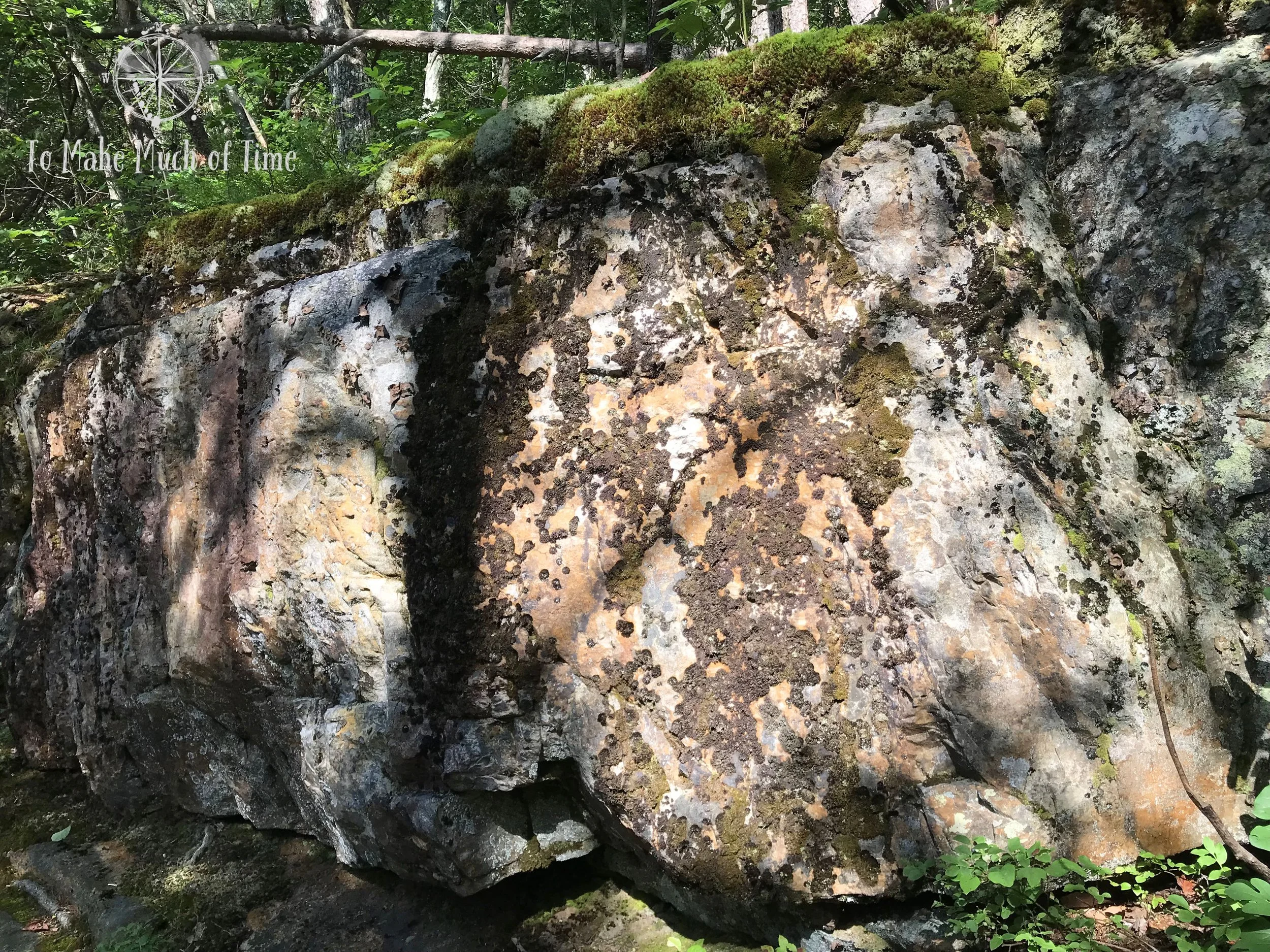
A close up of the cool coloration, mosses, and lichen on the Weeping Wall
Rocky scenery along the trail

A panoramic of the path at the top of the hill along Razorback Ridge, leading out to Buzzards Rock. To the left and right are Roanoke Valley and Bonsack, respectively.
As the path neared Buzzard Rock, it became narrower and began to weave among rocks and tree roots, the ground a tad slick at times with fallen pine needles. Right around Buzzards Rock are a number of large boulders and stone out-crops, including some really interesting patterns on one, which almost looks smoothed by water like what you would usually see at the shore.

Some boulders as we neared the summit. The whirls on them almost look like what you’d expect to see near a water source where water has eroded and smoothed the rocks over time.

Atop Read Mountain, overlooking the Roanoke Valley
At the summit is a second park bench - humorously (in my view) locked in place. After briefly exploring what appeared to be a little bit more to the trail, we settled on the bench for a water and snack break and a chance to enjoy the view. The most obviously visible spec below was the Roanoke airport - the runway is a dead giveaway.
While the morning had started off dark gray and threatening rain, the sky had cleared up quite a bit so the sky before us was mostly blue with some puffy clouds, though the visibility was a bit sub-par since the thick humidity created a hazy view. This would be a great spot on a clear day!
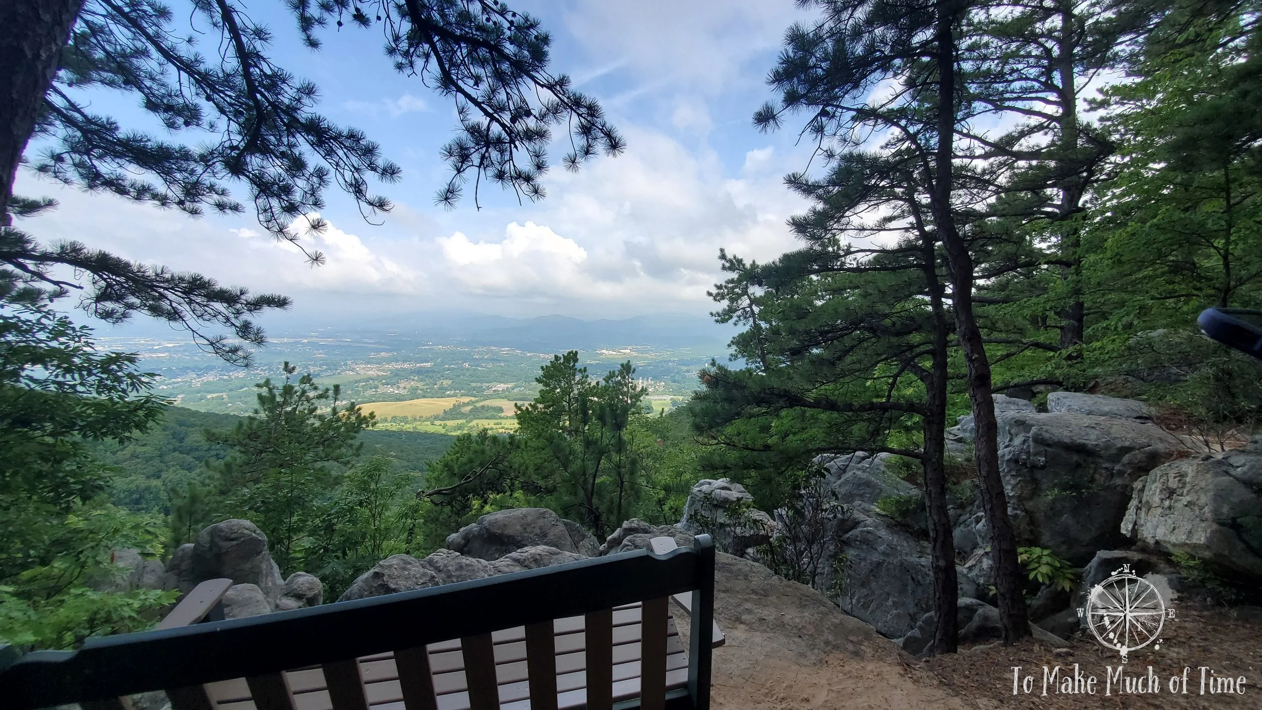
The view from Buzzards Rock with the Roanoke Valley spanning out below.

The day was on the hazy side so the mountains aren’t as visible as normal.

This photo gives just an inkling of the way the Roanoke Valley is surrounded by the beautiful Blue Ridge crests.
Because we couldn’t tell if the path continued on beyond the summit view, we followed what appeared to be a path a short ways further. I spotted a large black widow spider (specifically a Northern Black Widow, based on the 3 red dots instead of the more popularized red hourglass shape) gorging itself on a dead beetle of some sort. As we took a closer look, we spotted the spider’s new hatchlings in the nearby spider web. There were tons of baby black widow spiders. Cool and also ew! We had never met a black widow before moving to Roanoke and have met many since - they are frequent finds when we’re gardening in our yard so I always wear gloves.

Northern Black Widow spider chowing down

Nearby, her babies were on the move. At a really rough count, I’d say there were maybe 200 baby spiders in this nest. Per Google, they lay 250 eggs on average, so somewhere in that ballpark. 250 baby spiders too many, if you ask me!
To return, we followed the Buzzards Rock Trail back until it met up with the Crossover Trail (red). At around this elevation the forest became noisier with birds. We could visibly spot Robins flitting about in small groups, and we heard a periodic Raven soaring overhead. We pulled out our handy free bird app (Merlin Bird ID by The Cornell Lab) and were able to identify a number of birds: Carolina Chickadee, Tufted Titmouse, Hairy Woodpecker, Eastern Wood-Pewee, Blue Jay, Carolina Wren, and a Red-tailed Hawk. The only one indicated as ‘uncommon’ by the app was the Hairy Woodpecker, but we feel pretty confident that we had the right bird since we were able to visually spot a pair of them in a nearby tree.
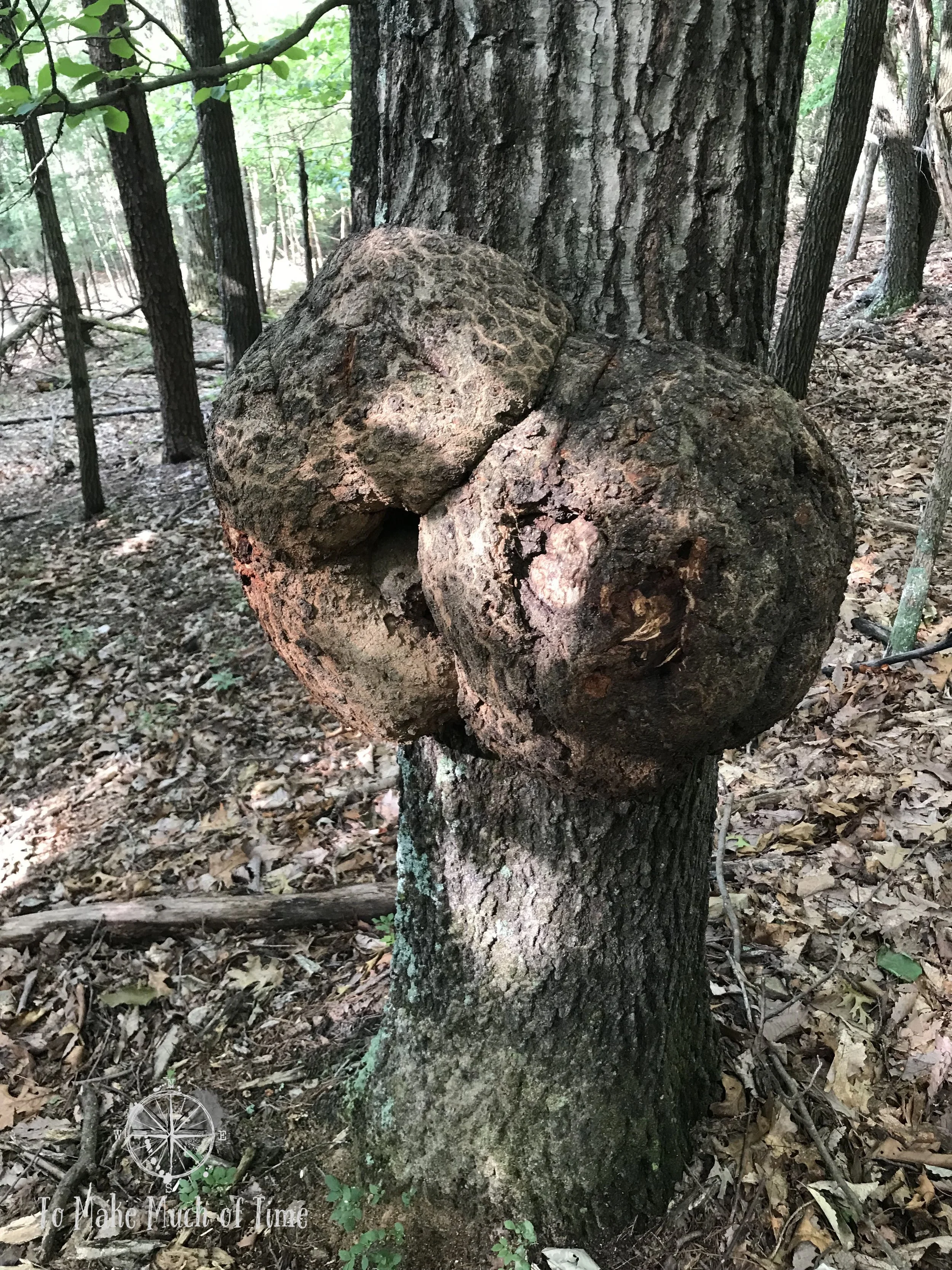
One of a few particularly fascinating trees on the trek

This tree must be nature’s attempt at polka dots!
Our experience of the hike was that we would go through areas filled with the hum of cicadas and then other areas devoid of them; similarly, there were areas filled with birds and other areas quite quiet and bird-free.

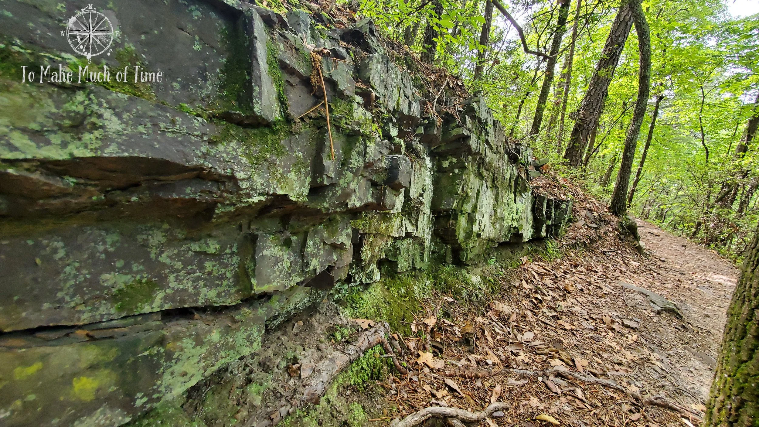
“The Fortress,” as our map appropriately named this area. This was just before we got to the section described below with the long, rocky staircase.
Towards the end of Rocky Way Trail (yellow), just before meeting back up with the original Buzzards Rock Trail, was the coolest, longest rocky staircase that meandered alongside a rock wall. With limited imagination, it looked like a house wall with a staircase next to it, and I kind of wanted to live there.
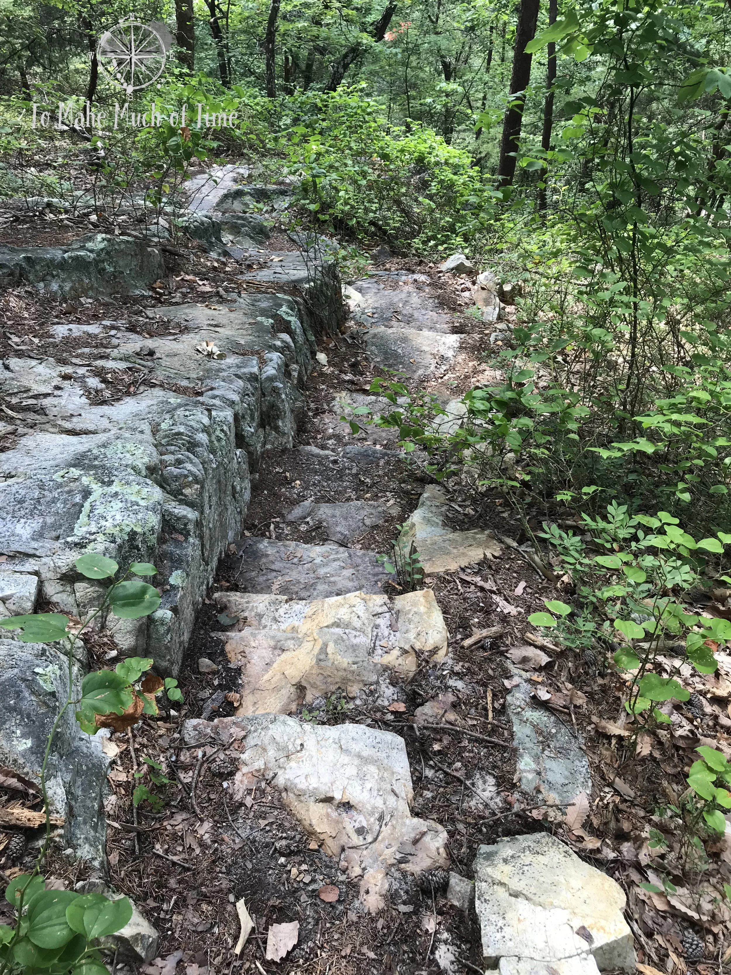
Heading down the long, rocky staircase

The stark wall rising up along the stairs

Looking back up the stairs
By the time we returned to the car, the sun was full-force, the humidity served as an exclamation point for the July heat, and we were very glad to have completed the hike in the morning! We only came across one other group of people during our entire time there - a man with a few very little kids.
HIKING read mountain preserve - ACCESSIBILITY
Because of personal experiences with this, we make a point of always addressing the accessibility of hikes for those who may have varying degrees of mobility limitations. In the case of this particular hiking area, the trails are definitely not accessible at all.
For kids, dogs, and those with balance concerns or prone to twisting ankles, be aware that the hike is filled with lots of rocks, stairs, and tripping hazards. I highly recommend hiking boots that cover the ankle for really any hike, this included, and while we do not use hiking poles, that would be a good addition for those looking for added stability.
Click the image below to save this post to Pinterest!

Check out our other posts about Virginia:


Hiking in Roanoke, Virginia
Check out other hikes and waterfalls in and around Roanoke, VA, in the Blue Ridge Mountains