
Hiking Read Mountain Preserve in Southwestern Virginia - 4.6 Mile Loop Hike

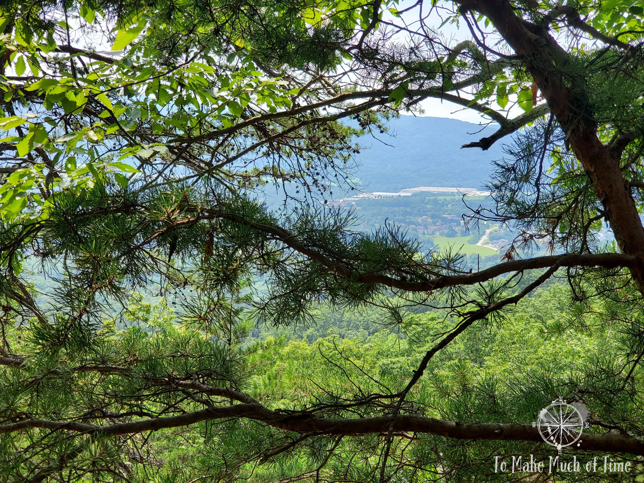
View of Bonsack in Roanoke Valley from Read Mountain.
UPDATED: 2/5/2023
Note: Some links throughout our site are affiliate links, which means we may receive a small commission at no cost to you.
isn’t this your second post on read mountain preserve?!
It is! Our last post was our first visit to Read Mountain Preserve. In that post, we provided an overview of Read Mountain Preserve, it's best kept secrets and more. We'll repeat some of that here for context, but those who have read our prior post should skip down to the section about our hiking route and experience. You can check out our prior post here. On our first visit, we hiked a 3.5 mile loop trail up to Buzzards Rock. On our return trip described in this post, we hiked a 4.6 mile loop. We've now hiked nearly all the paths in this park, except the green trail, which is a cutover between a couple of others.
what is read mountain preserve and where is it located?
Read Mountain Preserve is a 243-acre forested area of land placed in a conservation easement to be enjoyed by the public. The earliest trails opened in about 2010. The Preserve is surprisingly tucked away in a subdivision in Roanoke, Virginia. Literally between two houses is a small county park sign with a paved road that looks little different from the neighboring driveways. The road curves up an incline until it evens out into a small parking lot with some picnic tables. Read Mountain Preserve is - as its name suggests - a mountain. This mountain raises to an elevation of about 2,200 feet above sea level. Because of its location in the middle of the Roanoke valley, from the mountain top’s ridge, named Razorback Ridge, the main Roanoke valley is to the west, and a smaller valley containing the community of Bonsack is to the east.

CCC Trail
read mountain preserve’s BEST KEPT SECRETS
Driveway, mailbox, house, driveway mailbox, house, oh hello there county park!, driveway, mailbox, house. While we have grown accustomed to the way so many places eke out every urban green spot possible - this is a good thing! - and rural access roads to hikes in the area, this is the first time we have happened upon a hiking spot that is in the middle of a honest-to-god subdivision with houses built over the past couple of decades. The location of this hiking spot is definitely one of its best secrets. The other is that the top of it - Buzzards Rock - has a sweeping view of the Roanoke Valley and the rest of the Blue Ridge mountain chain on the valley’s western terminus. And it also has a lesser traveled path that we took on this second visit that hikes along the top of a ridge at about 2100 feet elevation before wending back on a lower, rocky path that has a lot of character and is pretty unique!
WHAT TO DO AND WHAT TO EXPECT when hiking AT Read Mountain Preserve
During our first visit - a Friday morning in July that was threatening rain - we discovered only one other vehicle upon our arrival. By the time we left about 2.5 hours later, there were a few other cars. Our second visit was a Sunday morning on a day that would quickly hit 90 degrees and with air heavy with humidity. On that visit, there were probably 3-4 cars there upon our arrival and maybe 7 total upon our departure. Due to the off-the-beaten track nature of this park, my guess is that finding parking here usually is not a problem, though the lot is not excessively large.
Right near the parking area is a port-a-potty, the only bathroom spot in the park. On this second visit, I used it and discovered it was in pretty good shape AND was one of the extra fancy port-a-potties with a mirror in it. Um yeah not a spot to hang out and primp. In the parking lot is also a kiosk with a map of the park. The large park map is protected by a plastic cover that has not aged well, rendering it nearly impossible to view the map. Luckily, we had printed out a trail map online, and next to the kiosk was also a box with what we think are pretty cool hand-drawn maps of the park. Bonus points for us saving paper: we brought our copy from the prior visit. Spots on the map are labelled things like “The Fortress,” “Rock Bridge,” and “Weeping Wall,” rendering it reminiscent of a treasure map kids might draw. I consider this an improvement over most matter-of-fact trail maps. The only flaw is that other than a distance key drawn on, none of the 5 trails have a clear distance indicated on the map. So, perhaps pair this with your pre-hike online research (such as this post!).
The park purports to have 4.5 to 5 or 6 miles of trails, depending on the source. Keep in mind that this distance is heavily dependent upon how the hiker chooses to connect the different paths.
The five trails have both colors (green, blue, yellow, orange, and red) associated with them, as well as names. The trees are blazed with the corresponding colors; the trail signs throughout list only the names of the hikes (with no corresponding colors or distances listed). When taking the blue trail / Buzzards Rock Trail up to the summit, which is the most popular choice, there are periodic signs that indicate 1 mile or 0.5 miles to go to the summit.

The map we picked up at the start of the hike. The route we took started at the picnic area at the very bottom, followed the blue trails out to the far right of the map, followed it up to the summit and then returned on the blue path until it got to the red trail. We followed the red and yellow trails back to the blue and returned to the parking lot from there. We did not have time to explore the orange and the rest of the yellow trails. We did not see the green trail on our hike and think it may be closed or lack signage.
There are a decent number of spots throughout the hike where what appears to be a trail veers off but have been marked with fading white signs indicating that the route is not the hiking trail and to return to the colored blazing. As with any hike, it is important to pay attention to your surroundings to avoid wandering off the wrong way; however, we found this site to be quite communicative. We did find the CCC Trail (orange) to lack really any trail blazing for the large bulk of it. Only at the end that connected with the Rocky Way Trail (yellow) to the far left of the map did we see any blazing. That said, the path was wide enough to be self-evident.
our hiking route and experience at read mountain preserve: Buzzards rock trail - rocky way trail - crossover trail - ccc trail - rocky way trail - back to buzzards rock trail
Or, if you prefer, we took the blue trail from the parking lot, connected up with the yellow trail, then red trail before reconnecting with the blue trail. We took that to the orange trail to the far left of the map, met up with the yellow trail, and then finally reconnected with the blue trail to return to the parking lot.
The net elevation climb was 820, which I got back comparing the elevation at the top of the ridge and in the parking lot. That seems to get me a more accurate result than my various fitness trackers; however, this doesn’t account for the elevation climb that results from the up-and-down nature of trails. This entire hike clocked in at 2 hours 40 minutes, and we covered 4.6 miles. We stopped to take photos along the way and generally kept a steady clip but didn’t hurry along by any stretch.

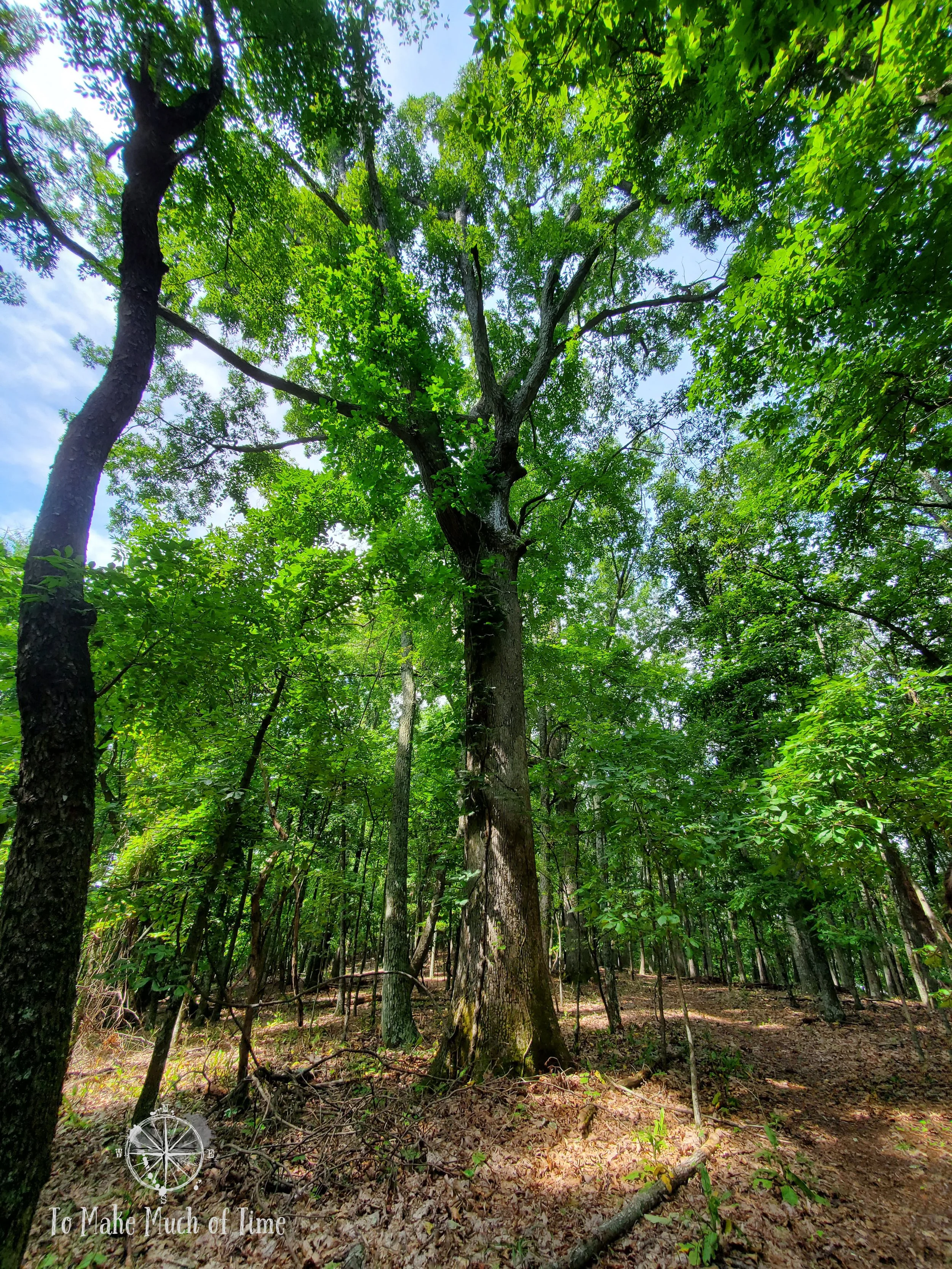
The first segment of the hike.

We enjoyed seeing various mosses and lichens along the trek.

The beginning of the rocky staircase up
The route we took meant that we spent the first 1.06 miles predominantly headed up-hill. It was a hot, sticky summer day that would get up to nearly triple digits by the afternoon. So, while we felt the up-hill nature of the trail for that first mile and were more uncomfortable from the weather, it wasn’t a particularly steep climb (based on our assessment of what we’re used to on hikes).
The area marked “Jacob’s Ladder” on the trail map corresponds with a large, rocky staircase. We counted 76 steps up, which is more-or-less the climb up a staircase for a 5-story building, though it felt less painful than it sounds since most of the steps weren’t particularly steep.

A wide lens view of the start of the rocky stairs up to the top of the mountain
At the top of the climb, the red trail met the blue one, which we followed until it met up with the orange trail atop Razorback Ridge. At that point, we were 1.32 miles from the trailhead and had covered the full height of the elevation climb - from the parking lot at 1,330 to the ridge at 2,150.

The walls of rock were large at various spots throughout the hike - this spot is near Jacob’s Ladder

The signage at the top of the mountain. For this hike, we turned left to the CCC trail. In our prior post, we took the trail out to Buzzard’s Rock.
The bulk of the orange trail is a straight path along the ridge. The path is generally quite wide, and we didn’t notice any blazing or signage. The part of the trail was a little overgrown in parts, which is not surprising since we expect most visitors head to Buzzard Rock overlook and views of the Roanoke Valley. In a few places, the trail wove through some fast-growing plants, but the trail itself was not hard to follow. After the original uphill climb, having the flat trail was a nice reprieve. Because it is on top of the ridge, the forest spanned out to the left and right with occasional glimpses of the scenery beyond. This path probably has some nice views in the fall when trees are ablaze with color and afterwards when many have dropped their leaves.

The view of the CCC Trail at the top of the mountain where it runs along the top of the ridge.
Scenery and trees lined the CCC Trail

Towards the end of the CCC Trail

Some of the CCC Trail was a little overgrown, such as in this short section

A rotting tree created a natural arch over the CCC path - just don’t stand under it when it decides to fall!

The yellow Rocky Way Trail
Towards the end of the orange path, the trail headed steeply downhill. While the incline was fairly sharp, the path was easy to maneuver. At 2.23 miles from the trailhead, we connected up with the yellow trail, where blazing became more prevalent again. The yellow trail would take us another 1.07 miles and was a really cool part of the hike. While there were some elevation changes throughout it, the path mostly weaved in and out of the mountain, following the natural undulation of its curves. There were neat rocky outcrops and little walkways through them. While there was not the same breeze that the ridge had offered, the tree cover and shade prevented us from being too hot even on a spicy day. As we made our way toward the end of this trail section, we started hearing more birds again and were kept company by a lot of robins in particular. We heard several crow caws and raven kraas as they flew overhead.

One of the coolest things we came across was this Ghost Plant. We had no idea what it was and looked it up. The plant is found in humus and shaded woody areas such as this hike. It was about 6-8 inches high, growing out from the fallen leaves.

Just before we reconnected with the blue trail, which would return us to the parking lot, we spotted a small overlook with beautiful views of the valley beyond. From there, we connected back with the blue trail and returned to the parking lot, thankful to be finishing the hike midday and before the heat and humidity increased! Near the parking lot we met a couple from Iowa who had stopped in Roanoke on their return drive home from a trip and were considering moving to the area. They were weighing which route to hike so we gave them some pointers, and they shared that moving somewhere with mountains and hiking was high on their list after living in a flatter geography. Whether this hike on a humid, hot afternoon sold them on moving here or scared them away, we’ll never know!
HIKING read mountain preserve - ACCESSIBILITY
Because of personal experiences with this, we make a point of always addressing the accessibility of hikes for those who may have varying degrees of mobility limitations. In the case of this particular hiking area, the trails are definitely not accessible at all.
For kids, dogs, and those with balance concerns or prone to twisting ankles, be aware that the hike is filled with lots of rocks, stairs, and tripping hazards. I highly recommend hiking boots that cover the ankle for really any hike, this included, and while we do not use hiking poles, that would be a good addition for those looking for added stability.
Click the image below to save this post to Pinterest!

Check out our other posts about Virginia:


Hiking in Roanoke, Virginia
Check out other hikes and waterfalls in and around Roanoke, VA, in the Blue Ridge Mountains